Location of Seeps
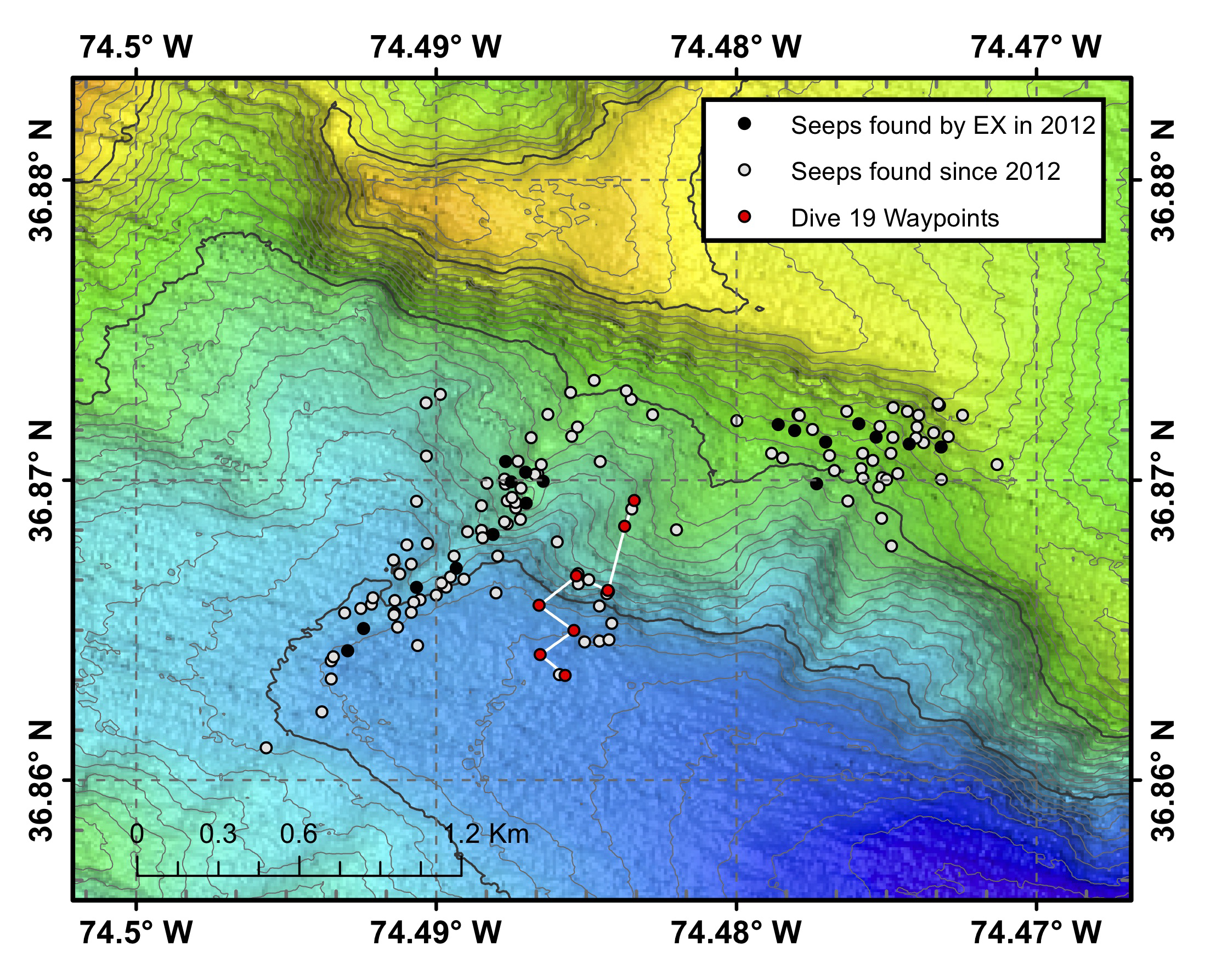
Map of Dive 19 waypoints (red points) and track (white line). Black points indicate seep locations identified with Okeanos Explorer multibeam sonar water column backscatter data collected in 2012 and published in Skarke et al. (2014). White points indicate seep locations identified by researchers at Mississippi State University with Okeanos Explorer multibeam sonar water column imaging data collected since 2012. The bathymetric data were collected with the Okeanos Explorer’s multibeam sonar and are contoured at 10 meter (~33 ft) intervals.
 and track (white line). Black points indicate seep locations identified with Okeanos Explorer multibeam sonar water column backscatter data collected in 2012 and published in Skarke et al. (2014). White points indicate seep locations identified by researchers at Mississippi State University with Okeanos Explorer multibeam sonar water column imaging data collected since 2012. The bathymetric data were collected with the Okeanos Explorer’s multibeam sonar and are contoured at 10 meter (~33 ft) intervals.")