Bathymetry
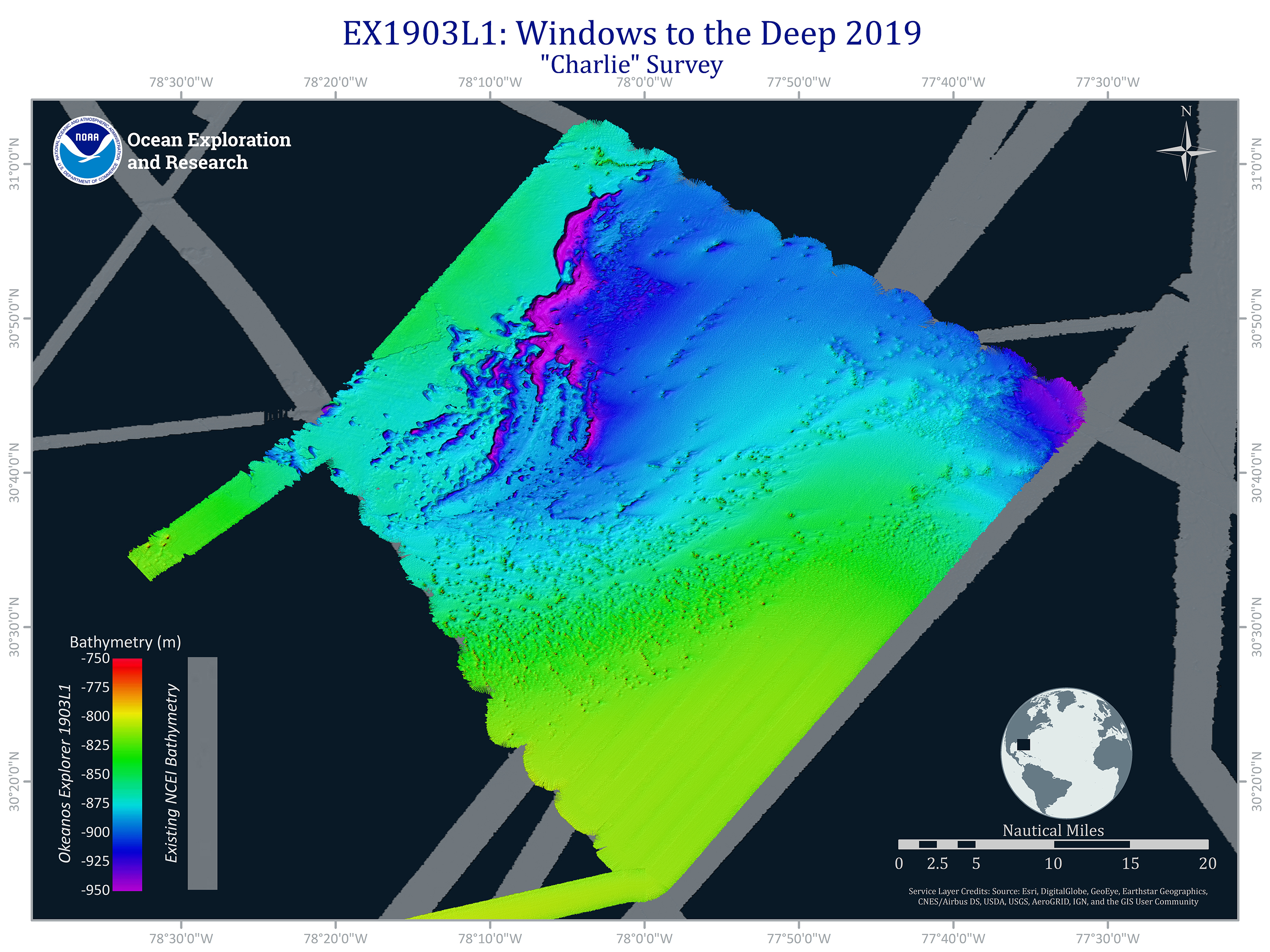
A survey area on the Central Blake Plateau, mapped during the first leg of the Windows to the Deep 2019 expedition. The seafloor mapping data revealed unique geological features in the northwestern part of the survey area, particularly a unique underwater cliff-like structure with a vertical drop of approximately 200 meters (656 feet).
.")