Bathymetry
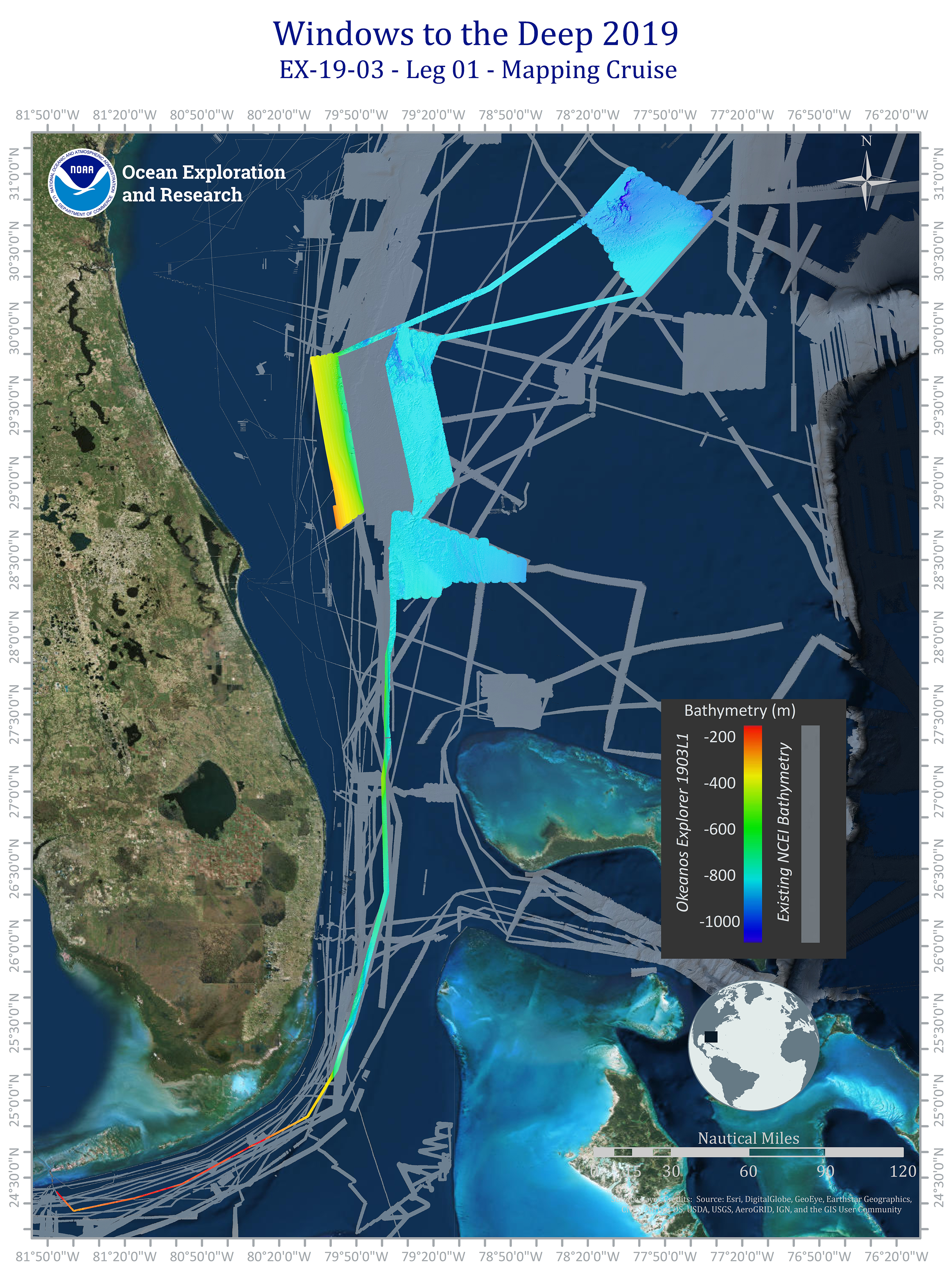
Areas mapped during Leg 1 of the Windows to the Deep 2019 expedition off the southeastern United States. The rainbow colored areas are the new areas mapped during Leg 1 of the expedition, and the grey areas represent existing seafloor mapping data from the NOAA National Centers for Environmental Information.
