The Gulf Stream direction and magnitude is modeled by the U.S. Navy Coastal Ocean Model (NCOM), which is a high-resolution model that offers ocean current data at a 2 nautical mile (2.3 mile) resolution every 24 hours. The navigator, dive supervisor, and ship operators use this model output to very roughly estimate expected currents at each dive site.
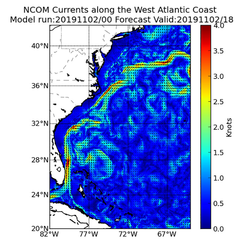
Gulf Stream Model
Image courtesy of NOAA Ocean Prediction Center. Download larger version (jpg, 344 KB).
The Gulf Stream direction and magnitude is modeled by the U.S. Navy Coastal Ocean Model (NCOM), which is a high-resolution model that offers ocean current data at a 2 nautical mile (2.3 mile) resolution every 24 hours. The navigator, dive supervisor, and ship operators use this model output to very roughly estimate expected currents at each dive site.
Learn more