
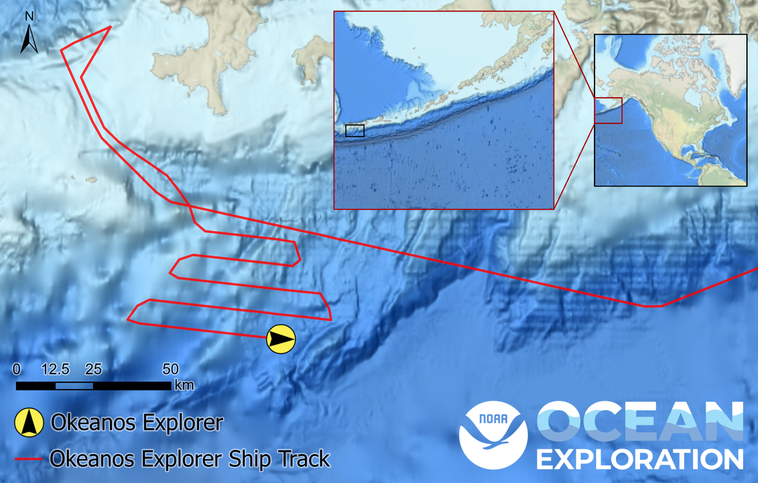
Ship tracks leading up to the location of NOAA Ship Okeanos Explorer at 16:45 UTC on May 16, 2023, during the Seascape Alaska 1: Aleutians Deepwater Mapping expedition. The tracks show a lawnmower pattern often used to ensure coverage of mapping target areas. The inset maps show the extent of the displayed tracks compared to the Aleutian Islands (left) and the location of the Aleutian Islands relative to North America (right).