
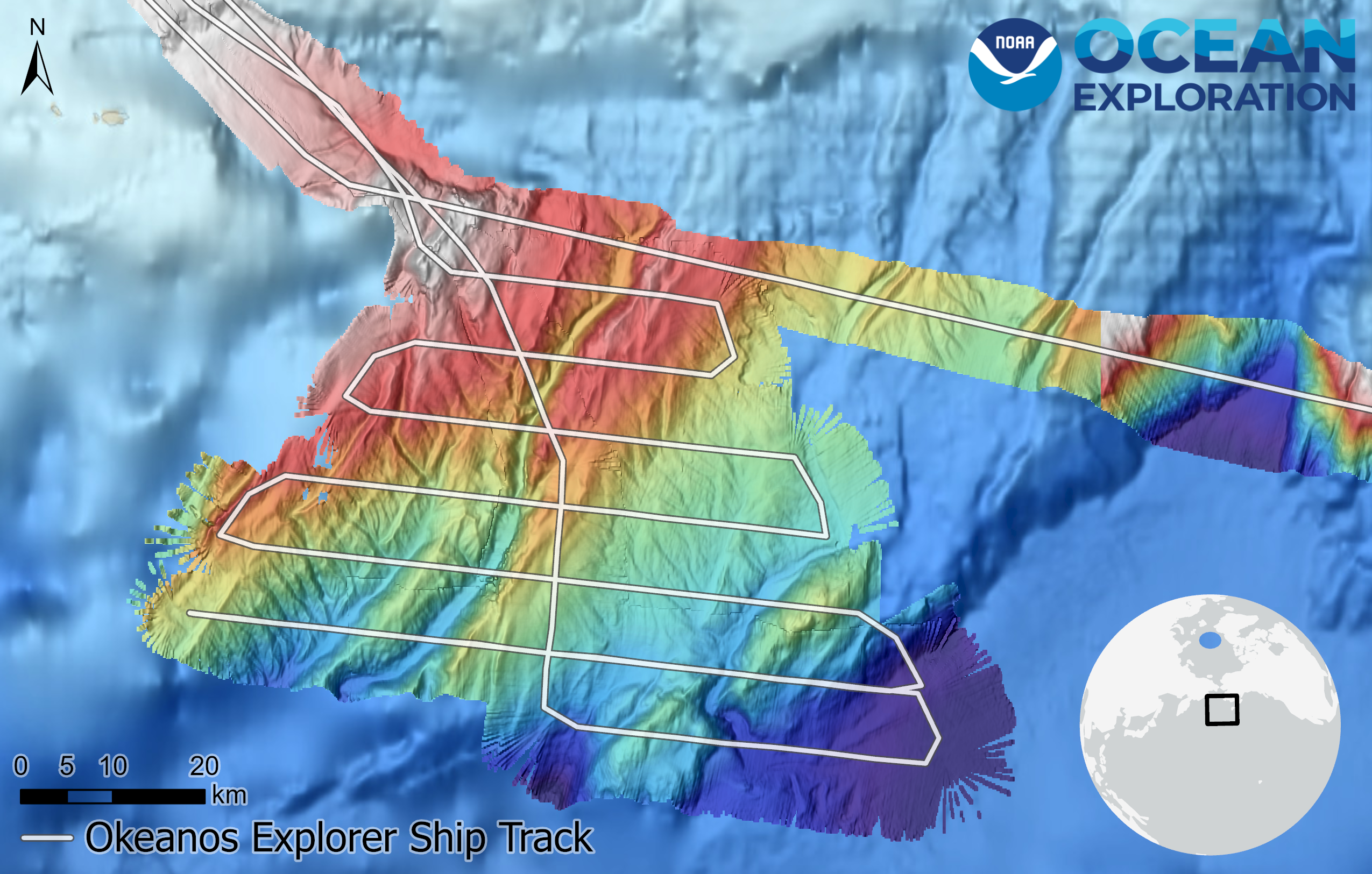
Bathymetry data collected on May 16, 2023, during the Seascape Alaska 1: Aleutians Deepwater Mapping expedition. The tracks depict NOAA Ship Okeanos Explorer’s lawnmower transects that were conducted to collect new mapping data. Features in dark blue are the furthest below the surface while those appearing white and red are closer to the surface.