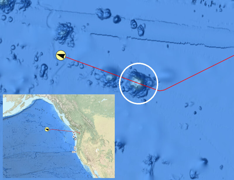
A screenshot of NOAA Ocean Exploration’s Okeanos Explorer - Live Operations Map showing the seamount mapped during the Seascape Alaska 1: Aleutians Deepwater Mapping expedition circled in white. The red line shows the Okeanos Explorer’s trackline, and the yellow circle with a black arrow shows the ship’s location at the time of the screenshot. The inset screenshot shows the ship’s position relative to the west coast of the United States and Canada.