
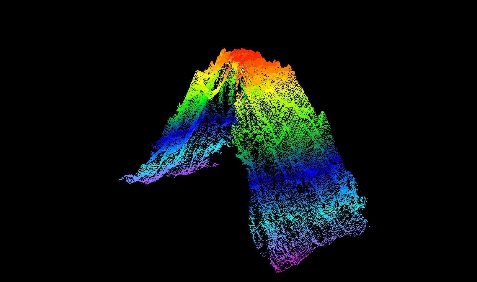
A point cloud of the seamount mapped during the Seascape Alaska 1: Aleutians Deepwater Mapping expedition, generated from acoustic data collected via multibeam echosounder. The hot colors (red, orange, and yellow) represent the newly mapped peak of the seamount at a depth of 895 meters (2,936 feet), while the cold colors (purple, teal, blue) represent the base of the seamount at a depth of around 4,000 meters (13,123 feet).