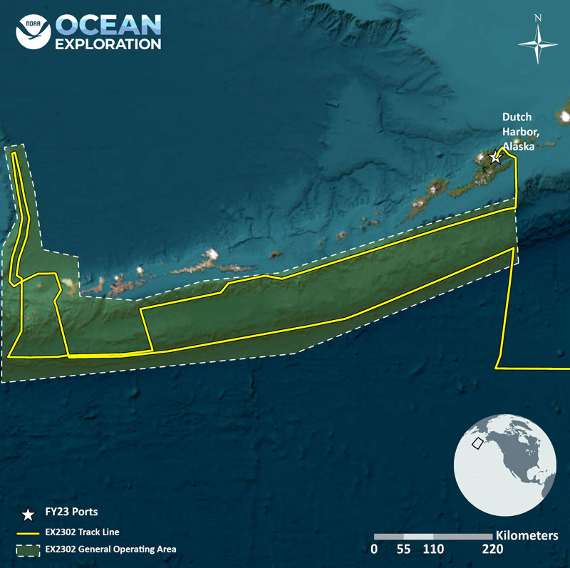
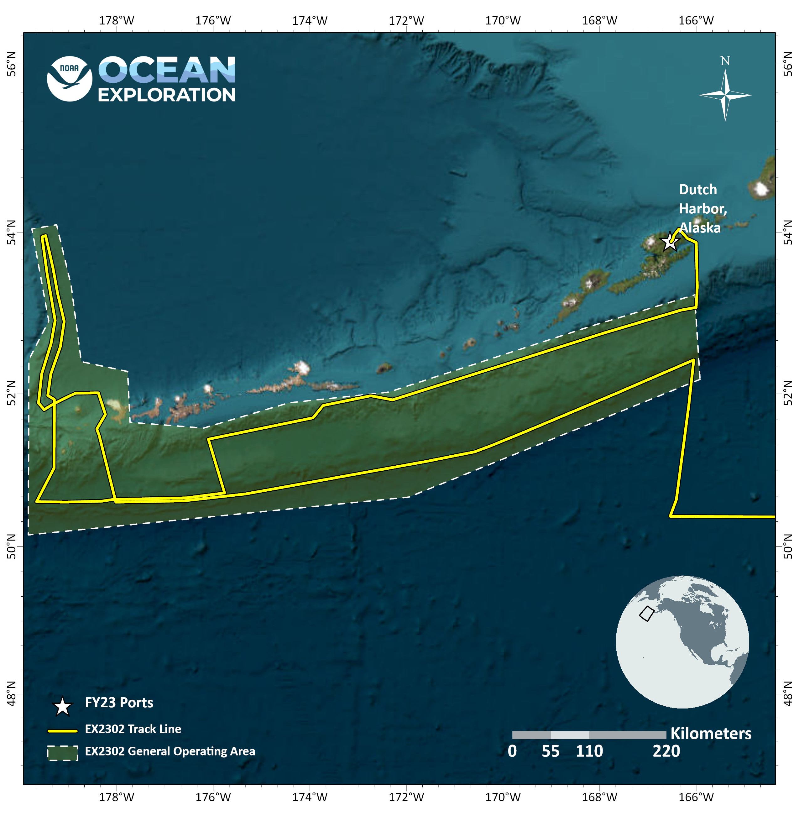
This map shows the general operating area along the Gulf of Alaska for the Seascape Alaska 1: Aleutians Deepwater Mapping expedition, with the approximate track of NOAA Ship Okeanos Explorer.