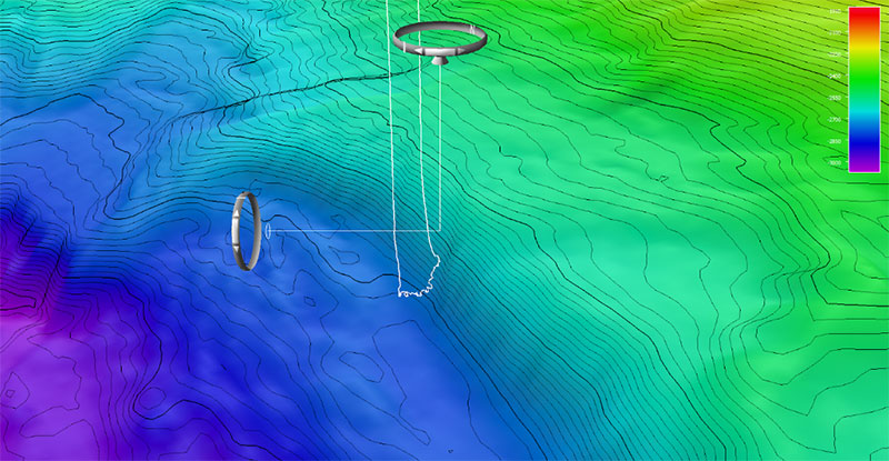
Three-dimensional view of bathymetry from Dive 05 of the Seascape Alaska 3 expedition showing the remotely operated vehicle (ROV) track up a submarine landslide scarp that may be related to the 1946 earthquake and tsunami on Unimak Island. The ROV landed at a depth of about 2,800 meters (9,186 feet) and covered about one-third of the scarp with its landslide rubble before ascending. The total relief on the scarp is about 400 meters (1,312 feet).