Seascape Alaska 3: Aleutians Remotely Operated Vehicle Exploration and Mapping
(EX2304)
Expedition Summary
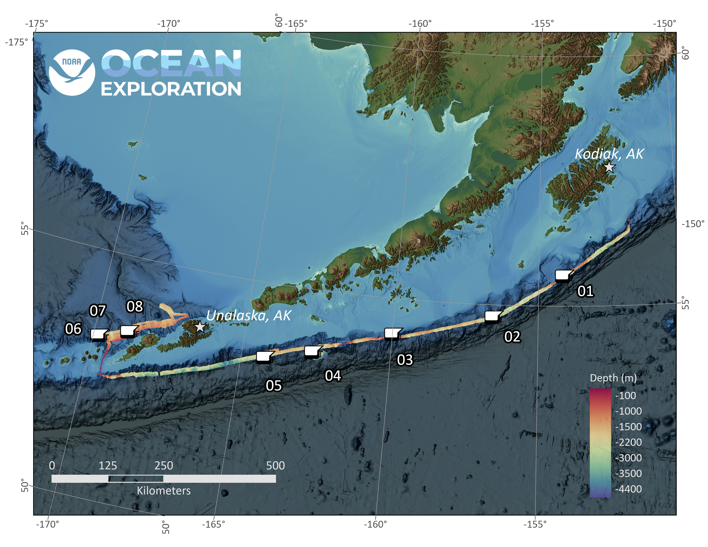
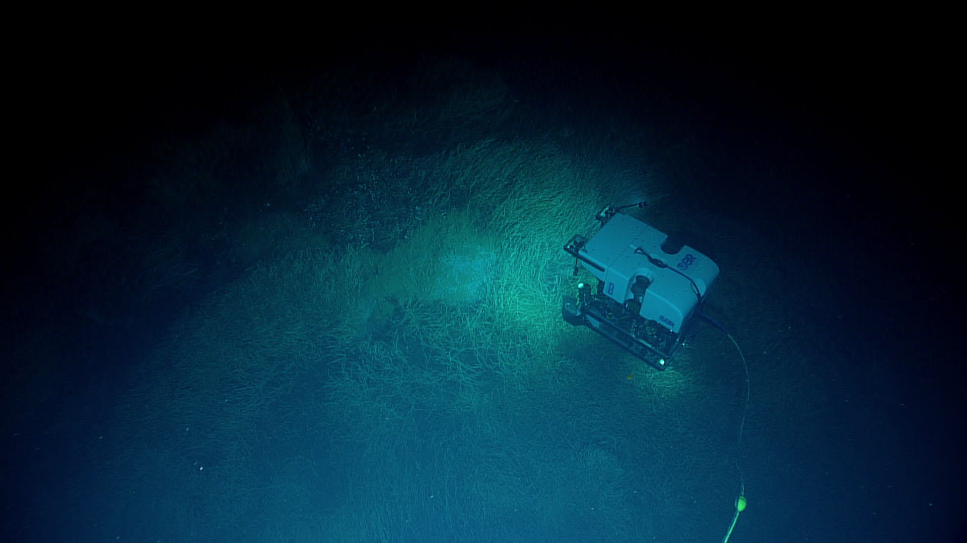
From July 14 - July 25, NOAA Ocean Exploration and partners conducted the third in a series of Seascape Alaska expeditions on NOAA Ship Okeanos Explorer. Over the course of 12 days at sea, the team conducted 6 full remotely operated vehicle (ROV) dives, mapped nearly 16,000 square kilometers (6,180 square miles), and collected a variety of biological and geological samples. When combined with numerous biological and geological observations, data from the Seascape Alaska 3: Aleutians Remotely Operated Vehicle Exploration and Mapping expedition will help to establish a baseline assessment of the ocean environment, increase understanding of marine life and habitats to inform management decisions, and increase public awareness of ocean issues.
During the Seascape Alaska 3 expedition, the team completed a total of six full remotely operated vehicle (ROV) dives, exploring sites ranging from the water column to an extensive gas seep covered with tubeworms and an amazing coral garden. The data collected during mapping and ROV operations throughout the expedition will help to fill some of the gaps in our understanding of the deep waters around the Aleutian Islands. Video courtesy of NOAA Ocean Exploration, Seascape Alaska. Download largest version (mp4, 274.2 MB)
Operational Summary
- Days at sea: 12
- Full ROV dives: 6, ranging in depth from 780 to 2,800 meters (2,559 to 9,186 feet)
- Biological samples collected: 22 primary samples, 31 associates
- Geological samples collected: 6
- Water samples collected for eDNA analysis: 28
- Seafloor area mapped: nearly 16,000 square kilometers (6,180 square miles)
- Science party participants: +40, from 5 countries
- Live video views: Approximately 21,800
New Species, New Records, New Observations
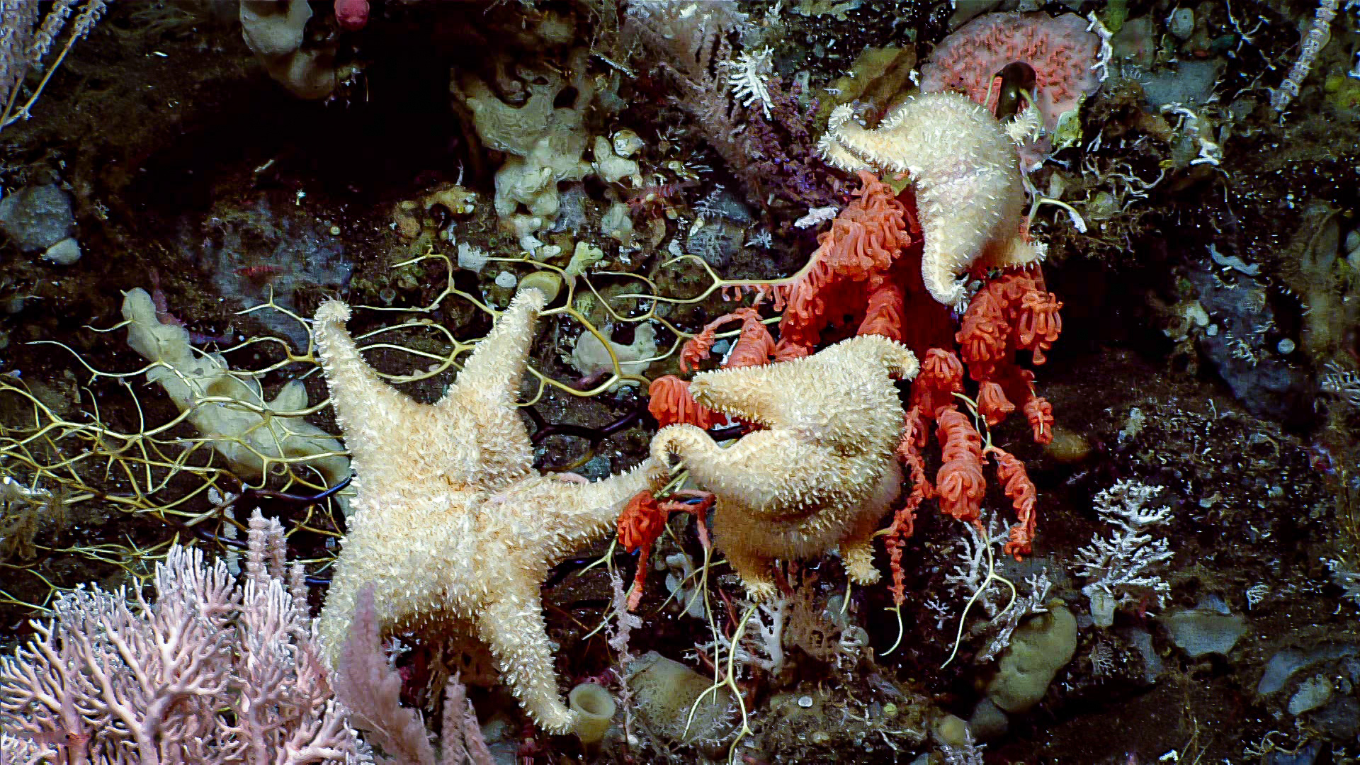
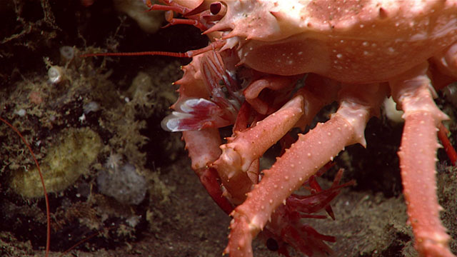
A major goal of the ROV dives conducted during the Seascape Alaska 3 expedition was to locate and characterize deep-sea coral, sponge, and chemosynthetic communities, and the dives did not disappoint!
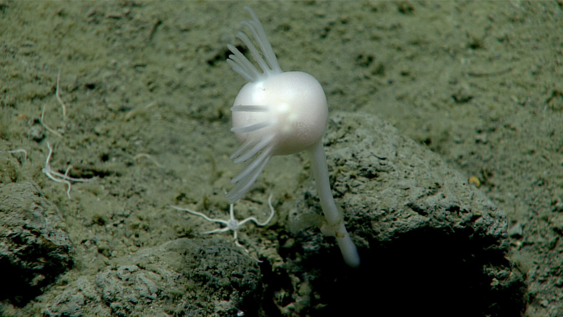
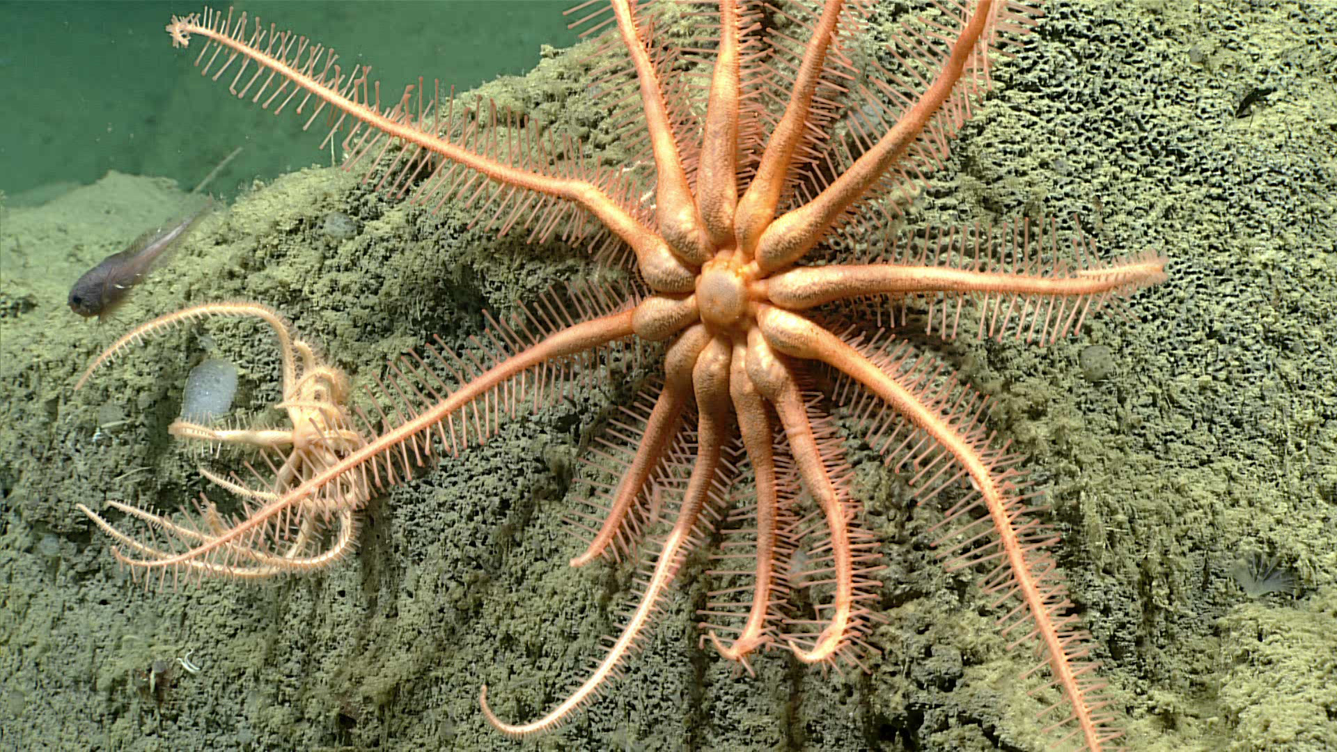
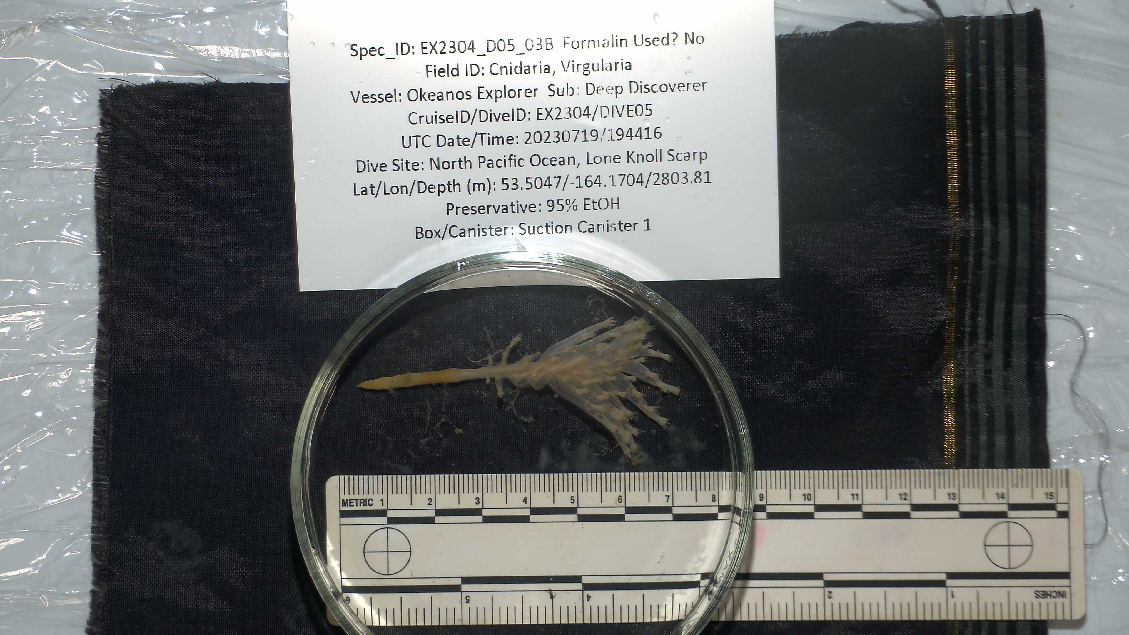
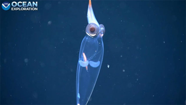
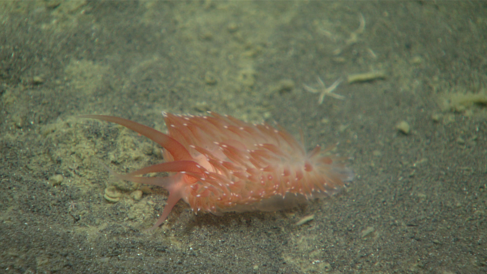
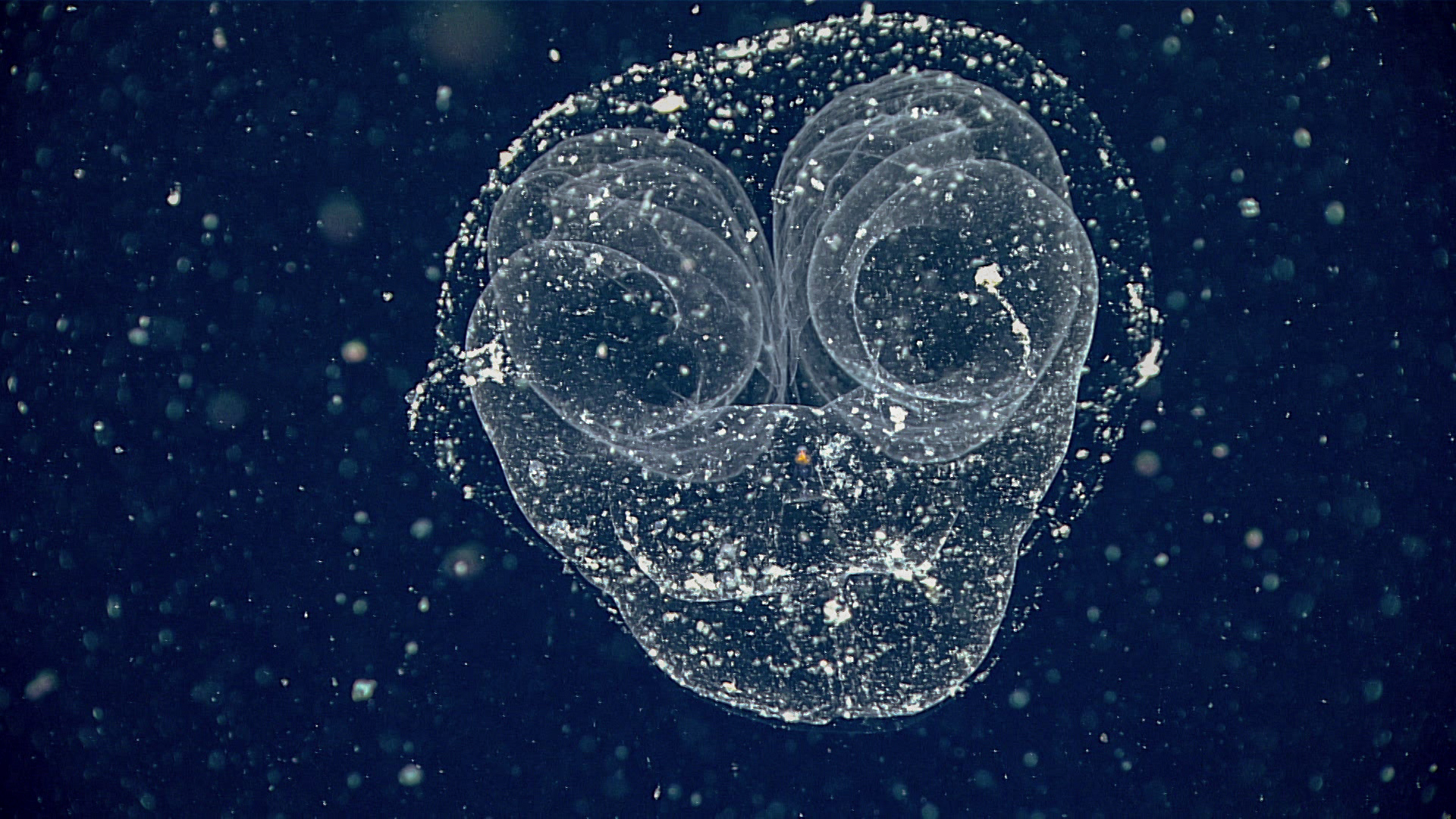
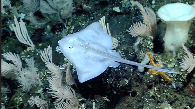
Exciting biological discoveries made during the expedition included imaging a potential new (to science) species of Virgularia sea pen, a potential new species of Cladorhizid sponge, and an unusual "simple," non-branching gorgoncephalid basket star. Scientists also identified range extensions for brisingid sea stars in the genus Astrocles and Hemicorallium coral, neither of which had been previously observed in this region of Alaska.
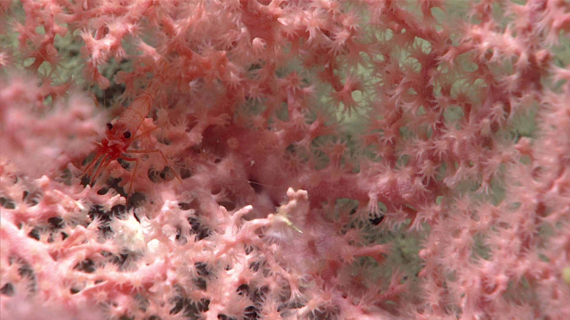
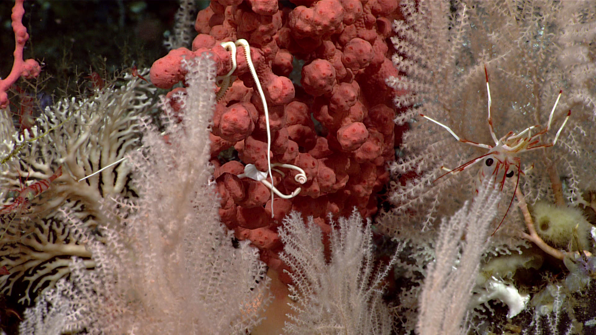
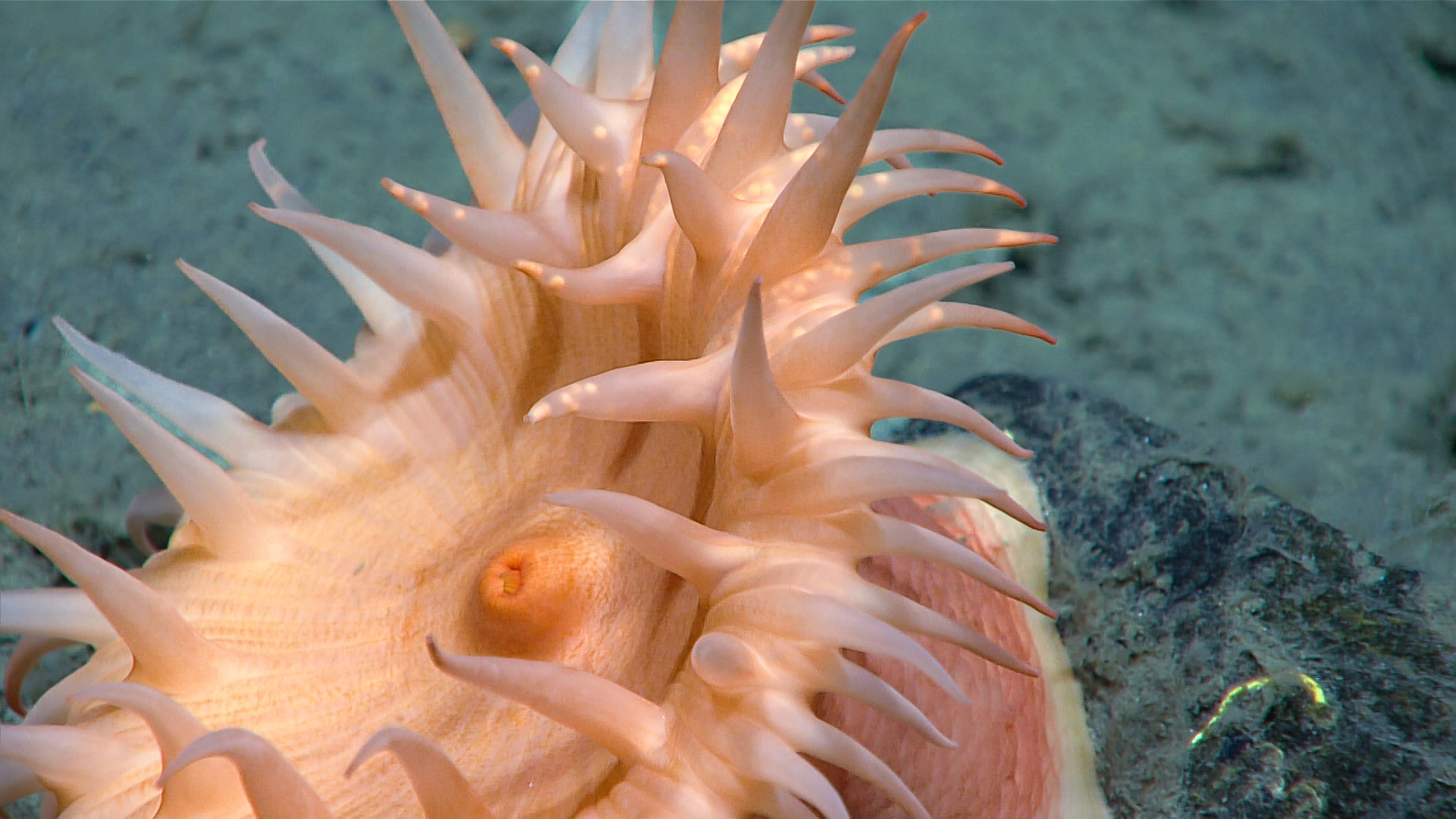
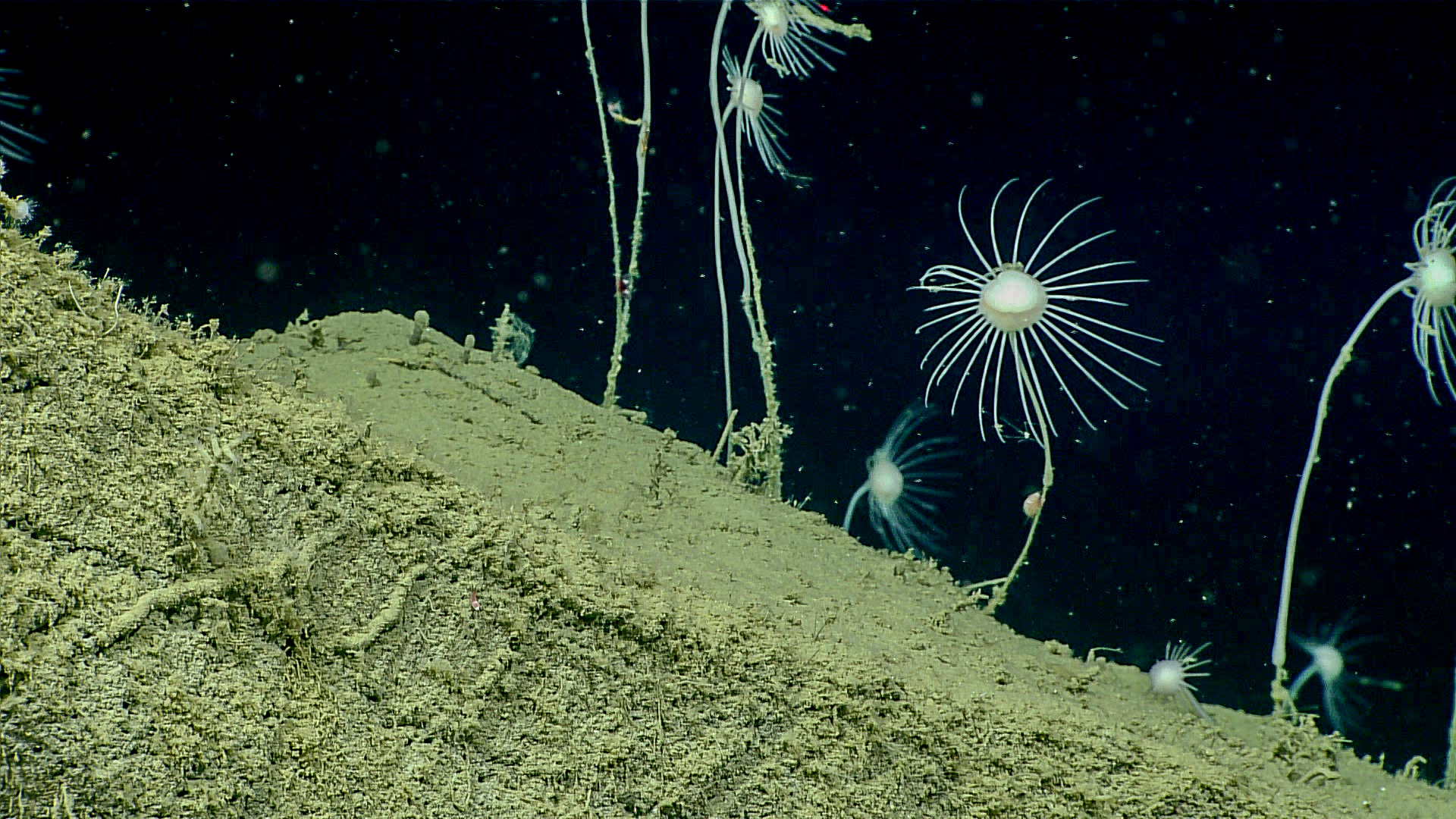
On Dive 07 of the expedition, a high-biodiversity coral and sponge garden was discovered while exploring "Uliaga Mound," a feature north of Uliaga Island with several small, approximately 500-meter (1,640-foot) -high mounds on the seafloor. Based on initial observations, scientists identified at least 15 different species of coral (Octocorallia, Scleractinia and Stylasterida), at least the same number of species of sponges, and many more species of associates. However, due to the extremely high densities of organisms seen on the dive, these numbers are likely vastly underestimated and will only increase once image analysis can be performed on collected video footage.
Dive 07 of the Seascape Alaska 3 expedition was spectacular! We were treated to a colorful array of diverse marine life, notably corals and sponges that served as "ecosystem engineers," forming habitat for other organisms. The mound feature explored during the dive was indeed a hotspot for biodiversity. Video courtesy of NOAA Ocean Exploration, Seascape Alaska. Download largest version (mp4, 82.3 MB)
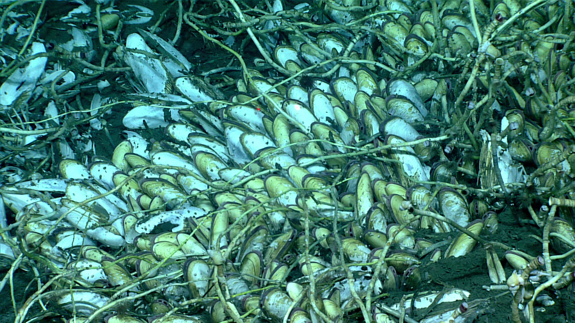
During the fourth dive of the expedition, the team discovered a large tubeworm and clam field on top of a hydrocarbon seep, located approximately 48 kilometers (30 miles) offshore Sanak Island, southwest of Anchorage. The seep was initially detected in mapping data collected during the Seascape Alaska 1 expedition. While the team was only able to survey a small fraction of the site during the ROV dive, they estimate that that field stretches nearly the length of two football fields, which would make it one of, if not the largest field of tubeworms and clams ever discovered.
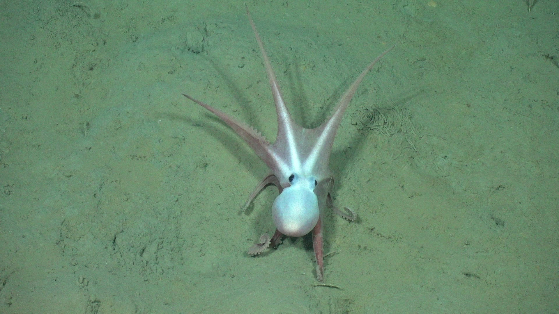
In addition to the biological discoveries made during the expedition, unique observations of organisms captured in images and video reveal new insights into life in the deep ocean, increasing our ability to manage marine resources and our understanding of deep-sea ecosystem connectivity across the Pacific basin. Some of these observations are highlighted in the gallery below (click on a thumbnail to learn more about each observation!).
Geological Insights
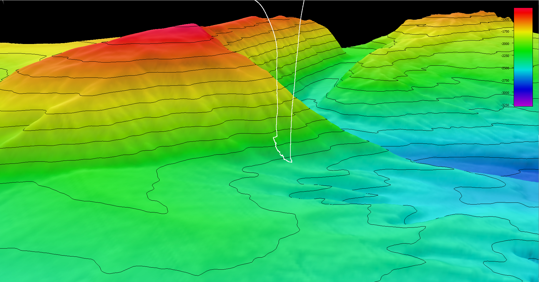
During the Seascape Alaska 3 expedition, the team mapped nearly 16,000 square kilometers (6,180 square miles) of seafloor, laying the foundation for follow-up exploration during ROV dives and the opportunity for more exciting discoveries during the expedition itself and filling critical gaps in mapping data within deepwater areas around the Aleutian Islands.
“Big Bend Canyon,” a previously unmapped and unexplored submarine canyon that is cut into the current continental slope, was discovered during the Seascape Alaska 3 expedition. The canyon was revealed in new multibeam data collected during the expedition and, using that collected data, part of the canyon was visually surveyed via ROV during Dive 02. Scientists observed exposures of fractured bioturbated mudstone along the canyon walls and glacial dropstones from a previous glacial advance at or near the shelf edge along the canyon’s floor.
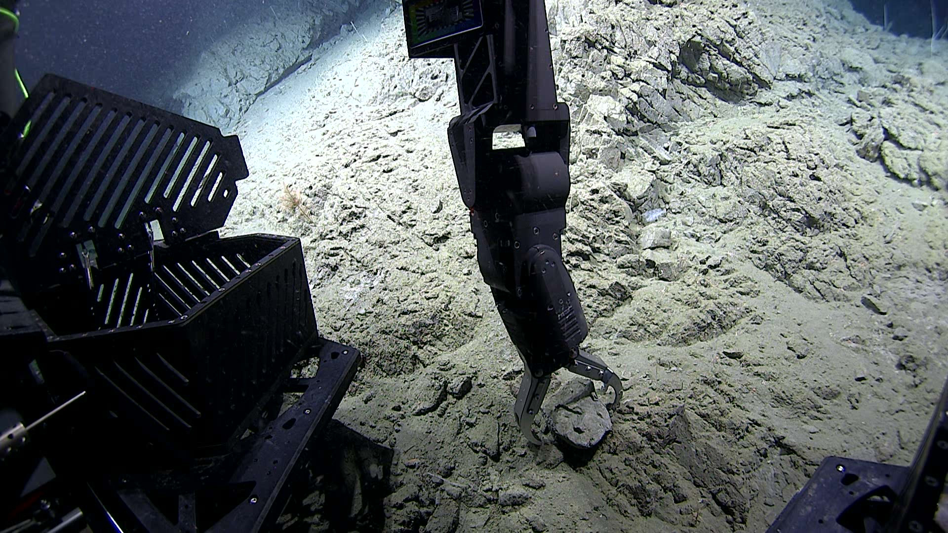
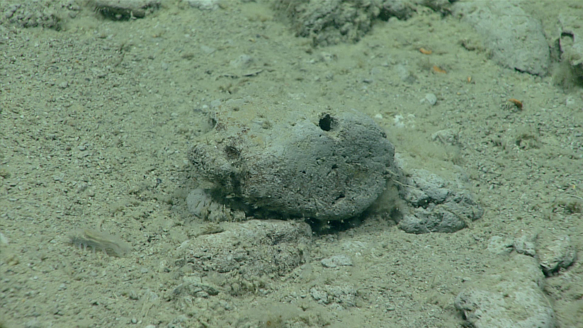
Many of the dives that yielded the exciting biological discoveries mentioned earlier also held geological discoveries. Several morphologies of in situ methane hydrates were discovered with associated methane-derived authigenic carbonate at the seep site where the large field of tubeworms and clams were found during Dive 04. A sample of conglomerate cemented with authigenic carbonate was collected during the dive; the carbonate might provide insight into the age and genesis of the hydrate accumulations and associated seep.
Lone Knoll Scarp, a very large landslide scarp, was explored during Dive 05 of the expedition. This scarp feature was previously interpreted as the landslide block partially responsible for the large and destructive 1946 tsunami that destroyed the Scotch Cap lighthouse on Uminak Island and crossed the Pacific and made it all the way to Antarctica.
All of these observations serve to increase our understanding of the geologic history of the region, which in turn can lend insights into potential causes and consequences of natural hazards such as submarine landslides and resulting tsunamis and the probability of future hazard occurrence.
Engaging the Scientific Community and the Public
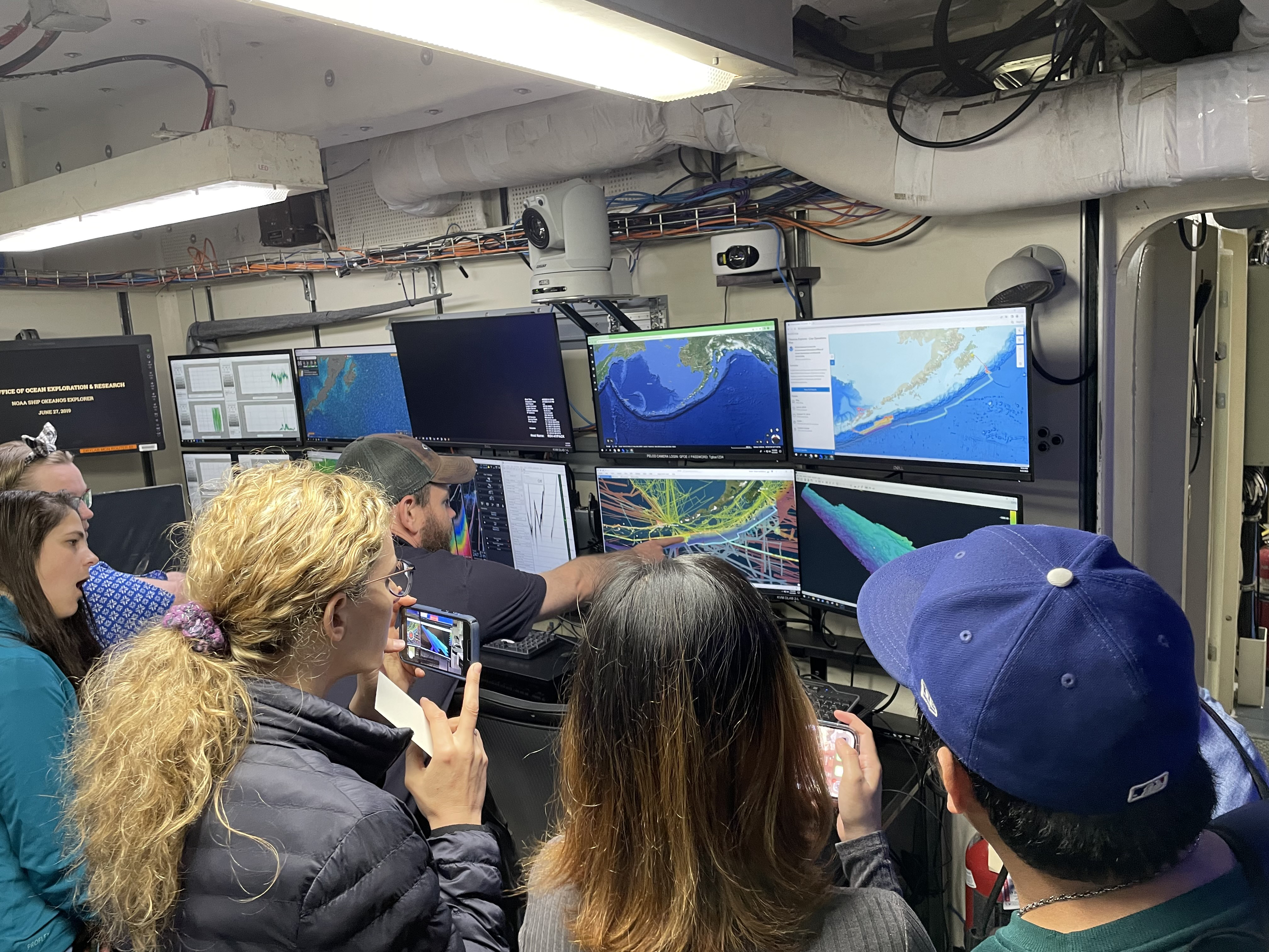
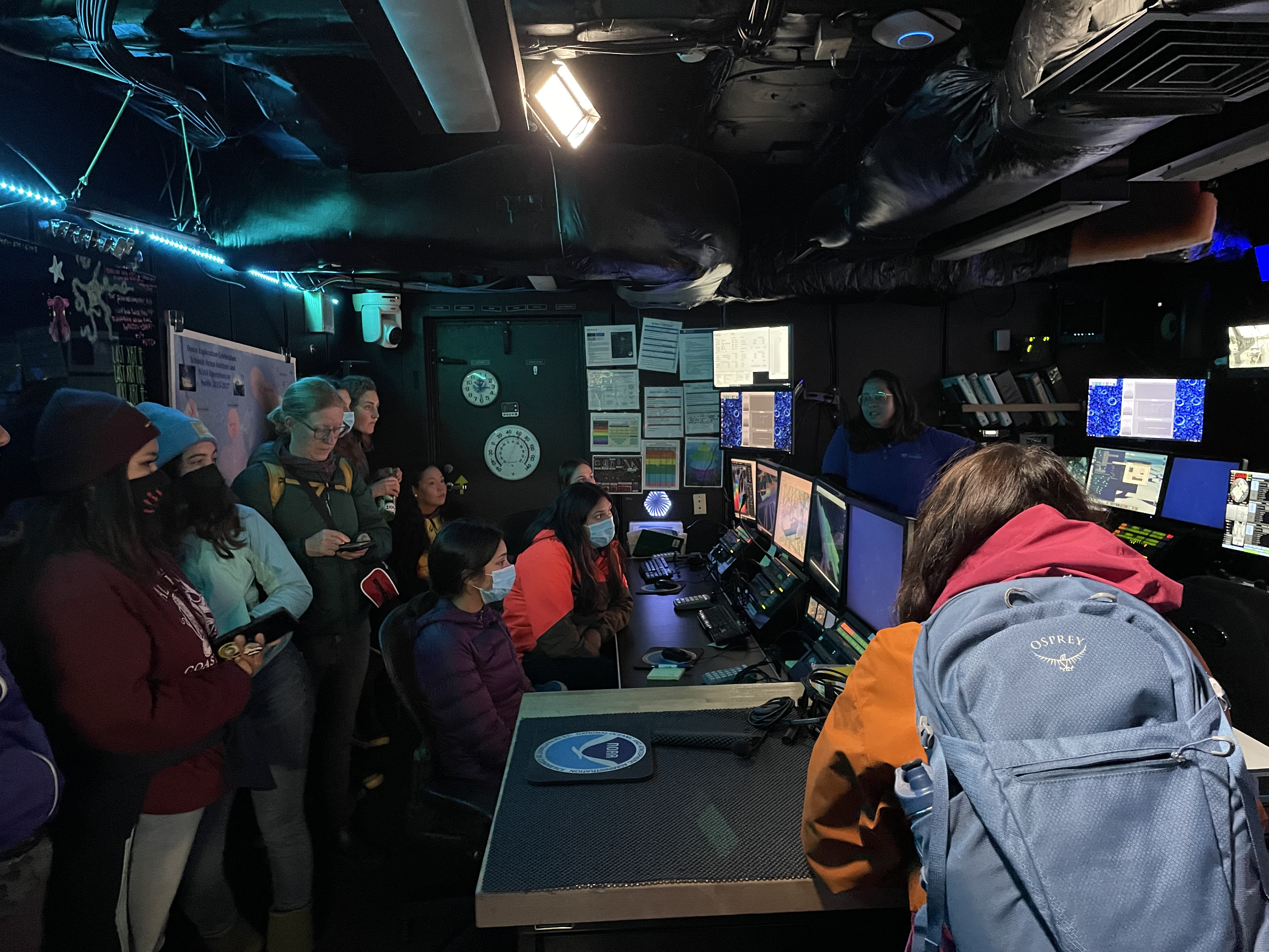
On this expedition, over 40 scientists, resource managers, and students from around the world, including in the United States, Canada, Japan, Sweden, and New Zealand, participated in the dives from shore, thanks to telepresence technology on the ship. Additionally, that same technology allowed us to host ship-to-shore interactions and deliver live online streaming of ROV dives to the general public, opening a window of understanding into the deep waters off Alaska for audiences around the world.
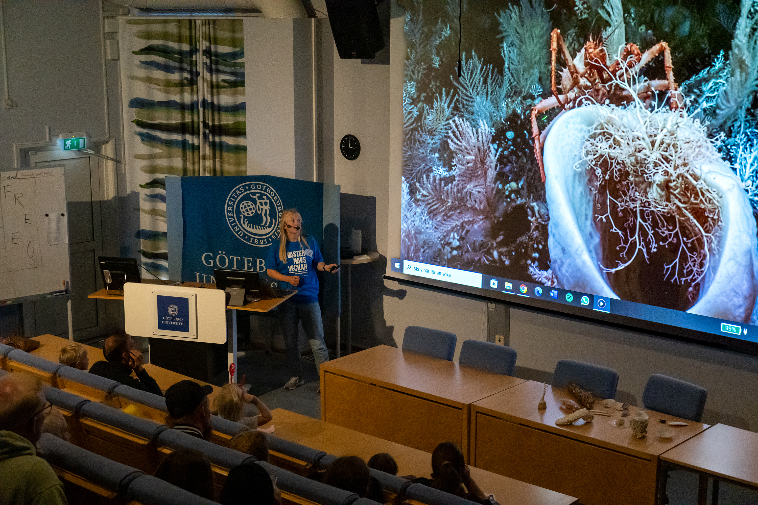
On the ground, ship tours conducted in Kodiak prior to the start of the expedition provided local community members, including educators with the Kodiak Island Borough School District, interns with the Alutiiq Museum/Center for Alaskan Coastal Studies, and staff from the NOAA Fisheries Kodiak Laboratory and Alaska Sea Grant, a behind-the-scenes glimpse into exploration work on Okeanos Explorer. Several members of the media also were given a tour of the ship and opportunity to learn more about operations. And, on the other side of the globe, a team at the Tjärnö Aquarium created a new exhibit to allow aquarium visitors to dive deep into the expedition with expedition biology lead Rhian Waller, a researcher at the Tjärnö Marine Laboratory in Sweden.
Published September 29, 2023