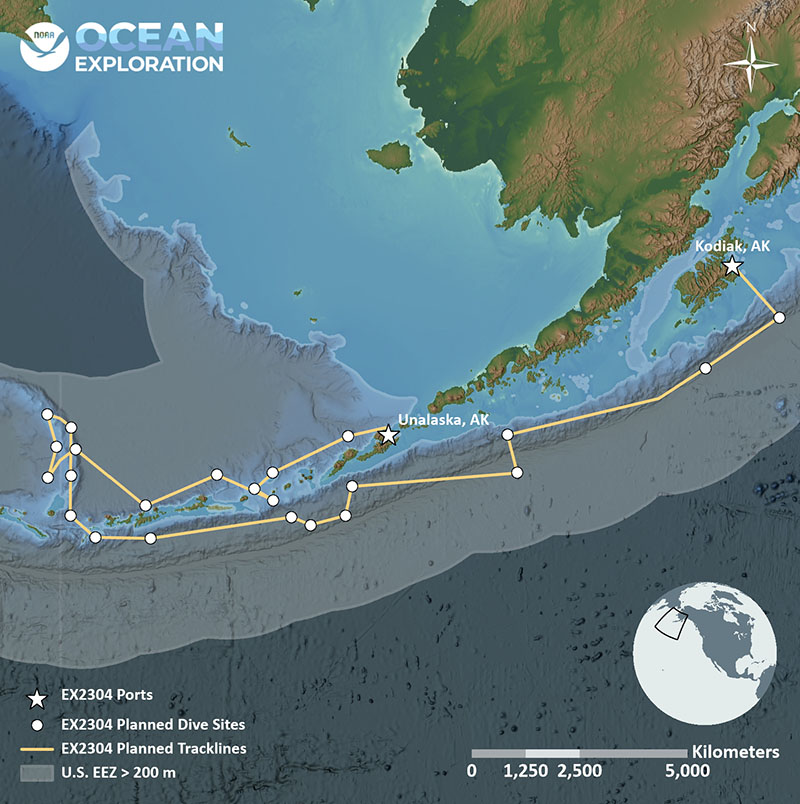
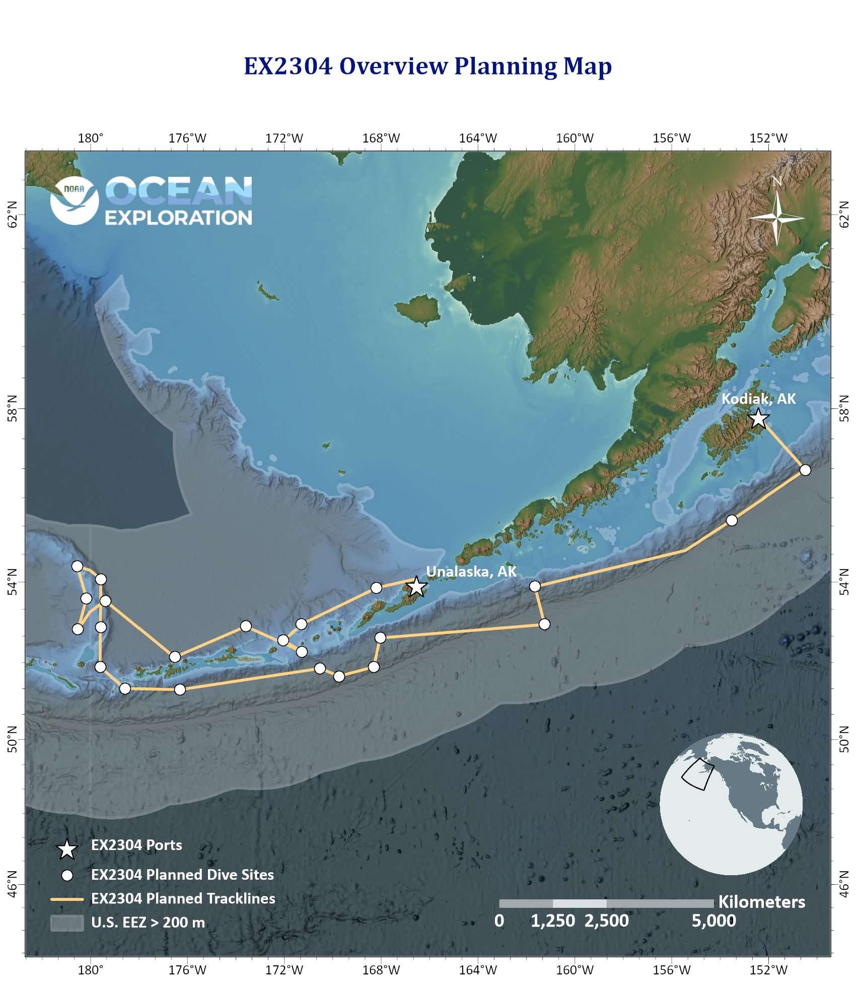
This map shows the general operating area off Alaska during the Seascape Alaska 3: Aleutians Remotely Operated Vehicle Exploration and Mapping expedition, with the approximate track of NOAA Ship Okeanos Explorer shown as a yellow line and proposed dive sites as white circles.