

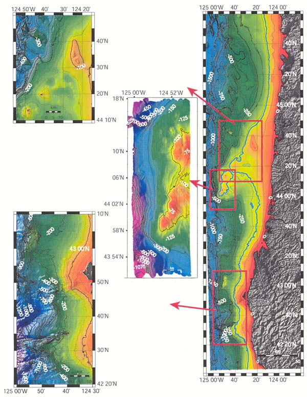
Map showing Oregon continental margin and three study areas. The panel in the upper left corner indicates target area for the August 2002 mapping effort. The middle panel shows Heceta Bank which was mapped in 1998, and the focus of a portion of the 2001 Lewis and Clark Ocean Exploration. Image courtesy of Lewis And Clark Legacy Expedition, NOAA-OER.