
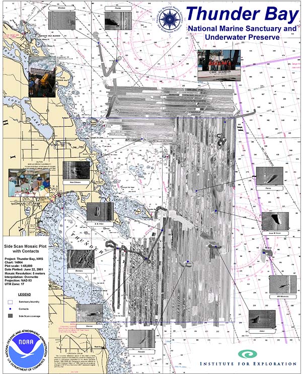
Map depicting the side scan sonar tracklines and shipwrecks found in the vicinity of the Thunder Bay National Marine Sanctuary and Underwater Preserve. Image courtesy of Thunder Bay 2001, Robert McGreevy, NOAA-OER.

Map depicting the side scan sonar tracklines and shipwrecks found in the vicinity of the Thunder Bay National Marine Sanctuary and Underwater Preserve. Image courtesy of Thunder Bay 2001, Robert McGreevy, NOAA-OER.