
by Elizabeth "Meme" Lobecker, NOAA Office of Ocean Exploration and Research
July 26, 2019
This video shows the location of an unknown shipwreck, indicated with a red pin, 70 nautical miles south of Block Island, Rhode Island, at the edge of the continental shelf break at Block Canyon. The wreck was mapped by NOAA Office of Ocean Exploration and Research in 2011. Created in QPS Fledermaus. Video courtesy of the NOAA Office of Ocean Exploration and Research. Download larger version (mp4, 31.6 MB).
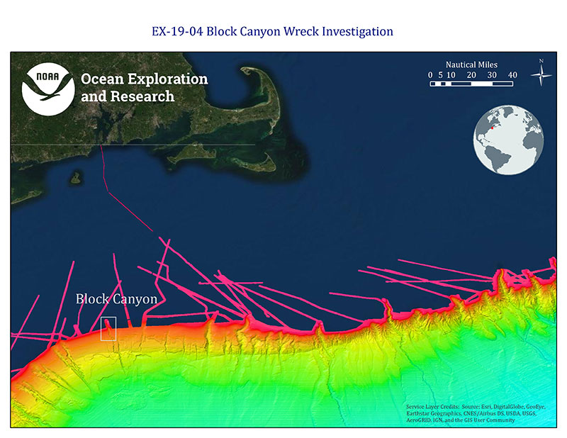
Figure 1. Map of area offshore Rhode Island and Cape Cod; Block Canyon indicated in grey box. Brightly colored bathymetry data are a compilation of Okeanos Explorer and Extended Continental Shelf Project data and reveals numerous submarine canyons. Image courtesy of the NOAA Office of Ocean Exploration and Research. Download larger version (jpg, 2.8 MB).
Situated on the continental shelf break, 70 nautical miles south of Block Island, Rhode Island, an unknown shipwreck rests in 350 meters (1,150 feet) of water at the head of Block Canyon, a popular location for commercial and recreational fishing. The wreck was mapped using NOAA Ship Okeanos Explorer’s EM 302 30 kHz multibeam sonar in 2011 during expedition number EX-11-06. During this expedition, we mapped numerous canyons along the continental shelf break between Cape Hatteras and Rhode Island, including Block Canyon (Figure 1). The 2011 cruise marked the first time the ship made port at her home pier in Davisville, Rhode Island, after conducting three years of ocean exploration work in the Pacific Ocean, as distant as Indonesia.
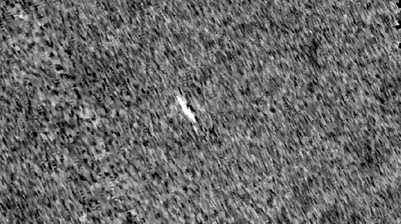
Figure 2. Bottom backscatter mosaic of shipwreck, with ship shown in white surrounded by a homogenous seabed. Image created in QPS FMGT, mosaic resolution 1.3 meters. Image courtesy of the NOAA Office of Ocean Exploration and Research. Download larger version (jpg, 373 KB).
Now these data will be used to conduct the next step of ocean exploration – high-resolution imaging and mapping with a remotely operated vehicle (ROV). The ROVs Deep Discoverer (D2) and Seirios will dive on this wreck on July 27, 2019, and will map it in fine resolution using the Kraken Robotics SeaVision® 3D laser imaging system mounted on D2 as part of the 2019 Technology Demonstration mission. The SeaVision® laser scanner uses a line of laser light to generate high-resolution, 3D representations of objects on the seafloor and has the potential to increase our ability to make precise measurements (size, density, etc.) about animals and other objects on the seafloor and thus enhance our ability to better understand and characterize deep-sea communities.
This video shows an 8-meter grid of the EM 302 multibeam bathymetry data collected over the unknown wreck at the head of Block Canyon. Created in QPS Fledermaus. Video courtesy of the NOAA Office of Ocean Exploration and Research. Download larger version (mp4, 6.8 MB).
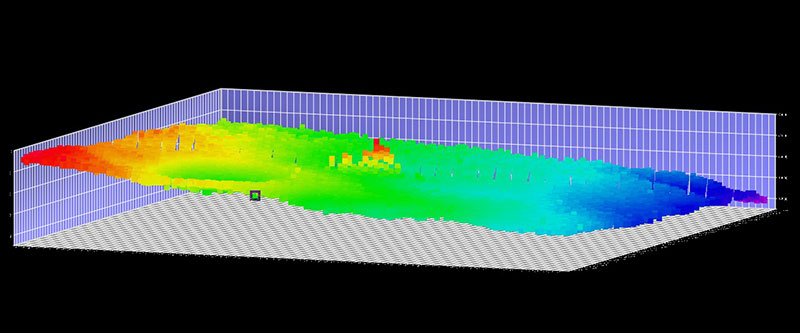
Figure 3. Unknown shipwreck at Block Canyon. This view is looking abeam. Image created in QPS Qimera 3D Editor, vertical exaggeration 3x. Image courtesy of the NOAA Office of Ocean Exploration and Research. Download larger version (jpg, 267 KB).
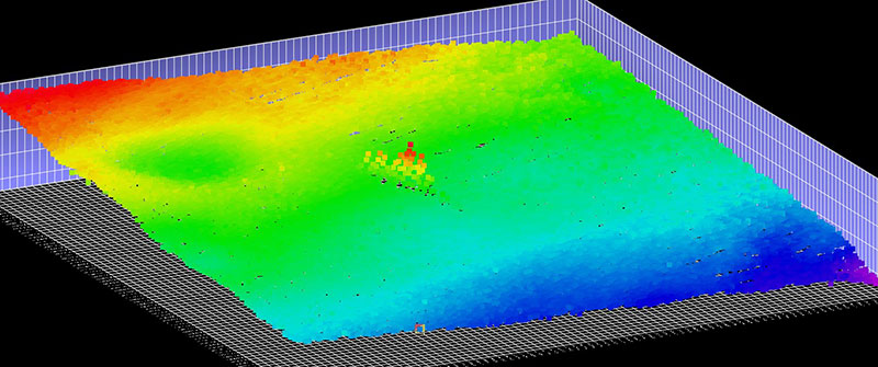
Figure 4. Oblique view of the shipwreck. Image created in QPS Qimera 3D Editor, vertical exaggeration 3x. Image courtesy of the NOAA Office of Ocean Exploration and Research. Download larger version (jpg, 524 KB).
The dimensions of the unknown wreck, as shown in Figure 2, are 105 x 18.6 meters (344.5 feet x 61 feet). A least depth of 333 meters* (1,093 feet) indicates it is 16.65 meters (54.6 feet) proud from the bottom, and initial data analysis reveals that the vessel may be sitting upright (Figures 3, 4). There is no scour surrounding wreck, which may indicate it has come to rest here relatively recently. The surrounding seabed is generally benign, with a homogenous substrate and a few shallow, round depressions in the area (Figures 2, 5, 6).
Tune in for the dive tomorrow to see what else we can uncover!
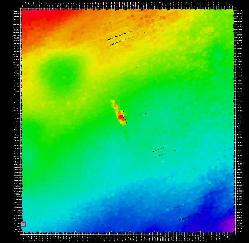
Figure 5. Overhead view of the shipwreck. Image created in QPS Qimera 3D Editor. Image courtesy of the NOAA Office of Ocean Exploration and Research. Download larger version (jpg, 358 KB).
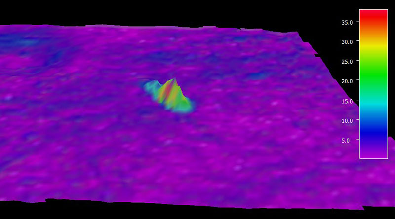
Figure 6. Shipwreck shown colored by slope, indicating surrounding seabed is generally flat with slopes of up to seven degrees. Image created in QPS Fledermaus, vertical exaggeration 3x. Color bar indicates slope of the seabed in degrees. Image courtesy of the NOAA Office of Ocean Exploration and Research. Download larger version (jpg, 181 KB).
Data notes: All data shown in these images was collected in partnership by the NOAA Office of Ocean Exploration and Research and NOAA Ship Okeanos Explorer, during cruise EX-11-06 and is freely available in public archives in freely usable formats. Bathymetry data shown was gridded to eight-meter resolution. *Data was not tidally corrected.