Ocean Exploration Technology:
Maritime Archaeology

For thousands of years, people across the planet have used the ocean, coastal waters, rivers, and lakes as a means of travel, allowing them to explore new places and share ideas and resources. Our deep connection with the sea can be seen in landscapes and material culture (meaning physical features and artifacts), as well as in cultural practices and worldviews. Maritime archaeology studies past human interaction with the ocean by examining material culture and other remains—and it has a big story to tell.

OYLA #24, November 2022
By Frank Cantelas, Phil Hartmeyer, and Rachel Gulbraa

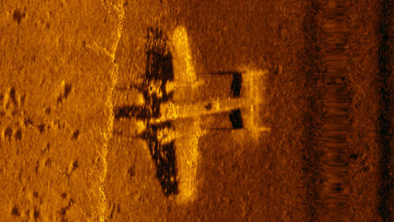
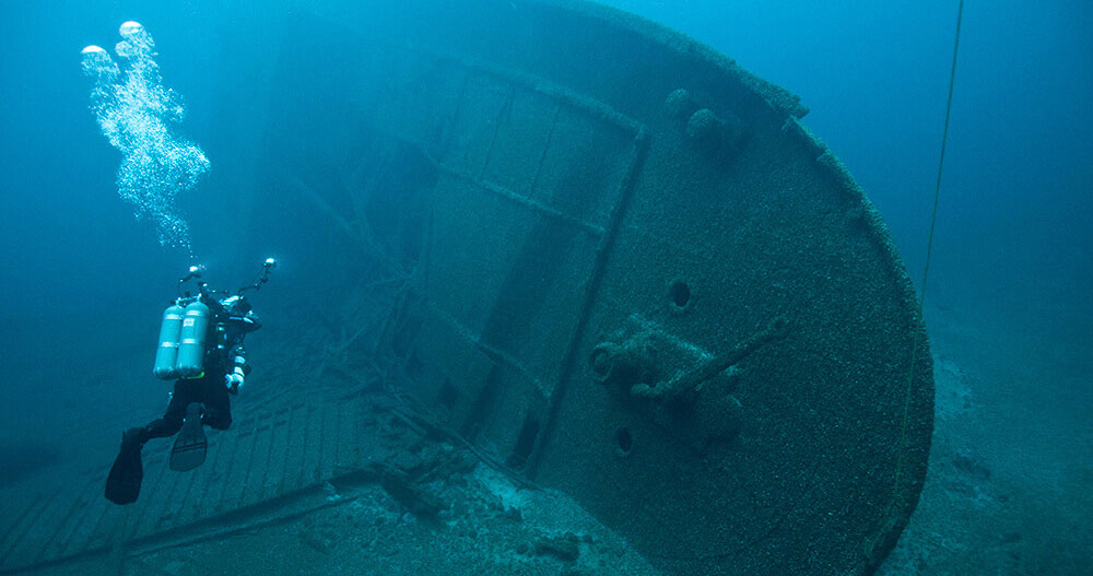
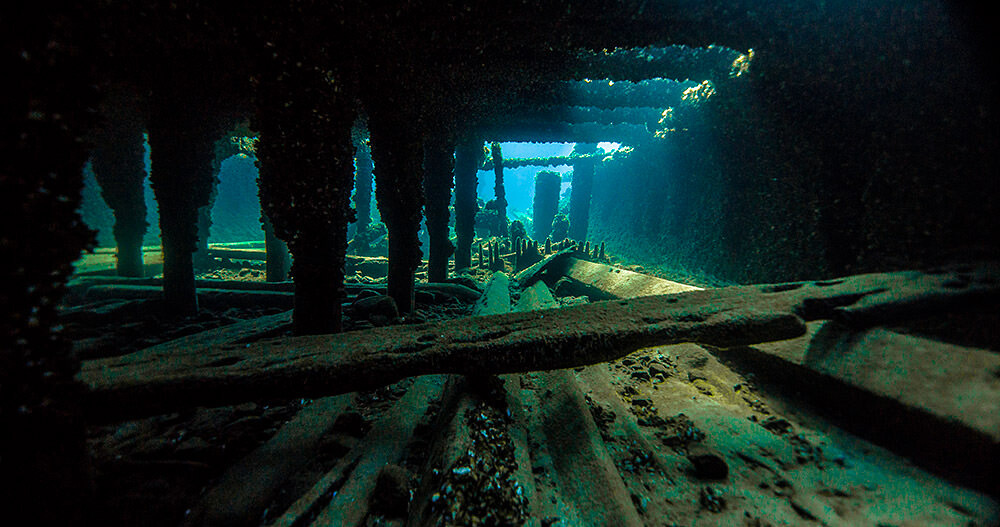
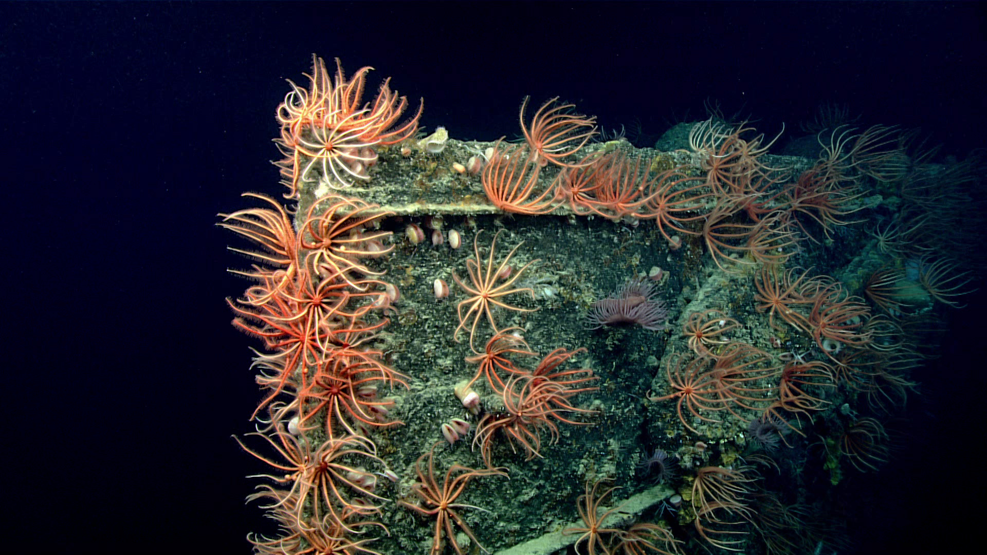
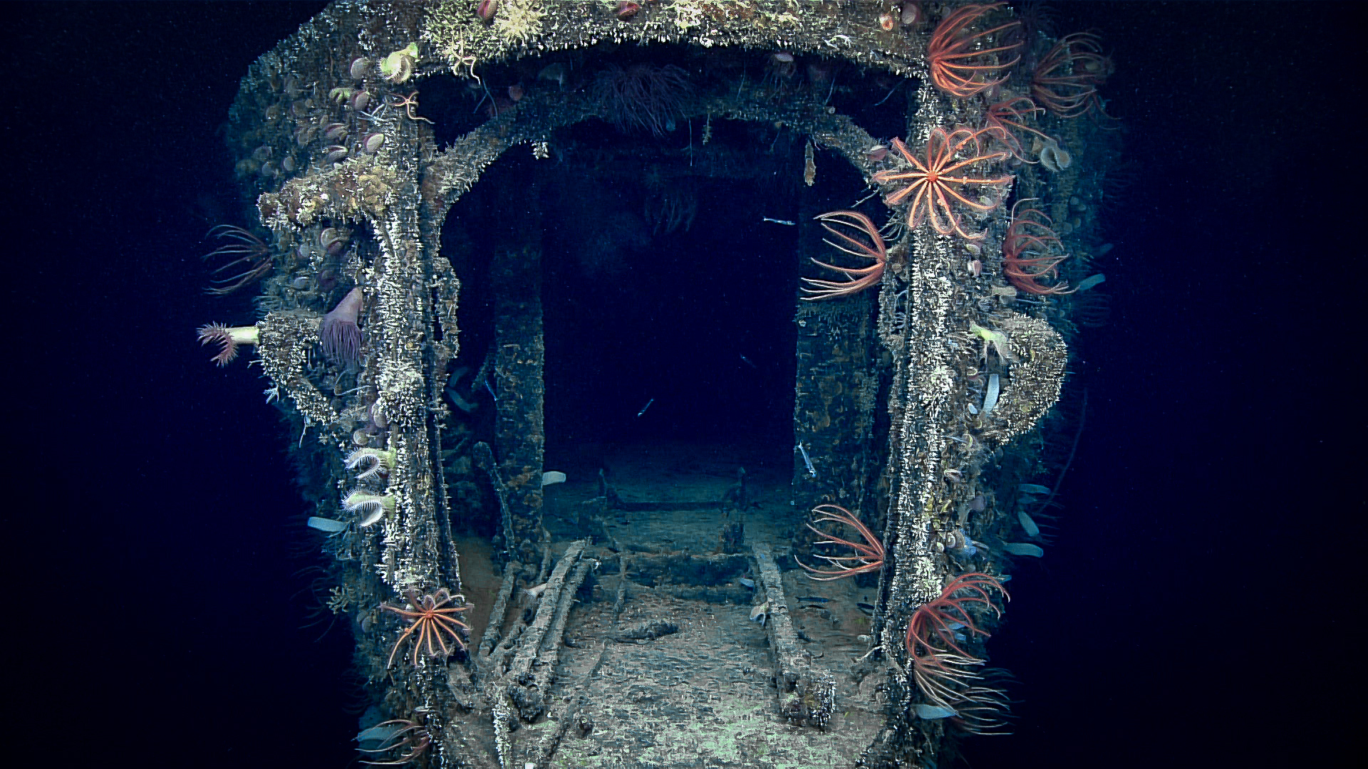
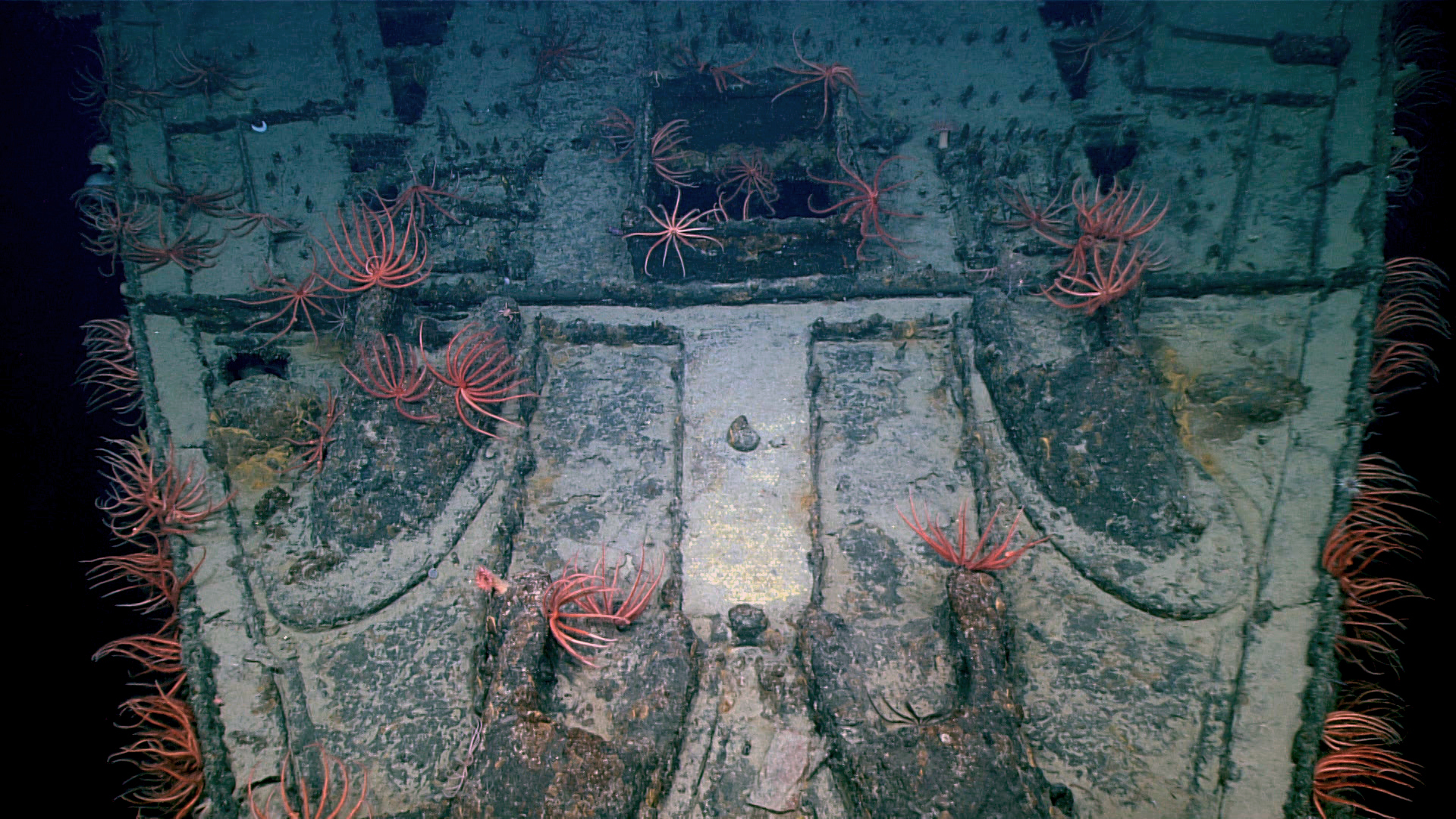
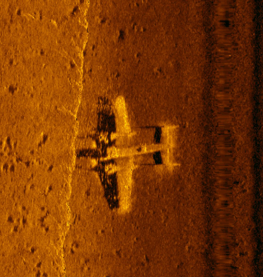
The stories that emerge from material culture left behind by our predecessors span time and geography. Dugout canoes built from single trees and excavated out of river banks tell the stories of Indigenous North Americans who used interior waterways to establish intricate trade networks. The remnants of slave ships lost in the Atlantic give testimony to one of humanity’s darkest chapters. Lost submarines, battleships, and other vessels of war recount past international conflicts that shaped the history of nations. These sites can expand our larger understanding of history while at the same time providing a glimpse into the everyday lives of those who came before through the objects and environments they interacted with.

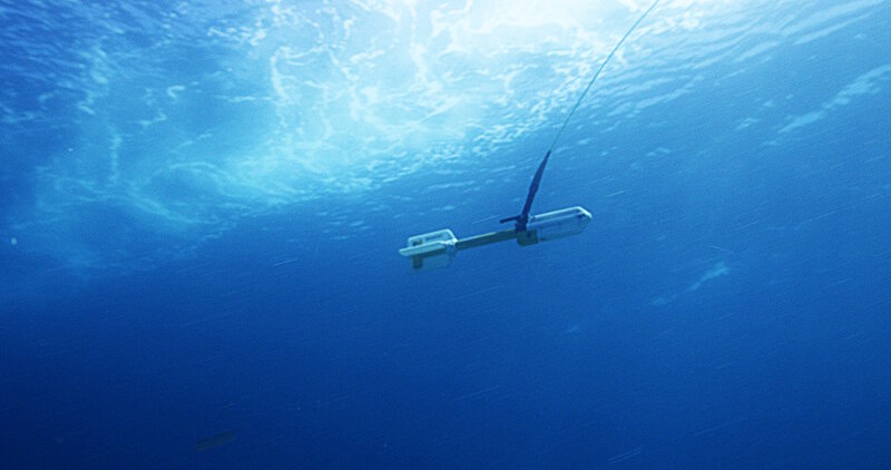
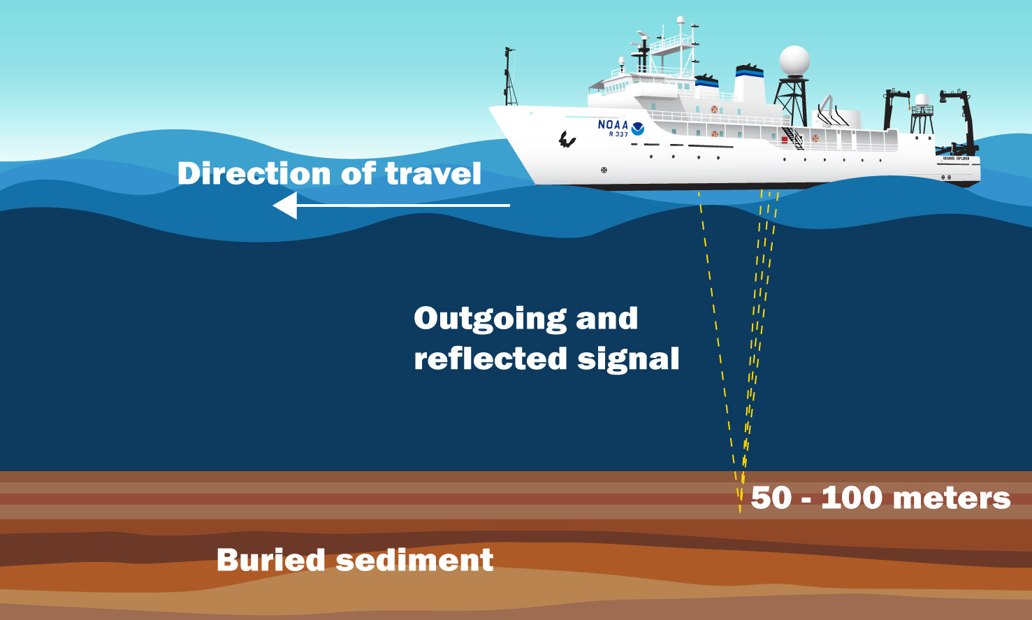
In addition to providing insight into our past, maritime archaeology can also help inform our future as we learn more about how this material record is impacted by human stewardship and climate change. Continuing advancements in ocean science technology allow us to better understand this heritage, and to discover more distant signals of the past in ever more difficult-to-reach places like the deep sea. Continue reading to learn more about maritime archaeology and the wide range of topics it encompasses—from ancient landscapes to shipwrecks.

A Brief History of Maritime Archaeology

The field of maritime archaeology began shortly after Jacques Cousteau patented the Self Contained Underwater Breathing Apparatus (SCUBA) in 1943. SCUBA allowed ocean stewards enough time underwater to conduct science and experience the underwater world in ways that were previously only available to tethered commercial divers. Archaeologists and maritime historians quickly incorporated this technology into their work, training across disciplines to create the new field of maritime archaeology.

Images courtesy of The Cousteau Society .

Their initial mission was to discover archaeological sites and recover artifacts that illuminated our maritime connections—all within the 30 meters (98 feet) operational depth limits of Cousteau’s new technology.

The field’s early focus on bringing their findings to the surface resulted in many of these first underwater artifacts being shared with the public. However, we now know that material culture that has been submerged for tens, hundreds, or thousands of years requires advanced stabilization techniques to stop the rapid deterioration they undergo when removed from seawater. Oftentimes the inability or failure to properly preserve recovered marine artifacts has led to their complete destruction. Maritime archaeologists now prefer to document underwater sites in situ, or in place, right where they are found on the seabed. This approach requires archaeologists to employ a variety of techniques and technologies to discover, characterize, and interpret a site.

Modern Methods

Maritime archaeological research generally begins in the archives. Scientists scour sources such as naval and lighthouse keeper records, shipwreck accounts, old maps and charts, and court proceedings to learn about vessels that may have been lost in an area of interest long ago. Archaeologists then deploy various technologies to map the seafloor and identify targets for further investigation. These technologies include side-scan sonar, an acoustic instrument which emits thousands of sound "pings" towards the seafloor and then creates a picture of the bottom using the time and strength of the sound return. Side-scan sonars are often towed behind a research vessel, mounted on the bottom of a vessel’s hull, or incorporated into more advanced autonomous and remotely operated vehicles.

A high resolution side-scan sonar image of a World War II B-25 discovered in 2017 in Papua New Guinea.
A high resolution side-scan sonar image of a World War II B-25 discovered in 2017 in Papua New Guinea. Image courtesy of Project Recover NOAA. Download largest version (jpg, 639 KB).

Because many ships incorporated iron materials into their construction in the form of rigging, fasteners, or the hulls themselves, marine magnetometers are another valuable tool used to find underwater sites. Like side-scan sonar, marine magnetometers can be towed behind a research vessel or incorporated into other platforms. They work by detecting changes in the Earth’s magnetic field. Even small iron objects, like cannonballs, have their own magnetic signals that can be detected by marine magnetometers. Both side-scan sonar and marine magnetometers are considered remote sensing technologies that allow scientists to gather information about a site without physically visiting it.

A geometrics cesium marine magnetometer is towed behind a research vessel.
A geometrics cesium marine magnetometer is towed behind a research vessel. Image courtesy of Brett Seymour, National Park Service Submerged Resources Center. Download largest version (jpg, 760 KB).

After remote sensing data is processed and archaeologists identify targets to investigate, it’s time to dive! In shallow waters, maritime archaeologists often use SCUBA diving, visual media, and hand measurements collected using underwater slates and tapes. In deeper waters that are inaccessible to divers, remotely operated and autonomous vehicles are needed to explore targets and record high-resolution video that scientists can study, often in real time. These data help archaeologists interpret, identify, and ultimately protect underwater cultural heritage sites. These methods, technologies, and in situ approach are important steps in preserving archaeological sites so that many more generations can enjoy, study, and become stewards of our maritime past.

For marine archaeologists, 'treasure' comes not in the form of material goods collected from a shipwreck, but rather the knowledge that can be gained from studying the wreck. On December 9, 2017, we explored 'Wreck 15377,' gathering information that will help us learn from and connect to our past. Download largest version (mp4, 85.7 MB).

Big Topics in Maritime Archaelogy: Paleolandscapes

How and when the first humans came to the Americas is a significant question for archaeologists. To answer it, we must first understand what the landscape and environment were like in the past. This is the study of ancient (or "paleo-") landscapes. The last ice age exposed vast areas of the continental shelf and created a land bridge between Asia and what is now Alaska. Early peoples likely traveled and lived on this exposed coastal margin, enjoying abundant marine and estuarine resources as they made their way by land and water from northeast Asia to present-day Alaska, the west coast of Canada, and then south along the Pacific coast to Oregon, California, and beyond.

Beringia Land Bridge. Animated gif of its progress from 21,000 BP (before present) to modern times.
Beringia Land Bridge. Animated gif of its progress from 21,000 BP (before present) to modern times. Animation courtesy of NCEI, NOAA .

At the end of the last ice age, 15,000–8,000 years ago, melting continental glaciers caused sea levels to rise, pushing shorelines inland and submerging vast areas of coastal lands along with traces of early human activities and settlement. Ancient geological features that are now submerged, such as paleo-estuaries, sinkholes, caves, rock shelters, and even tar seeps, are often associated with sites of human activity. These are places where people lived, gathered food, hunted, and found resources to help their culture flourish. Finding and understanding these features is one of the first steps for maritime archaeologists searching for clues to understanding these early people. However, many of these features have been partially or fully buried by sediment or have been impacted by dynamic coastal processes during sea level rise, making them difficult to detect.

Buried paleo-river channels, flood plains, and other physical features can be detected using an acoustic instrument called a sub-bottom profiler. This device uses sound to penetrate sediment layers and create a two-dimensional image of the buried sediment structure that archaeologists can study to understand how humans may have interfaced with their surrounding environment.

Sub-bottom profiling system mapping buried sediments and rock.
Sub-bottom profiling system mapping buried sediments and rock. Image courtesy of NOAA Ocean Exploration.

Big Topics in Maritime Archaelogy: Shipwrecks

Humans have long designed and built vessels to expand our understanding of the world, develop trading systems, and engage other cultures. Ships and water-going craft reflect cultural traditions, ingenuity, and purpose.

However, along with great technological achievement, travel by sea is associated with accidents and disasters that have claimed countless lives. Fire, ice, rough weather, war, human error, and mechanical failures are just a few reasons behind the estimated hundreds of thousands, if not millions, of shipwrecks on the planet. Many of these ships found their ultimate resting places below the surfaces of rivers, lakes, and oceans.

A Few Reasons Why Shipwrecks Happen

Fire icon

Fire

Ice icon

Ice

Rough weather icon

Rough Weather

War icon

War

Human error icon

Human Error

Mechanical failures icon

Mechanical Failures

The loss of a vessel captures a moment in time when suddenly a ship, or even an aircraft, along with everything remaining inside, is entombed in water. The ship, its cargo and equipment, and the personal belongings of those on board help us to understand past cultures and societies. Information gathered from archaeological sites is often not available anywhere else, including in written history.

A diver explores the massive remains of the shipwreck Norman.

Thunder Bay National Marine Sanctuary

Preserved by the cold, fresh waters of Lake Huron, the shipwrecks found in NOAA’s Thunder Bay National Marine Sanctuary are some of the best preserved in the world. These ships often have masts still standing and original cargoes intact, which tell the story of European immigrants embarking on unfamiliar vessels to reach their new homes in Michigan and Wisconsin. Sunken commercial ships of the mid-late 1800s highlight the Great Lakes bulk material industries like lumber, iron ore, and limestone that built homes, skyscrapers, and highways across the United States. Over 100 shipwrecks have been identified, with another 100 estimated awaiting discovery — and each has its own history to tell.

A diver explores the massive remains of the shipwreck Norman.
A diver explores the massive remains of the shipwreck Norman. Image courtesy of Thunder Bay National Marine Sanctuary.
View below decks of the sunken D.M. Wilson.
View below decks of the sunken D.M. Wilson. Image courtesy of Thunder Bay National Marine Sanctuary.

B-29

There is plenty more out there beyond shipwrecks: this American B-29 Superfortress was discovered in the Northern Mariana Islands in 2016, 72 years after it was lost during World War II. With recent resolution advances in site discovery technologies, aircraft archaeology is a burgeoning subfield in maritime archaeology. These sites were often the final resting places of passengers and thus should be approached with the utmost respect.

New Hope

In September 1965, the U.S. Coast Guard performed a daring helicopter rescue of tugboat New Hope’s crew during Tropical Storm Debbie in the Gulf of Mexico. The entire crew was saved, but the wreck site is a stark reminder of the threats that storms pose to mariners on the open ocean. Maritime archaeologists from the Bureau of Ocean Energy Management stitched together thousands of overlapping photos captured by a remotely operated vehicle to create a digital 3D model of the entire site. This documentation method is called photogrammetry and is a popular way to characterize sites quickly or capture areas that are difficult to reach.

How Do Wreck Sites Affect the Environment?

Maritime archaeology sites can remain lost to human history for decades, centuries, or even forever — but that doesn’t mean they aren’t known to other organisms, or that they disappear without a trace. In fact, wreck sites, along with other human-made structures, are known to act as artificial reefs. They provide a hard substrate similar to naturally occurring exposed rock faces, which organisms can use for settlement or protection. Microbes are the first to attach and colonize these hard surfaces, creating a biofilm that acts as a physical and chemical signal to attract other organisms. Sessile organisms — those that are anchored in place, such as corals and sponges—settle and provide additional habitat as well as food. Anemones, crinoids, crabs, and fish are also frequently found at these sites. In the Gulf of Mexico, the presence of artificial reefs created by oil and gas structures on the continental shelf is significant enough to have benefited commercial fisheries. The degree of impact that artificial reefs play in deep-sea fisheries remains to be seen—but it is clear that hotspots of biodiversity can spring forth from these wreck sites.

Shipwrecks can have negative ecological impacts as well, most notably due to the potential to release fuel into the environment. Often these wrecks are largely forgotten until they begin to leak oil, becoming sources of mystery spills that threaten economies and the surrounding environment alike.

In order to address this issue within U.S. waters, NOAA compiled a national report of shipwrecks to be assessed and mitigated if they are found to be a pollution threat.

During the Deep-Sea Symphony: Exploring the Musicians Seamounts expedition, the sunken wreck of the iron hulled USS Baltimore, which was scuttled 73 years ago, was explored and described in detail.

The Future of Maritime Heritage

The seafloor and the bottoms of lakes and rivers contain tremendous museums of human history. Yet the underwater cultural heritage they hold is fragile and under threat. The effects of climate change mean that significant weather events, like hurricanes that threaten site stability, are increasing in frequency. In some inland areas, fluctuating water levels cause erosion that exposes once-buried archaeological sites to the elements. On the coasts, rising sea levels have placed once-dry heritage sites in the crosshairs of intertidal environments, dislodging and scattering artifacts.

Sea Level Change (1993 - 2021)

A map of sea level change from 1993 to 2021
Between 1993 and 2021 mean sea level has risen across most of the world ocean (blue colors). In some ocean basins, sea level has risen 15-20 centimeters (6-8 inches). Rates of local sea level (dots) on the coast can be larger than the global average due to geological processes like ground settling or smaller than the global average due to processes like the centuries-long rebound of land masses from the loss of ice-age glaciers. Map courtesy of NOAA Climate.gov based on data provided by Philip Thompson, University of Hawaii.

In terms of direct human stewardship, if proper scientific protocols aren’t followed during the exploration of maritime archaeological sites, or if care is not taken by visitors to these sites, important parts of our history can be lost forever. Luckily, our understanding of what it takes to preserve a site or an artifact has come a long way since the early days of the field, and advancements in technology continually enhance our ability to gather information about a site without disturbing it.

The stories that these landscapes, sites, and objects can tell enrich our understanding of our cultures, histories, and lands. But you don’t have to be an archaeologist to get involved in maritime archaeology! Many sites, such as the Amsterdam wreck on Bulverhythe Beach in the United Kingdom’s East Sussex or the Mallows Bay-Potomac River National Marine Sanctuary in Maryland, allow people to visit maritime archaeology sites firsthand without even getting wet. With this access comes the great responsibility of being a good cultural heritage steward and refraining from touching these fragile resources.

Should you ever encounter possible wreckage or artifacts on the beach or shore, take pictures, record your location, and inform your local experts. Even if you can’t visit a maritime archaeology site firsthand, maritime museums, national marine sanctuaries, and other educational institutions are tremendous resources that can help you learn more online or in person. Just like the land beneath our feet, our waters hold a wealth of human history and knowledge. It will be up to the next generation (yours!) to preserve it for years to come.