
By Paula Keener, David McKinnie, and Emily Crum
In 2000, a Presidential panel issued Discovering Earth’s Final Frontier: A US Strategy for Ocean Exploration (President’s Panel for Ocean Exploration, 2000), a timely, compelling and moving call for an “innovative and bold” US ocean exploration program in which “discovery and spirit of challenge are the cornerstones.” As part of this national exploration program, the Panel envisioned a “flagship” dedicated to voyages of discovery that centralized “data collection and outreach technologies on a dedicated platform.”
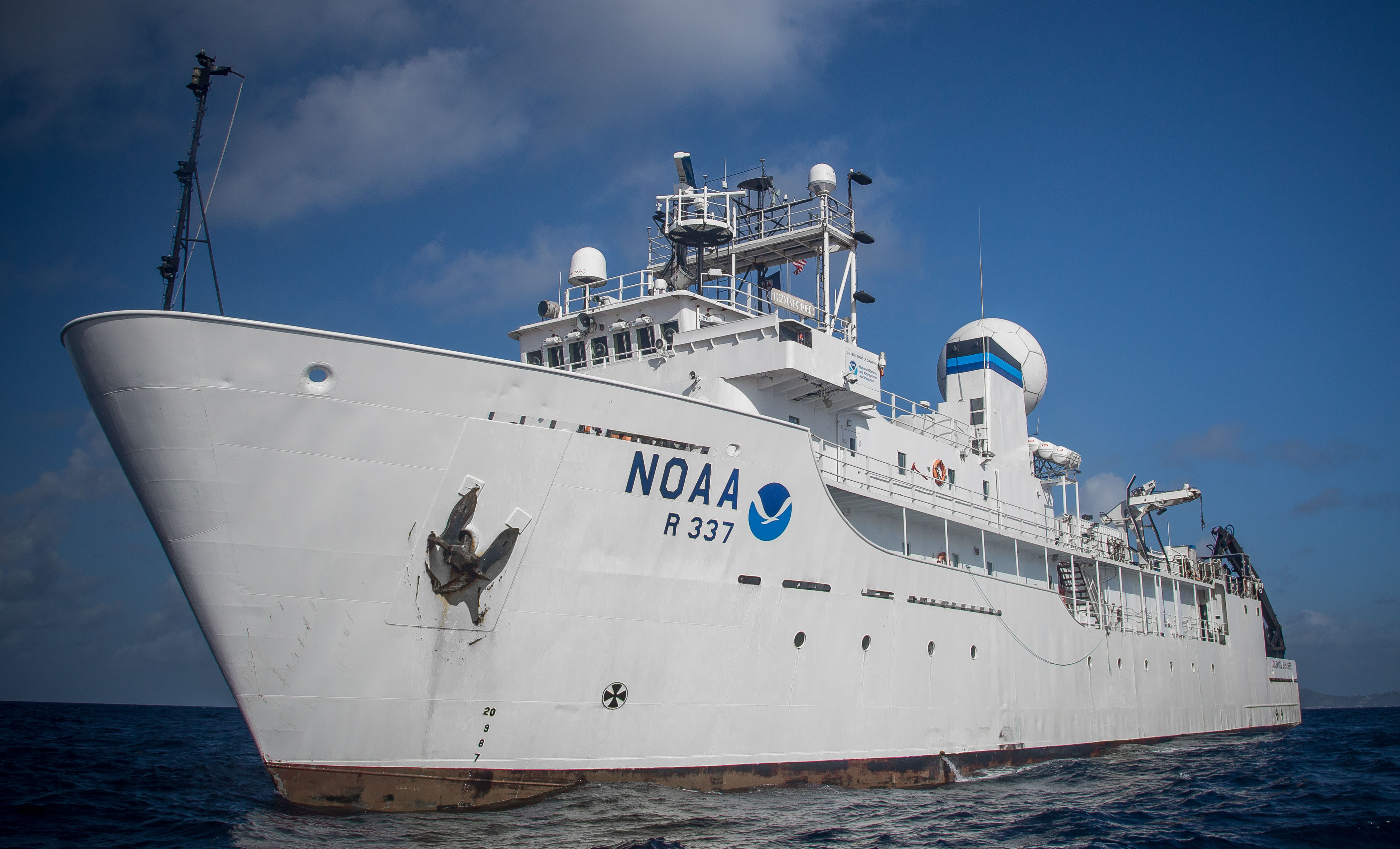
In keeping with the Panel’s vision, the National Oceanic and Atmospheric Administration (NOAA) commissioned NOAA Ship Okeanos Explorer in 2008 as America’s first civilian agency ship dedicated to ocean exploration. Since its first voyage in 2009, Okeanos Explorer has served as the “new technological eyes” that allow NOAA’s Office of Ocean Exploration and Research (OER) to pursue the Exploration Objectives described in the Panel’s report:
These Exploration Objectives set the stage for 10 years of innovative, exciting, and far-reaching ocean exploration aboard Okeanos Explorer, as we outline below.
Since 2008 when Okeanos Explorer was commissioned, the ship has traveled the globe, exploring the ocean and seafloor from as far away as Indonesian waters and the Central and Western Pacific, to the Gulf of Mexico and Atlantic. During these voyages of discovery, telepresence allowed the science teams on the ship and on shore to work together in real time to map, or characterize, unknown and little known areas of the world ocean.
In 2010, the now fully operational Okeanos Explorer set sail for Indonesia to explore the deep waters of the Sangihe Talaud region, in the heart of the Coral Triangle. The Indonesia-US Sangihe Talaud (INDEX-SATAL) expedition was bold and risky. In this early demonstration of telepresence, Okeanos Explorer transmitted imagery captured by the remotely operated vehicle (ROV) Little Hercules from the seafloor to scientists at organized Exploration Command Centers (ECC) in the United States and Indonesia within seconds. During the expedition, the first-ever deepwater dives in Indonesia’s Sulawesi Sea revealed previously unknown seamounts and as many as 50 previously unknown species, while the Indonesian research vessel Baruna Jaya IV mapped potential ROV targets for Okeanos Explorer and collected geological and fisheries samples near ROV dives. The result was a successful partnership of two maritime nations working together to document the extraordinary biodiversity of the Coral Triangle Region. The INDEX-SATAL expedition set the stage for OER’s efforts via Okeanos Explorer to characterize the world ocean at new scales, from the seafloor to the water column, to discover new species, and to understand seemingly otherworldly deep-sea environments.

During preliminary operations near Guam, Indonesian scientist Dr. Michael Purwoadi makes the first ‘call’ using telepresence from the NOAA Ship Okeanos Explorer to colleagues in the newly established Jakarta Exploration Command Center. Image courtesy of The NOAA Office of Ocean Exploration and Research.
In 2014, Okeanos Explorer passed the 1,000,000 km2 milestone of seafloor area mapped using the vessel’s high-resolution multibeam sonars. Much of the mapping was within the US Exclusive Economic Zone (EEZ). OER’s continued seafloor mapping is contributing to the US Extended Continental Shelf Project, a multi-agency partnership to establish the full extent of the continental shelf over which the United States can exercise sovereign rights. These new high-resolution seafloor maps display previously unknown deep-sea features and enable a better understanding of the little-known, likely resource-rich deep ocean realm.
Okeanos Explorer’s sonars also revealed dense layers of marine life and plumes of bubbles rising through the water column. An ROV was deployed to systematically explore these and other features in water column in more detail. A relatively recent addition to Okeanos Explorer operations, midwater ROV transects were conducted for the first time in 2012, and OER has now explored the water column at a total of 42 sites (Ford and Netburn, 2017; Netburn et al., 2018), most within the last four years. Each midwater dive has been a first for the site, with many likely new species observed and unexpected biodiversity and abundance discovered at many areas.

This dark ctenophore was observed with its tentacles fully extended at ~1,460 meters depth. Image courtesy of the NOAA Office of Ocean Exploration and Research, Gulf of Mexico 2018.
Virtually every OER expedition aboard Okeanos Explorer has yielded new biological and geological insights, helping us to better understand and appreciate marine resources and characterize deep ocean ecosystems. From 2015 to 2017, OER and partners executed the Campaign to Address Pacific monument Science, Technology, and Ocean NEeds (CAPSTONE) to explore the deepwater areas of US marine protected areas in the Central and Western Pacific. CAPSTONE findings include the first documentation of precious corals in seven regions of the Commonwealth of the Northern Mariana Islands and the identification of over 70 high-density deep-sea coral and sponge communities. Discovery of the largest sponge known to date within Papahānaumokuākea Marine National Monument and the first observation of a living member of the fish family Aphyonidae, deep-sea eel-like fishes, both made during CAPSTONE expeditions, demonstrate why these areas need protection. Prior to CAPSTONE, little to no data were available about most of these areas because of their remoteness. Yet, they are of high interest to federal and state agencies with research and management responsibilities due to the vulnerablility of their marine habitats, the presence of high concentrations of commercially valuable deep-sea minerals, and the need to more fully understand deep-sea biogeographic patterns across the region.
Massive sponge seen at 2,117 meters depth within Papahānaumokuākea Marine National Monument. Video courtesy of NOAA Office of Ocean Exploration and Research, 2015 Hohonu Moana: Exploring Deep Waters off Hawaii.
First observation of a living member of the family Aphyonidae (ghostfish), deep-sea eel-like viviparous fishes, many species of which have features that are more similar to fish larvae than adults. Seeing this individual in its natural habitat increases our understanding of its unique, and curious, life history. Video courtesy of the NOAA Office of Ocean Exploration and Research, 2016 Deepwater Exploration of the Marianas.
Site characterizations conducted by Okeanos Explorer have also added to our understanding of America’s maritime heritage. A significant chapter in this story lies in the discovery and investigation of three nineteenth century shipwrecks in the Gulf of Mexico by OER and partners during expeditions conducted from 2012 to 2014. Artifact assemblages suggest that the three vessels may have been lost together during the first decades of the nineteenth century, at a time when communities in the region were transitioning from colonies to independent counties. These wrecks thus offer a snapshot of a formative time in US history and are a significant contribution to our understanding of Gulf of Mexico maritime heritage.
 discovered in the Gulf of Mexico. The rudder attached to the stern post has been twisted around to the left, or port side, making it difficult to see in this image. This type of damage suggests the vessel impacted the seafloor sternfirst, displacing the rudder. Two draft marks made of lead are visible on the stern post.")
Copper sheathing covers the stern post and aft part of the lower hull of this wreck (Site 15577) discovered in the Gulf of Mexico. The rudder attached to the stern post has been twisted around to the left, or port side, making it difficult to see in this image. This type of damage suggests the vessel impacted the seafloor sternfirst, displacing the rudder. Two draft marks made of lead are visible on the stern post. Image courtesy of The NOAA Office of Ocean Exploration and Research.
In 2016, OER and partners worked with the Department of Defense POW/MIA Accounting Agency on the discovery of a World War II B-29 Superfortress bomber in the channel between Tinian and Saipan. This was the first B-29 crash site discovered of over one dozen American B-29s lost in the area while flying missions against Japan. The sites represent America’s final push to end the war, a historically significant time in US history, and are of interest to multiple management groups and several universities and foundations working to identify crash sites for the families of lost service members.

From 2008 to 2018, NOAA Ship Okeanos Explorer mapped more than 1.5 million square kilometers of ocean floor globally. These baseline data were used to select ROV dive sites for further characterization of the seafloor and to choose locations for collection of water column temperature and salinity information. These data have also been used externally by managers, scientists, educators, and other entities. OER’s community-driven approach to site selection, combined with the open availability of these mapping data, have opened the deep waters of the US Exclusive Economic Zone and areas of interest to the US Extended Continental Shelf Project to further research. Image courtesy of The NOAA Office of Ocean Exploration and Research. Download (jpg, 3.8 MB).
Exploration technologies on board Okeanos Explorer, including telepresence, have enabled in situ explorations of ocean dynamics and interactions at new scales—as they are unfolding and at new depths—including current flow, seepage out of the subsurface, underwater volcanic eruptions, and organisms’ interaction on and within the seafloor, to name a few. These observations of ocean dynamics and interactions at new scales, although still “snapshots in time,” expand our scientific understanding of ocean properties, biogeochemical processes, and interactions taking place within the ever-changing, larger Earth system.
Some of the most dynamic—and unusual—ecosystems within which to observe ocean dynamics and interactions at new scales can be found at hydrocarbon seeps. OER expeditions on Okeanos Explorer in the Gulf of Mexico between 2012 and 2018 have uncovered many previously unknown seep sites, allowing scientists to document the chemosynthetic communities that often live there and the geologic processes at work. Although these seep discoveries have added much to what we know about chemosynthetic communities, the importance of these ecosystems remains largely unknown. Because seeps can be an indicator of the presence of undiscovered petroleum deposits and may be potential sites for exploratory drilling and offshore oil wells, building our understanding of these dynamic systems is critical to properly managing them.

A dense cluster of Escarpia sp. chemosynthetic tubeworms at a cold seep, accompanied by an Alvinocaris sp. shrimp and a chaetopterid polychaete waving its pair of feeding palps from its slender bamboo-like tube. Image courtesy of the NOAA Office of Ocean Exploration and Research, Gulf of Mexico 2017.
Understanding and establishing baseline characterizations of deep-sea coral ecosystems are critical to determining possible effects of environmental changes as we learn more about the role(s) these dynamic ecosystems play in the deep ocean. For example, deep-sea corals in the Gulf of Mexico provide habitat for other animals, add structure and complexity to the ocean floor, and may produce compounds important to human health; these ecosystems are also highly vulnerable to, and slow to recover from, environmental change. Prior to the Deepwater Horizon oil spill, OER sponsored 11 expeditions in the Gulf of Mexico, several within a few kilometers of the Deepwater Horizon platform; following the event, Okeanos Explorer dedicated ROV dives in the vicinity. The combined data are helping us to document the condition of deepwater coral communities before and after the spill and assisting with the continuing assessment of the potential impacts of Deepwater Horizon on these important ecosystems.
In 2012, capitalizing on the complementary capabilities of five NOAA ships, including Okeanos Explorer, NOAA embarked on the Atlantic Canyons Undersea Mapping Expeditions (ACUMEN) project to map all or part of every submarine canyon in the US EEZ from the US-Canada border to North Carolina. Over 70 submarine canyons are located off the Atlantic coast, providing refuge for a variety of fauna. While some of these canyons had been studied previously, most were poorly understood yet of high interest to federal and state agencies with research and management responsibilities. The ACUMEN campaign led to the discoveries of rich and diverse deep-sea ecosystems within several hundred kilometers of some of the most densely populated regions off the US east coast. These scientific discoveries were used to support the establishment of the Frank R. Lautenberg Deep-Sea Coral Protection Area, which protects more than 100,000 km2 of seafloor habitat in the Mid-Atlantic region. OER led the ACUMEN campaign with support from other NOAA offices, in collaboration with the Bureau of Ocean Energy Management and US Geological Survey, and key state and regional constituents.

Often multiple species of invertebrates are found co-occurring on rock ledges and canyon walls. Here a brisingid sea star, an octopus, bivalves, and several individuals of the cup coral, Desmophyllum, are found in close proximity to one another. Image courtesy of Deepwater Canyons 2013 - Pathways to the Abyss, NOAA-OER/BOEM/USGS.
Explorations such as these, which allow investigation of ocean dynamics and interactions at new scales, have led to new scientific understanding of deep-sea species assemblages at previously unexplored hydrothermal vents, canyons, seamounts, and cold seeps. We have witnessed feeding, swimming, and mating behaviors not previously observed in the deep sea and have uncovered unusual burrows in places never seen before. With continued exploration via Okeanos Explorer, OER is expanding our understanding of the ocean’s complex and dynamic ecosystems.
During Okeanos Explorer expeditions, OER’s dual-bodied ROV system, composed of Deep Discoverer and Seirios, provides scientists with unprecedented access to the deep ocean. The design and build of this system and its final integration with Okeanos Explorer in 2013 opened new exploration territory for OER. These ROVs, combined with Okeanos Explorer’s ability to deliver high-quality imagery within seconds of its capture from the seafloor to any Internet-enabled device, revolutionized the concept of ocean exploration. Scientists were no longer required to physically be on a research vessel or even at a dedicated Exploration Command Center. Now, due to advancements in telepresence technologies, video and other data are transmitted from the ship to shore in real time, opening the door for anyone, anywhere on the planet with Internet access, to participate in our expeditions. The result is not only more robust engagement of multidisciplinary science teams in ROV dives, greatly expanding the available scientific expertise when making discoveries, but also a major shift in OER’s methods of engaging the public. Via online tools such as the OceanExplorer.NOAA.gov website and social media, the public can watch scientists from around the world exploring, in real time, unknown areas of the deep ocean.
In recent years, OER has extended telepresence capabilities to engage shore-based teams in Okeanos Explorer seafloor mapping expeditions. In 2016, shipboard and shore-based teams used a combination of existing telepresence technologies in a new way to successfully execute a multibeam mapping expedition within the Wake Island Unit of the Pacific Remote Islands Marine National Monument. The overall result was faster data processing, quality control, production of value-added products, public archiving, and secure backup of data, as well as more efficient management of personnel time.
Okeanos Explorer’s technological demonstration platform capabilities were also realized when its EM 302 multibeam sonar led to yet another unexpected discovery in the deep ocean—the detection of gas plumes rising 1,400 meters from the seafloor along the northern California margin (Gardner et al., 2009). Since then, several hundred methane cold seeps have been discovered along the Atlantic Ocean margin of the United States in an area previously believed to be devoid of such features , according to a study published in Nature Geoscience and based on data collected on Okeanos Explorer missions (Skarke et al., 2014). The discovery of these gas seeps, along with others discovered by E/V Nautilus along the Cascadia margin (Embley et al., 2016), suggests that natural methane leakage from the seafloor is far more widespread than previously thought. Scientists now estimate that tens of thousands of seeps could still be discoverable in the region.
Since the inception of Okeanos Explorer education programming, OER has provided over 230 teacher professional development workshops for over 5,400 educators in the use of the NOAA Ship Okeanos Explorer Education Materials Collection. Expedition webinars and online courses enable educators to access new tools so that they can share ocean exploration with their students. Materials have been translated into Spanish, Portuguese, and Bahasa Indonesia, and professional development has been offered in some of the most remote regions of the world to increase access to these materials.
The OceanExplorer.NOAA.gov website as well as OER social media accounts, including Facebook, Twitter, Instagram, and YouTube, have greatly expanded the reach of Okeanos Explorer expeditions, inviting members of the public to watch live video of ROV dives and follow expedition discoveries. Online expedition content has caught the eye of traditional media as well, resulting in coverage of Okeanos Explorer missions by hundreds of media outlets.
Live interactions between the ship and classrooms, informal science centers, and members of the US Congress, partner organizations, and others have allowed OER to share the excitement of ocean exploration and demonstrate its value. Additionally, OER has hosted public events at ports as well as ship tours for educators, members of the media, and VIPs.
As part of its commitment to train the next generation of ocean explorers, OER has collaborated with the NOAA Educational Partnership Program, University Corporation for Atmospheric Research, and University of New Hampshire to engage hundreds of students in OER’s Explorer-in-Training program. These students and early career scientists gain hands-on experience by actively participating in mapping expeditions on Okeanos Explorer. Since 2009, OER and partners have hosted over 120 mapping Explorers-in-Training. For many, this first at-sea experience was invaluable to subsequent academic and career pursuits.
The full benefits of a national ocean exploration program could not be realized without significant partnerships among federal, state, and local governments; industry; academia; formal and informal educational institutions; and nongovernmental organizations. The “targeted campaign” approach taken with the INDEX-SATAL, ACUMEN, and CAPSTONE expeditions, which engaged multiple ships, associated observing platforms, and other assets, enabled discoveries that would not have been possible using the assets of one ship or one organization, informing important management decisions. Additionally, advancements in telepresence technologies and ROV design and integration through collaborative sharing of assets and capabilities at the University of Rhode Island’s Inner Space Center and the Global Foundation for Ocean Exploration opened the door for anyone with Internet access to participate in deep ocean exploration.
Partnerships at all levels have resulted in Okeanos Explorer serving as a testbed for acquisition of state-of-the-art data, including multidisciplinary oceanographic, environmental, and acoustic data and geospatially tagged images and video. These data have been complemented by detailed mission plans, mission and dive summaries, and peer-reviewed scientific publications based on expedition results. Through collaborative systems integration and optimization, OER and its partners can deliver data quickly. The data from Okeanos Explorer and other NOAA ships are synthesized and made publicly available through the NOAA National Centers for Environmental Information, with a turnaround time as quick as 60 days. These data are critical to our understanding of US submerged resources and are important for resource managers who need accurate baseline information for informed decisions.
In 2009, Okeanos Explorer was capable of providing integrated telepresence capabilities that connected via Internet2 to shore-based Exploration Command Centers where small interdisciplinary teams of scientists participated in ocean exploration expeditions. Ten years later, anyone, anywhere with a standard Internet connection can participate in Okeanos Explorer expeditions—from an ECC, a laboratory, aquarium, or home. This model of telepresence is replicated on ships of exploration belonging to the Ocean Exploration Trust and the Schmidt Ocean Institute. Several vessels of the US academic research fleet (i.e., UNOLS vessels) also utilize telepresence. It is with these exploration partners and other not-for-profit organizations, academic institutions, and private sector entities that we are greatly expanding our knowledge of the deep ocean. That free public access to telepresence-enabled deep ocean exploration has become “routine” is a testament to the wisdom of the 2000 President’s Panel for Ocean Exploration and an important measure of the value of the NOAA ocean exploration program. The vision of the 2000 Panel participants for telepresence exploration has been fulfilled.
Looking forward over the next 10 years of ocean exploration, large ships such as Okeanos Explorer will remain important, but platforms like autonomous underwater vehicles, drifters, unoccupied surface vehicles, satellites, and moored arrays will be integral to ocean exploration. More capable and less expensive sensors will allow explorers to characterize larger geographic areas of the deep ocean and will support NOAA’s effort in the international collaborative project, Seabed 2030, which aims to bring all available bathymetric data to produce the definitive map of the world ocean floor by 2030 and make it available to all. Robust commercial communications networks that are platform (and sensor) independent may permit “bundled services” to be transmitted from the deep ocean to shore, allowing real-time data flows and remote interactions with people and devices at sea. Latency—the time it takes a signal to reach an observer on land from a sensor in the deep ocean—will likely be reduced. The outcome is enhanced, high-quality, publicly accessible scientific data, fit for purpose as we seek to increase understanding of deep ocean areas and phenomena in support of national and international policy for management and sustainable use of our limited, yet dynamic and interconnected, Earth system.
Almost 20 years after the President’s Panel reported, there remains an urgent need to continue to explore the unknown and poorly understood deep ocean. Agile strategies that stimulate technological advances will be key to meeting national needs for ocean exploration results over the next decade. An educated and informed public that is aware of ocean issues and of the need to understand deep ocean habitat, ecosystems, and processes is critical. Our nation’s economic prosperity and security depends on wise stewardship of the ocean that only will be realized through better cooperation and engagement among the many domestic and international partners and stakeholders with an interest in a healthy, resilient ocean providing services and benefits for all. The progress NOAA has made in responding to the President’s Panel report recommendations over the past 10 years, and the major contribution of non-federal ocean explorers such as the Ocean Exploration Trust and Schmidt Ocean Institute and many others positions us well for another decade of similar achievement in understanding our ocean world.
Keener, P., D. McKinnie, and E. Crum. 2019. Ten years of ocean exploration with NOAA Ship Okeanos Explorer: Taking the rest to “see through new technological eyes.” Pp. 58–69 in New Frontiers in Ocean Exploration: The E/V Nautilus, NOAA Ship Okeanos Explorer, and R/V Falkor 2018 Field Season, N.A. Raineaut, and J. Flanders, eds. Oceanography 32(1), supplement, https://doi.org/10.5670/oceanog.2019.supplement.01 .