

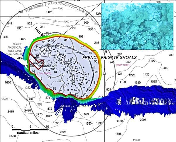
A photograph of a rich coral bed is correlated with bottom classification, bathymetry and statistical information at French Frigate Shoals. The multibeam data from this project will add three-dimensional and textural information and will help to develop benthic habitat maps, which provide scientists with information about where corals are likely to exist and fish and lobsters are likely to live and feed. (Coral image courtesy of Joyce Miller.)