

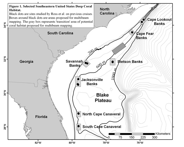
Figure 1. Map generated using ArcMap software giving an overview of the 2004 expedition cruise plan. All information on the map, aside from the text, are georeferenced and spatially accurate. Image courtesy of Ross et al., NOAA-OE, HBOI.
Related Links
Life on the Edge 2005: Oct 19 Log