

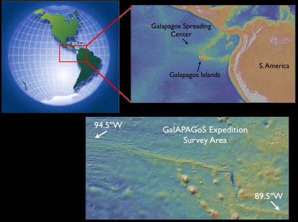
GalAPAGoS Expedition survey area lies within the red box shown on the globe at upper left. A blow-up map of the region within the red box (upper right) shows the location of the Galapagos Spreading Center and Galapagos Islands. Zooming in closer (map at lower right), we see that the Galapagos Spreading Center is an east-west ridge that rises above the surrounding deeper (>3500 m) seafloor (yellow shading corresponds to more shallow depths). The ridge crest is most shallow (only 1600 m deep) north of the Galapagos Islands, where the Galapagos mantle plume is centered. Image courtesy of Haymon et al., NOAA-OE, WHOI.
Related Links
GalAPAGoS: Where Ridge Meets Hotspot
GalAPAGoS: Where Ridge Meets Hotspot: Mission Plan