

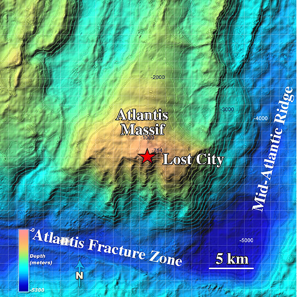
The Atlantis Massif or mountain is bounded to the east by the slow-spreading Mid-Atlantic Ridge, and to the south by the Atlantis Transform Fault. The mountain rises ~14,000 from the seafloor and is a bit larger than the Cascade volcano Mt Rainer. In contrast to Mt. Rainer, however, the Atlantis Massif was not formed through volcanic processes but by long-lived faulting and uplift. The Lost City hydrothermal field is located near the top of the mountain (red star) on crust that is ~ 1.5 million years old. Image courtesy of University of Washington.
Related Links
Download high-resolution Map of Atlantis Massif (jpg, 1.1 Mb)