

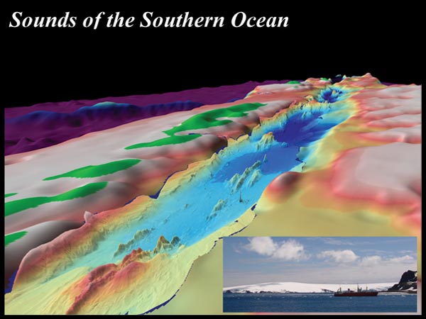
Three-dimensional perspective of the seafloor of the Bransfield Strait, the ocean basin separating the South Shetland Islands (green topography on the left) and the Antarctic Peninsula (green topography on the right). Bathymetry is 10 times vertical exaggeration. Depths vary in the image from greater than sealevel (green) to 1 to 1500 m (red and yellow) to great than 1500 m (light and dark blue) in center of image is >1900 meters depth. The image is oriented from the southwest (left) to the northeast (right), covering a total distance of ~150 km along strike of the Bransfield Strait. Image courtesy of NOAA/Vents, Korea Polar Research Institute (KOPRI)
Related Links