

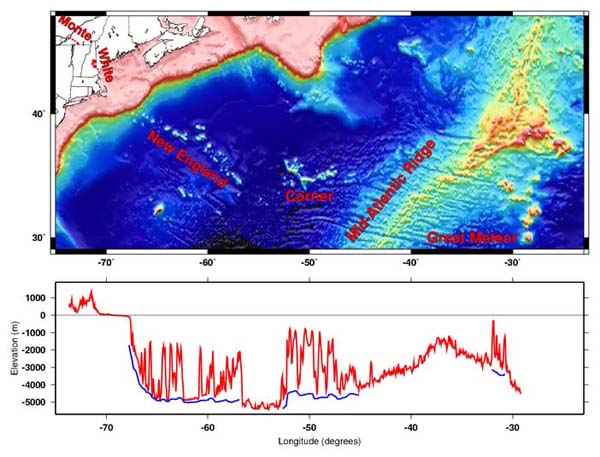
Map of the entire track of the hotspot that formed the New England Seamounts and other associated volcanoes, from the Monteregian Hills (red dots) in the west to Great Meteor Seamount in the east.
The bottom graph shows in red the height of the land and depth of the seafloor along the hotspot track. Blue lines show the seafloor depths surrounding the seamounts to emphasize how high the volcanoes rise above their surroundings. Image courtesy of Daniel Scheirer, US Geological Survey, based on data from Smith and Sandwell (1997, Science).
Related Links
North Atlantic Stepping Stones 2005