

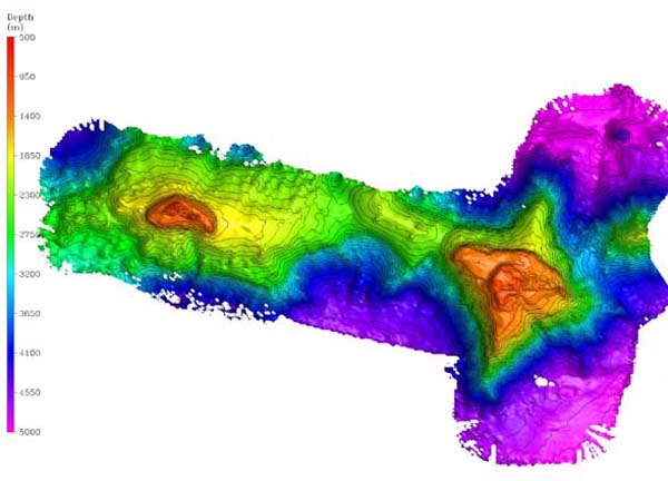
Bathymetry of the Milne-Edwards (western) and Verrill Seamounts (eastern), shaded relief map. The image above shows the entire Central Corner Rise seamount complex, including the summits and ridges where we dove with the ROVs Hercules and Argus. The resolution of the image is approximately 40 m. Image courtesy of Allen Gontz of the University of Massachusetts and Jonathan Shanahoff of NOAA.
Related Links
North Atlantic Stepping Stones 2005