

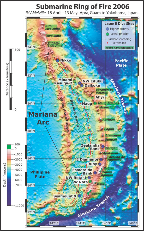
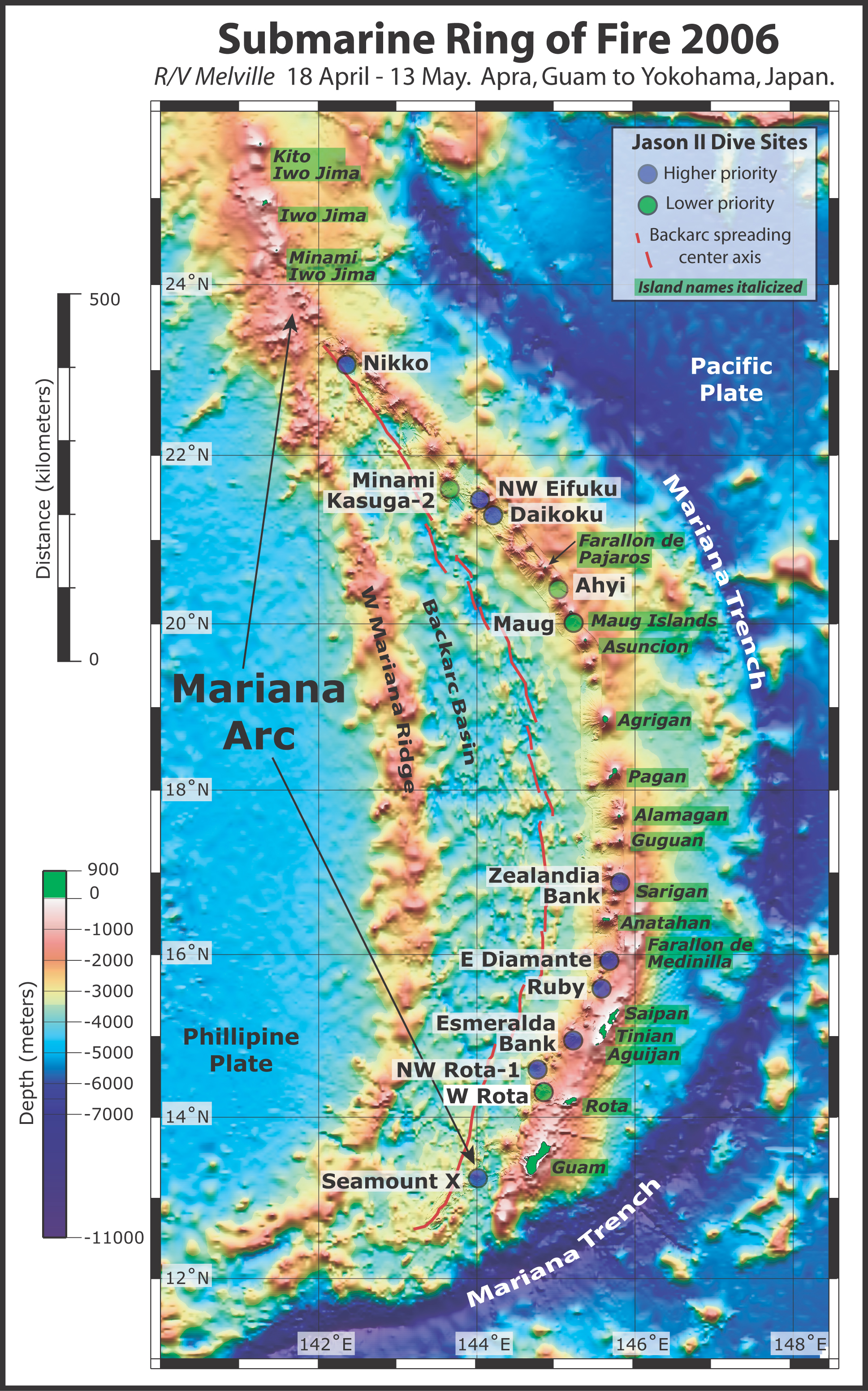
This map shows the Northwest Pacific from Guam to Iwo Jima. Possible dive targets for the remotely operated vehicle Jason II during the SRoF'06 expedition are designated by the blue and green circles. Bathymetry data are satellite-derived (bottom, 3,500 m resolution); EM300 (top, along the arc, 30 m resolution). Plate tectonic features are also indicated. Satellite-derived bathymetry from Sandwell and Smith. EM300 bathymetry data are courtesy of Pacific Marine Environmental Laboratory.