

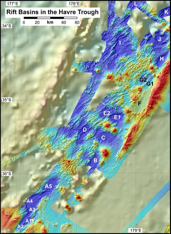
This map shows the location of several of the small rift basins in the Havre Trough (labeled A - L) that have been sampled by our conductivity-temperature-depth-optical (CTDO) system during the cruise. The largest is the Ngatoro Rift (A1 - A5), where we did five separate casts. Image courtesy of New Zealand American Submarine Ring of Fire 2007 Exploration, NOAA Vents Program, the Institute of Geological & Nuclear Sciences and NOAA-OE.
Related Links
New Zealand American Submarine Ring of Fire 2007
New Zealand American Submarine Ring of Fire 2007: August 9 Log