

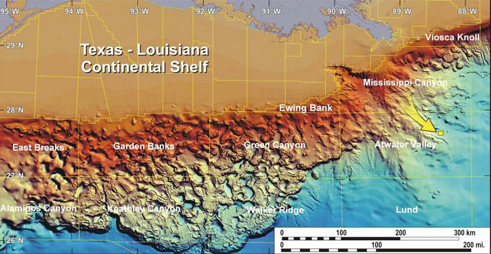
This map provides a general overview of the sea-floor topography in the Gulf of Mexico. AT 340 is highlighted (by a yellow arrow) in the eastern portion of the Gulf. Image courtesy of Harry Roberts, Louisiana State University.
Related Links
Expedition to the Deep Slope 2007