

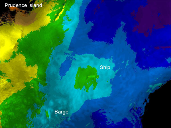
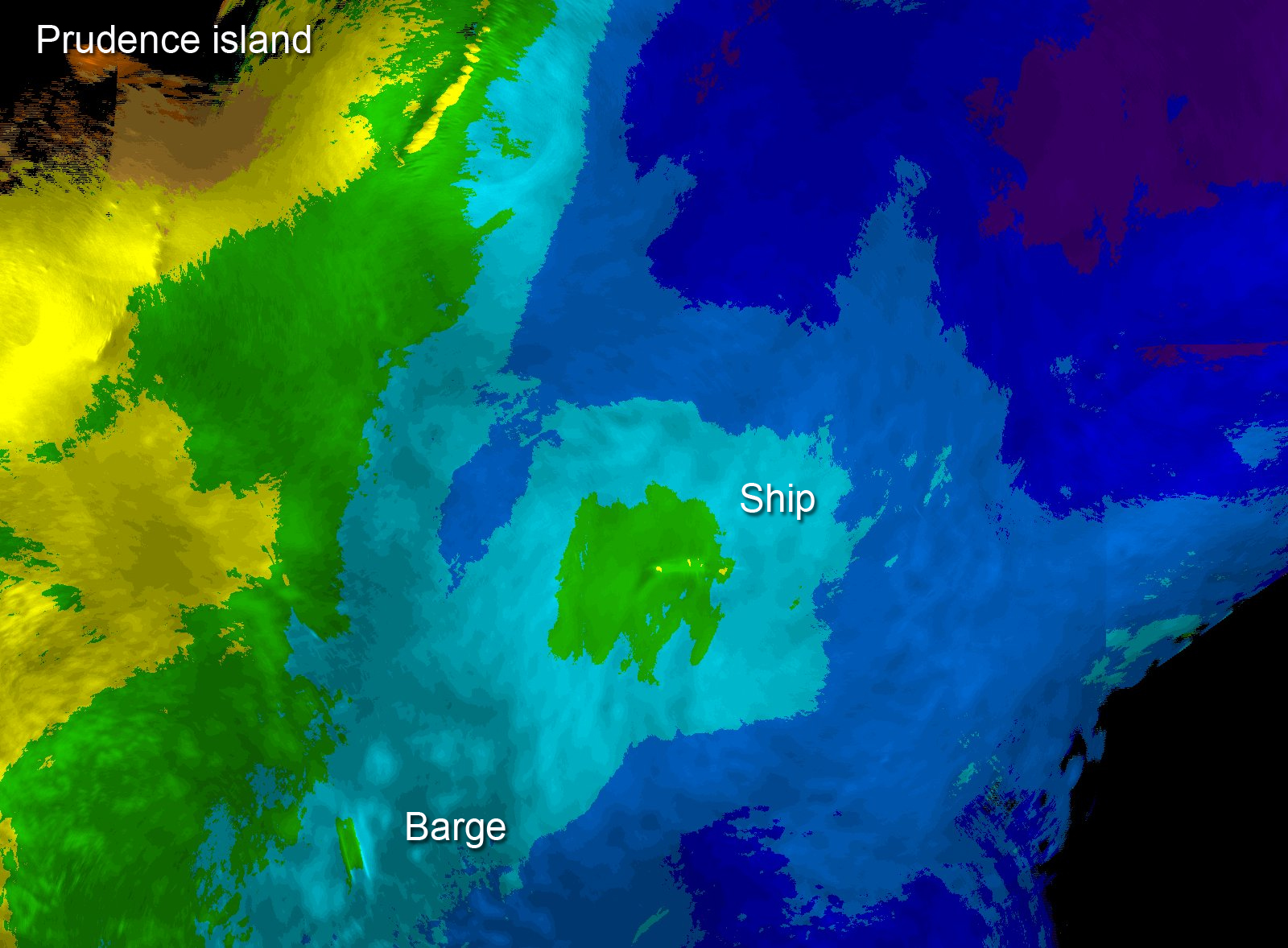
Figure 4. Data collected by iPUMA can be processed into bathymetric (depth) charts. This chart shows the bathymetry of the area around the wrecks off Prudence Island. Image courtesy of AUVfest 2008: Partnership Runs Deep, Navy/NOAA, OceanExplorer.noaa.gov.