

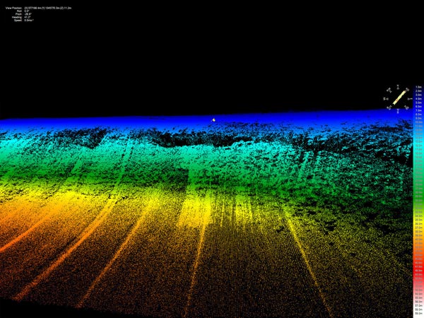
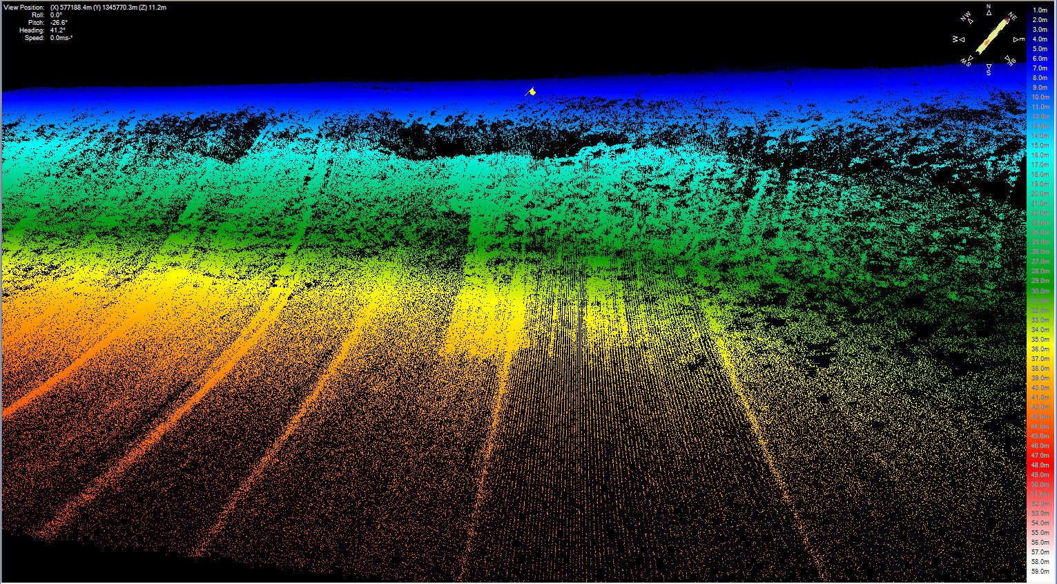
The bathymetric sonar onboard the Gavia autonomous underwater vehicle (AUV) provides an incredibly dense map of the reef structure. Each colored dot represents a sonar depth measurement with the colors indicating depth. (Dark blues are shallow — less than 5 meter (m), and yellows are depths around 35 m. Black areas are shadow zones where the reef drops off steeply.) You can see the overhanging coral on the crest of the reef and the steep sheer face, which is why this dive site is called “Cliffs.” Each AUV mapping survey generates millions of bathymetric soundings. Image courtesy of Bonaire 2008: Exploring Coral Reef Sustainability with New Technologies.
Related Links
Bonaire 2008: Exploring Coral Reef Sustainability with New Technologies
Bonaire 2008: Exploring Coral Reef Sustainability with New Technologies: Jan 16 Log
Download high-resolution image (jpg, 2.6 Mb)