

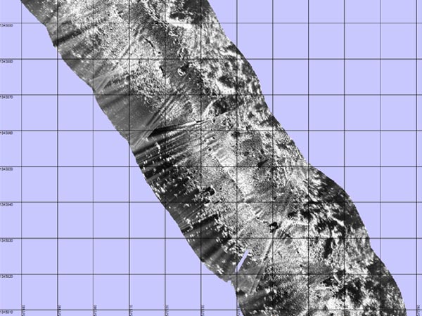
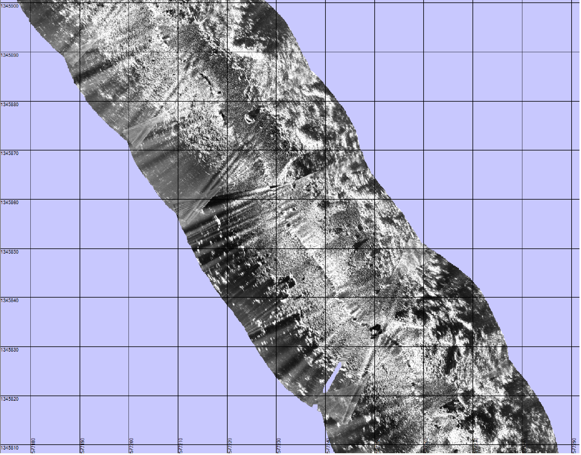
An example of a high-resolution side-scan sonar mosaic created from survey data collected by the GeoSwath sonar on the Gavia autonomous underwater vehicle (AUV). The image results from the measurement of high-frequency (500 kHz) short bursts of sound waves that bounce off of the seabed and return to the sonar unit. Bright areas indicate high return energy associated with coral fragments or scattered rocks, while dark patches represent shadow zones (areas where the sound was blocked) or patches of soft sand and/or mud that absorb more sound than rocks or corals. In this image the beach is towards the right and each grid cell is a 10- by 10-meter (m)/33- by 33-foot (ft) square. The total swath width (lateral distance from edge to edge) is 40 m (131 ft) , and the line length from tip to tip is approximately 100 m (328 ft).
Related Links
Bonaire 2008: Exploring Coral Reef Sustainability with New Technologies
Bonaire 2008: Exploring Coral Reef Sustainability with New Technologies: Jan 17 Log
Download high-resolution image (jpg, 1.5 Mb)