


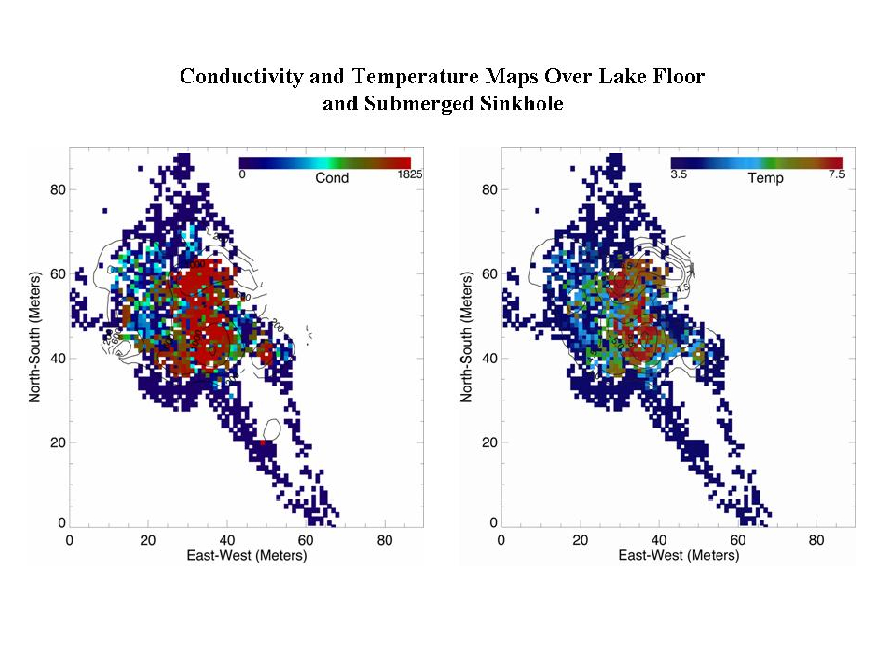
Figure 3: Conductivity-temperature-depth (CTD) mapping by a remotely operated vehicle (ROV) just over the Isolated Sinkhole at 91 meter (m) (299 ft) depth over a 35- x 55-m (115- x 180-ft) area. This maps shows enhanced conductivity and temperature at venting sites in September 2003. Image courtesy of Thunder Bay Sinkholes 2008, NOAA, OceanExplorer.noaa.gov
Related Links
Thunder Bay Sinkholes 2008: Mission Plan
Download high-resolution image (jpg, 840 Kb)