By Derek Smith, PhD Student, Department of Biology - University of Washington
September 16, 2011
As the port town of Chiquilá fades into the distance, I finally see the Costa Escondida coastline from the water for the first time. Even after two hot, dusty days of helping prepare a flatbed truck’s worth of scientific and camping equipment, I can hardly contain my excitement. I first discussed my involvement on this project with Dr. Dominique Rissolo almost three years earlier when we met and I have been waiting for this moment since that first discussion. As we race along the nearly still waters of Laguna Holbox towards the Vista Alegre site, our Veracruzan guide Roberto points out the Magnificent Frigate birds (Fregata magnificens) soaring high overhead as if to signal our arrival into the hidden world of the maritime Maya. As the boat slows down and enters the narrow, shallow channel marking the entrance to the site, I can now clearly make out the patchy network of green seagrasses enjoying the incoming water from the rising tide. I try to make scientific observations in my head as the tangled roots and branches of red mangrove trees (Rhizophora mangle) lining the shoreline go by, but my mind wanders and I can’t help but wonder if the ancient Maya inhabitants of this site felt the same way I do right now: Bliss.

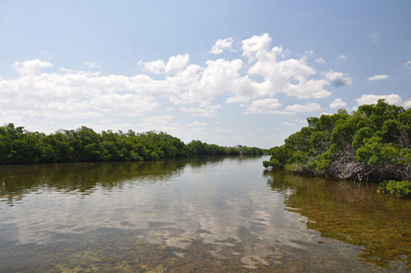
The entrance channel to Vista Alegre is lined with red mangroves, while an abundance of seagrass is visible through the clear waters of the estuary. Image courtesy of Proyecto Costa Escondida Maritime Maya 2011 Expedition, NOAA-OER. Download larger version (jpg, 1.9 MB).
As the project’s coastal ecologist, part of my contribution to this multidisciplinary effort is to begin quantifying the existing terrestrial and marine flora and fauna associated with the Vista Alegre site in order to put together an initial ecological assessment. Rather than cut down and clear the overgrowth as part of an ecologically-destructive excavation, archaeologists prefer to study sites as they appear now, including an inventory of all of the vegetation and animals associated with the area. This site has not seen permanent inhabitants for close to 500 years so the Yucatan jungle has definitely had an opportunity to reclaim its former glory, with red tourist trees towering overhead, palms creating a dense canopy, and red mangroves licking the brackish water along the shorelines.

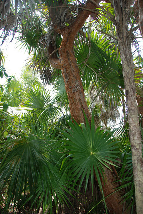
Palms and the towering Gumbo limbo (Bursera simaruba) or “tourist trees” were among some of the common types of vegetation at Vista Alegre. The Gumbo limbo tree is known to locals as the “tourist tree” due to its red, peeling bark – in reference to tourists who come to the Yucatan and get sunburned. Image courtesy of Proyecto Costa Escondida Maritime Maya 2011 Expedition, NOAA-OER. Download larger version (jpg, 4.2 MB).
In order to start assessing the terrestrial and marine ecology of the Vista Alegre site, I turned to some classical ecological quantification methods using some very simple tools as well as some innovative methods designed on-the-spot after seeing the jungle with which I had to contend. In the shallow waters around the site, I used a 30-meter tape, underwater slate and pencil, and point-intercept transects to investigate the percent cover of soft sediments and species of seagrasses Syringodium filiforme and Thalassia testudinum).
A 360 degree view of the foliage at one of 40 locations documented by Derek Smith during his ecological survey of the site shows the variety of plant species growing at Vista Alegre including palms (Family: Palmae) and a small Gumbo Limbo or “Tourist Tree.” Video courtesy of Proyecto Costa Escondida Maritime Maya 2011 Expedition, NOAA-OER. Download (mp4, 6.8 MB).
In the jungle overgrowing the site, I conducted GPS-driven transects starting at the mirador (the site’s central pyramid) and extending to the shoreline in the four cardinal directions. Often times, I found myself crawling on my hands and knees through the thick foliage trying to get to a pre-determined GPS point. The mosquitos were very happy each time I got held up for a few minutes deciding which way was the best way through. Once at each point, I shot a series of photographs in every direction from 40 locations around the site. I also shot photographs looking directly up through the canopy and straight down to the ground. Using photo-processing software I will be able to stitch the photos into a 360° panoramic view of the trees at each location to identify species richness and abundance and also analyze the canopy percent cover and ground cover. (Slide Show – EcologyTransect.m4v)This will give an idea of how the community of species changes around the site, possibly due to factors such as small changes in elevation, proximity to the shoreline, and competitive interactions between species.

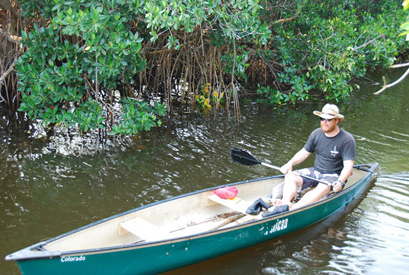
Derek Smith prepares to head out for an ecological survey by canoe. With the site being uninhabited, many areas were only accessible via canoe or by cutting paths through the jungle with machetes. Image courtesy of Proyecto Costa Escondida Maritime Maya 2011 Expedition, NOAA-OER. Download larger version (jpg, 4.0 MB).

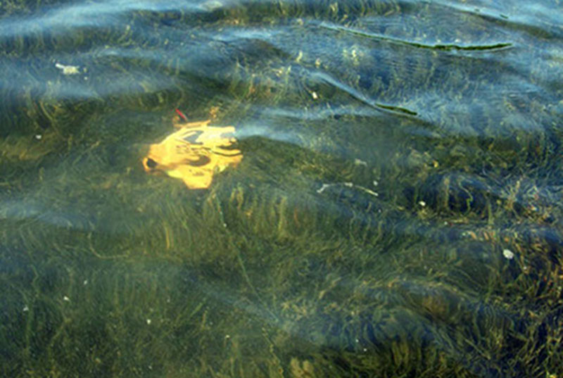
A 30-meter tape is laid out underwater as Derek conducts a transect to investigate the species and cover of seagrass and soft sediment in the shallow waters surrounding Vista Alegre. Image courtesy of Proyecto Costa Escondida Maritime Maya 2011 Expedition, NOAA-OER. Download larger version (jpg, 1.8 MB).
These ecological methods will help establish a baseline so we can start to see how the plant and animal communities at Vista Alegre are changing and have changed over time. This will, of course, require a multi-year sampling effort. And for my part, I hope to continue working at this amazing site with this incredible team for quite some time to come…