
By Jeffrey B. Glover, PhD - Department of Anthropology, Georgia State University
and Dominique Rissolo, Ph.D., RPA - Waitt Institute
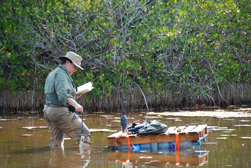
Standing knee-deep in a partially enclosed lagoon-like area near Vista Alegre, Trish Beddows measures the salinity and pH of the water to gather another data point for the salinity map of the area surrounding Vista Alegre. The waters in this area had unexpectedly high salinity levels. Image courtesy of Proyecto Costa Escondida Maritime Maya 2011 Expedition, NOAA-OER. Download larger version (jpg, 3.9 MB).
While detailed discussion of the mission’s results must await the various lab analyses of the cores and the other datasets collected, overall, we thought the expedition was a great success and that the data collected will allow us to address the major objectives outlined in the mission plan.
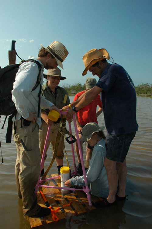
The team works together using a mobile coring platform and tripod to collect a core from the West Tidal Flat area of Vista Alegre. The West Tidal Flats had very shallow water that also had extremely high salinity. Image courtesy of Proyecto Costa Escondida Maritime Maya 2011 Expedition, NOAA-OER. Download larger version (jpg, 2.3 MB).
As expected, the expedition produced, and will continue to produce, baseline environmental data that will be essential for our investigations as well as for future researchers working in the area. We have created the first salinity map around Vista Alegre and in Holbox Lagoon. The unexpectedly high salinity readings are of themselves interesting for the modern ecological communities occupying this area, but will also prove extremely useful as we begin to think about possible economic activities of the ancient inhabitants of Vista Alegre. We know from historical sources that salt was one of the most valuable commodities traded at the time of Spanish contact, and now we can postulate that the ancient Maya at Vista Alegre were engaged in small-scale salt making. Another thing these high salinity levels mean is that our search for the freshwater source for the island’s inhabitants is far from over. We hope that the cores will have some answers for us.
We collected a total of 12 cores from various submerged areas around the site, and overall the coring program was a success. While we do not know the absolute date range of the cores yet, the longer cores, those over 1 m in length, have stratification that appears to be very promising in terms of revealing long-term environmental data and will hopefully allow us to add some data points to the Holocene sea-level curve. We also hope that past storm events might be recorded in the cores’ stratified sediments. In addition, these longer cores came from three different areas around Vista Alegre, which is also promising for our detailed reconstruction of past environments immediately around Vista Alegre.
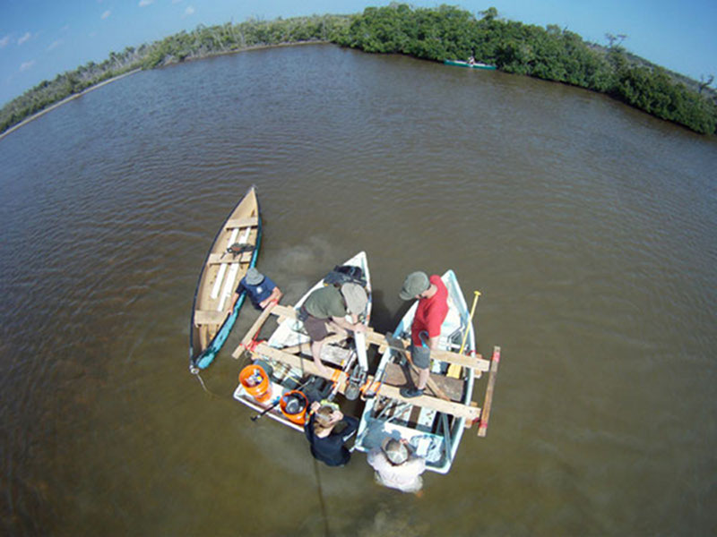
Collecting cores in the field required a team effort and coordination of equipment and people. The team makes use out of the floating coring platform and canoes to collect a core from the West Harbor area. Using a camera mounted on a 5-meter pole, Dominique Rissolo is able to capture an overhead view of the process. Image courtesy of Proyecto Costa Escondida Maritime Maya 2011 Expedition, NOAA-OER. Download larger version (jpg, 3.3 MB).
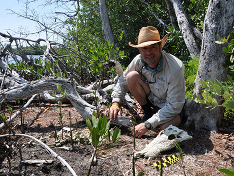
Dominique Rissolo helps Derek Smith measure and photo-document a partial crocodile skeleton that was discovered during an ecological survey near Vista Alegre. Ecological surveys were conducted all around the site to create a picture of the current flora and fauna to compare with data found in archaeological records as well as the ecological records from the cores. Image courtesy of Proyecto Costa Escondida Maritime Maya 2011 Expedition, NOAA-OER. Download larger version (jpg, 2.8 MB).
We are also recording tidal data through ReefNet Sensus data loggers and will be able to create the first tidal chart for this area where the Gulf and Caribbean meet.
In terms of the ecological data, detailed surveys were conducted in the ancient harbors around Vista Alegre as well as on-site. More general ecological surveys were conducted slightly further away from Vista Alegre. These data will be compared to the faunal data from the archaeological record as well as the ecological data from the cores in order to discuss environmental change through time. We are also in the process of obtaining remotely sensed data so that we can extrapolate from our survey data to better characterize the broader coastal and near-coastal region.
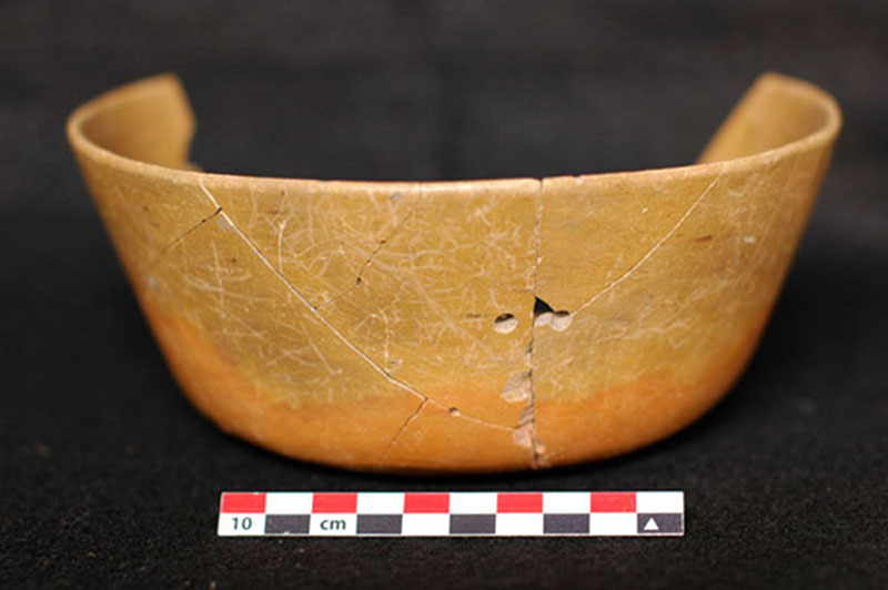
During excavations at Vista Alegre, one of the more interesting items uncovered was a nearly intact Ticul Thin Slate bowl. During the time of the Maya, bowls similar to this were produced in an area near Coba, which is roughly 100 km (~62 miles) to the south of Vista Alegre. Image courtesy of Proyecto Costa Escondida Maritime Maya 2011 Expedition, NOAA-OER. Download larger version (jpg, 2.0 MB).
In the two excavations we recovered four burials, large amounts of ceramics (local and trade wares), animal bone (mostly fish) and shell, as well as shell beads and other artifacts, including a bark beater for making paper and numerous obsidian blades. Of particular interest is what appears to be a dedicatory offering of some exquisite non-local ceramic dishes and bowls, including an almost intact Ticul Thin Slate bowl (most likely produced by a master potter in the area around Coba – about 100 km to the south), a Celestun Red dish (from the west coast of the Yucatan Peninsula), as well as a cream-color slate dish (most likely from the Chichen Itza – Ek Balam area). In general, the artifacts and eco-facts collected will help us refine the site’s occupational history, better document external trade relations, and will allow us to better understand the subsistence practices of the past inhabitants of Vista Alegre.
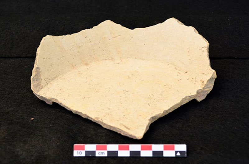
A cream-colored slate dish discovered during excavations was most likely produced in areas near Chichen Itza and Ek Balam, close to 150 km (~93 miles) southwest of Vista Alegre. Image courtesy of Proyecto Costa Escondida Maritime Maya 2011 Expedition, NOAA-OER. Download larger version (jpg, 5.5 MB).
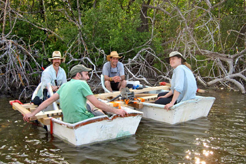
Pulling the mobile coring platform out of the sun, Jeffrey Glover, Wes Patterson, Dominique Rissolo and Beverly Goodman sit and discuss options for collecting cores in the East Harbor. Many discussions and sharing of new ideas in the field assisted in the overall success of the expedition. Image courtesy of Proyecto Costa Escondida Maritime Maya 2011 Expedition, NOAA-OER. Download larger version (jpg, 4.7 MB).
While we have many months of data analysis ahead of us, other, less tangible results were produced by the expedition. These results are the new ideas and hypotheses that developed thanks to the on-going dialogues between team members. These conversations covered a variety of topics from the more methodologically focused (tricks of the trade) to more substantive ones geared toward how we recreate past social and ecological systems and how we study their dynamic intersection. The time in the field and subsequent conversations have certainly got Dominique and me thinking in different ways about the archaeological site and the types of questions we can ask, and I think this cross-pollination of ideas was a benefit for all expedition members. It really was a privilege for us to be part of such a dynamic INTER - not just multi – disciplinary team, and this teamwork made the exploration a success regards of the data produced. We feel this lies at the heart of NOAA OER’s mission, and we are very fortunate to have benefited from their support.