
By Steve W. Ross, Ph.D, Research Professor - UNC-W, Center for Marine Science,
Sandra Brooke, Ph.D, Director of Coral Conservation - Marine Conservation Institute,
and Rod Mather, Ph.D, Professor - University of Rhode Island
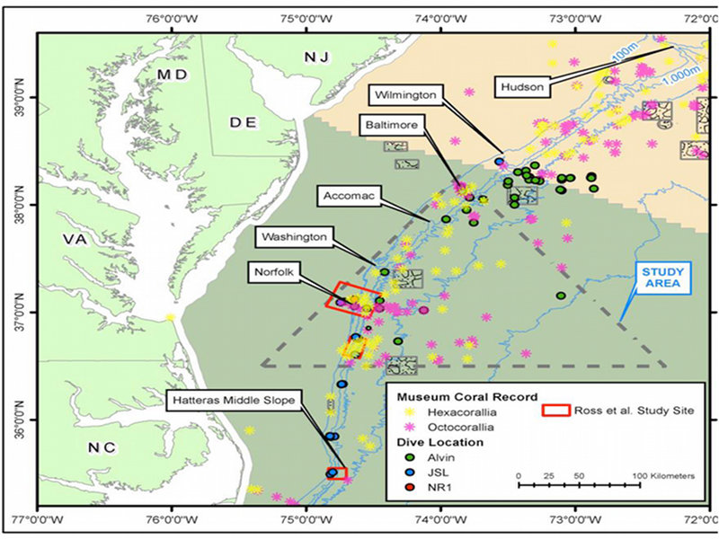
The primary target areas for the Deepwater Mid-Atlantic Canyons Project are in and around the Norfolk, Washington, Accomac, and Baltimore canyons. are This map shows places where deep-sea corals were previously identified (indicated by yellow and pink stars) as well as locations of previous submersible dives (green, blue, and red circles). Image courtesy SW Ross, UNC-W. Download larger version (jpg, 300 KB).
The Deepwater Mid-Atlantic Canyons Project represents a major systematic exploration of submarine canyons on the continental margin of the eastern United States. Funded by the Bureau of Ocean Energy Management, Regulation, and Enforcement (BOEMRE), the U.S. Geological Survey (USGS), and NOAA Ocean Exploration and Research (OER), our diverse team of scientists will investigate deepwater canyons, hard-bottom habitats, and shipwrecks off Virginia and Maryland. During the project’s first cruise in June of 2011, scientists and technicians onboard the NOAA Ship Nancy Foster will collect seafloor bathymetry (depth measurements) and water-column profiles. This cruise is critical for establishing the foundation of information necessary for the planning of multidisciplinary investigations in later years.
Perhaps the most striking feature of the continental margin of the eastern U.S. are the dozens of deep submarine canyons found in that region. Most of these canyons are relatively minor features, but several are incredibly extensive and cut quite deeply into the seafloor. The primary purpose of the multiyear Deepwater Mid-Atlantic Canyons Project is to discover and characterize the seafloor communities that live in association with east coast submarine canyons. Our mission will provide essential information on the ecology and biodiversity of these deep-sea communities to regulatory agencies for consideration in advance of any potential future energy development.
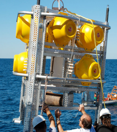
The benthic lander was designed at University of North Carolina – Wilmington for deploying multiple instruments and experiments to the deep-sea floor. Data collected by these platforms provide measurements of environmental variability that are typically unattainable. Image courtesy SW Ross, UNC-W. Download larger version (jpg, 497 KB).
This expedition is part of a new interagency effort involving NOAA, BOEMRE, and USGS in addition to scientists from numerous universities, working through the BOEMRE contractor, Continental Shelf Associates. Scientists and managers will use data and information from this multiyear project to improve knowledge of the type and extent of unique deep-water communities in the mid-Atlantic canyons.
Now in 2011, the first expedition of this multiyear partnership, the NOAA ship Nancy Foster departs from Charleston, South Carolina, on June 4. The ship will head north to our study sites, which include the Norfolk, Washington, and Baltimore canyons located off Virginia, Maryland, and Delaware in water depths from 150 to 1,000 meters (492 to 3,281 feet). The ship will return to Charleston June 17. This initial cruise is critical for establishing the foundation of information necessary for the planning the multidisciplinary investigations in 2012 and 2013.
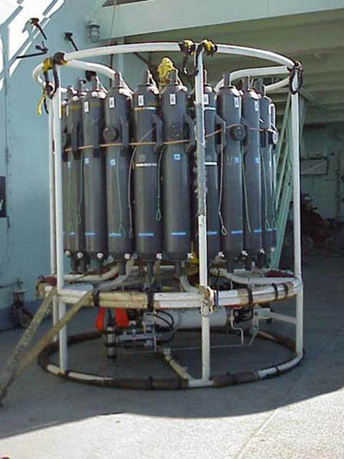
A Conductivity, Temperature, Depth (CTD) instrument will be used extensively during this expedition to profile the water column and collect sound velocity data for the multibeam sonar. The gray tubes are Niskin water sampling bottles. Image courtesy of NOAA-OER. Download larger version (jpg, 497 KB).
Multibeam sonar mapping is the primary activity during the Deepwater Mid-Atlantic Canyons 2011 cruise. Maps of the seafloor produced during the cruise will help guide sampling activities during future expeditions when we will use a remotely operated vehicle (ROV) to survey habitat and make collections. These sophisticated underwater vehicles are very expensive to use, and having good maps of the seafloor helps us optimize the limited ROV time. Without these maps we would be effectively searching in the dark for small targets over a vast area.
Some multibeam maps are already available for our study area, so we will prioritize areas that have not yet been mapped, such as Baltimore Canyon, or those that need better resolution, such as Norfolk Canyon.
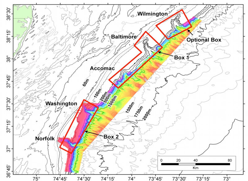
The red boxes outlines priority areas to be mapped during the June 2011 mapping expedition on board the NOAA Ship Nancy Foster. The color-shaded areas show multibeam data from previous expeditions. Image courtesy of SW Ross, UNC-W. Download larger version (jpg, 559 KB).
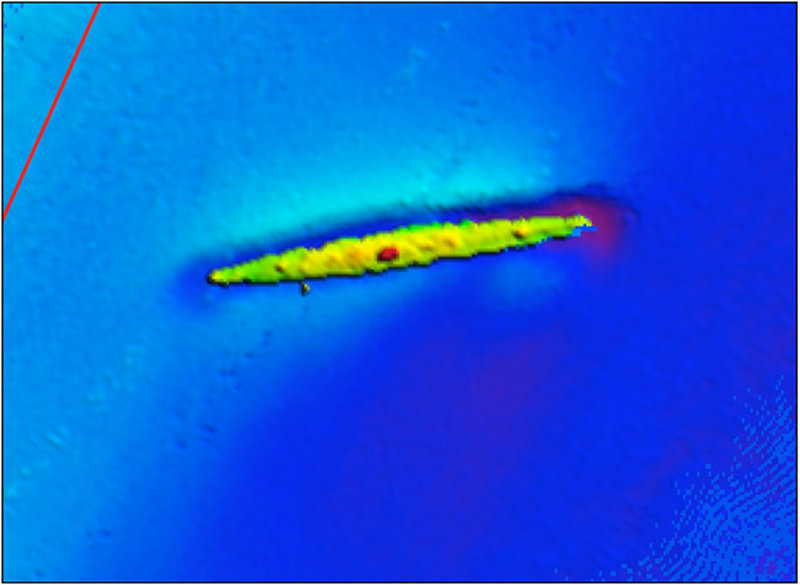
This high-resolution multibeam sonar image shows a shipwreck on the continental shelf near Norfolk Canyon. Image courtesy R Mather, URI. Download larger version (jpg, 316 KB).
We will also deploy instruments from the ship to 'characterize,' or describe, environmental conditions at different depths and locations along the canyon axis. We will attempt to recover a benthic lander (an observational platform that sits on the seafloor and records data) en route to the mapping sites.
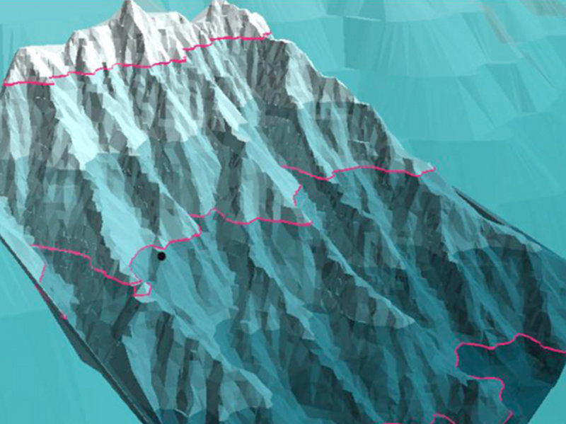
3-D rendering of a submarine canyon system just north of Cape Hatteras, NC which illustrates both the rugged canyon topography and the kind of detail we can obtain from multibeam sonar mapping. Image courtesy SW Ross, UNC-W. Download larger version (jpg, 255 KB).
This is the first cruise of a four-year project to study the biology, geology, and oceanography of a series of canyons off the mid-Atlantic coast of the U.S. Of particular interest are areas of hard substrate that could support deepwater coral ecosystems or other unusual habitats, such as methane seeps. Another major component of this study is marine archaeology, primarily searching for historically significant shipwrecks.