By James Connors, Web Coordinator - NOAA Office of Ocean Exploration and Research
May 2, 2013

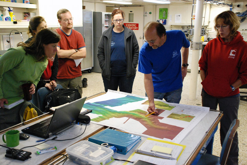
Co-chief scientist Steve Ross identifies targets for the first ROV dive at the nightly science meeting. Image courtesy of Deepwater Canyons 2013 - Pathways to the Abyss, NOAA-OER/BOEM/USGS. Download larger version (jpg, 1.3 MB).
In 2012, the Deepwater Canyons project focused primarily on surveying and sampling Baltimore Canyon, with a smaller amount of work done in Norfolk Canyon. The reverse is true of this year’s exploration: remotely operated vehicle (ROV) dive and sampling targets in Norfolk Canyon will comprise the majority of our days at sea.

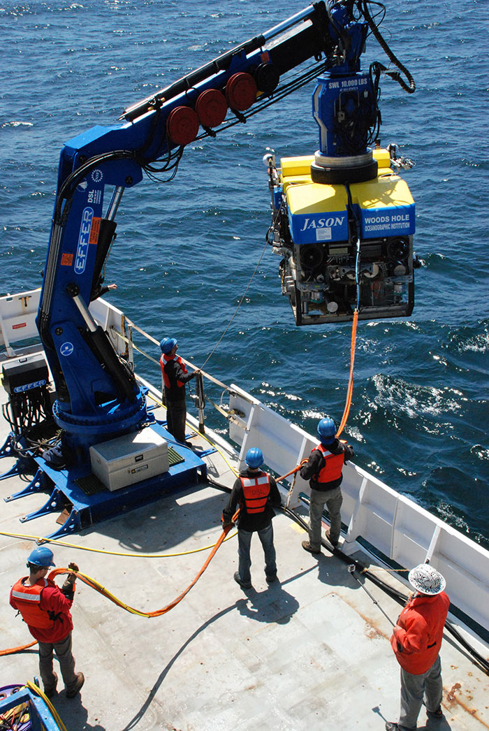
The Woods Hole crew hoists Jason into the water for its first dive on Norfolk Canyon. Image courtesy of Deepwater Canyons 2013 - Pathways to the Abyss, NOAA-OER/BOEM/USGS. Download larger version (jpg, 1.7 MB).
Norfolk Canyon is one of a jagged series of cuts in the outer continental shelf of the U.S. East Coast, stretching from North Carolina to Maine (there are 13 major canyons in all, dispersed at fairly regular intervals). As the continental shelf runs roughly North-Northeast mirroring the Carolina shoreline, the canyon cuts into the shelf horizontally, approximately 35 miles offshore.
Norfolk Canyon was most likely formed by riverine erosion during a period in the Pleistocene epoch (2.5 million to 12 thousand years ago) where intense glaciation caused sea levels worldwide to drop 300 feet or more below their current levels. Additional collapse and deposition have occurred since the canyon became a marine environment.

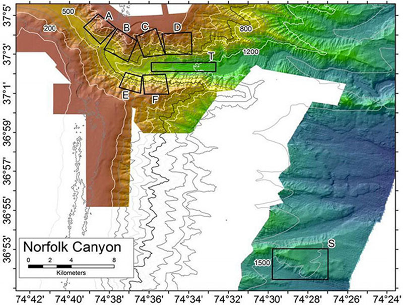
Proposed ROV dive areas (Boxes A-F and S) for Leg I in Norfolk Canyon. Image courtesy of Deepwater Canyons 2013 - Pathways to the Abyss, NOAA-OER/BOEM/USGS. Download larger version (jpg, 385 KB).
For the 2013 project, 15 ROV dives are scheduled in Norfolk Canyon. The principal investigators Sandra Brooke and Steve Ross have delineated six approximately one-square-mile target areas, four along the northern slope and two along the southern face (A – F on the map to the right). Each dive will begin in one of the target zones and explore the area intuitively based on what is seen. The schedule is tentative and additional dives may be allocated to any area that proves to be particularly interesting to the science team. A target southeast of the canyon (S) where the Okeanos Explorer discovered methane gas seeps in 2012 will also be explored with Jason.
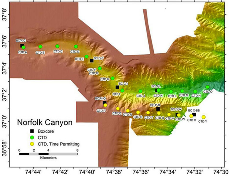
Throughout the night, bottom trawling will be conducted across the soft bottom of the canyon (T), and near the seep site (S) for the first half of Leg I operations. During the second half of Leg I, box coring (the art of taking a pristine sample of layers of seafloor sediment and the water directly above it) and CTD surveys will take place throughout the canyon at predetermined locations (see map below).

Box core and CTD sampling stations in Norfolk Canyon. Image courtesy of Deepwater Canyons 2013 - Pathways to the Abyss, NOAA-OER/BOEM/USGS. Download larger version (jpg, 255 KB).
Previous study has shown that the Mid-Atlantic Canyons are home to unique biological communities not found in the regions of continental shelf separating them. But how these communities relate among the canyons is not clear. Scientists on board are interested not only in what animals and habitats are present in Norfolk Canyon, but also how Norfolk and Baltimore Canyons compare to one another: is each canyon a unique, relatively isolated ecosystem, or is there substantial genetic interchange between them that results in an overall biological uniformity? The data gathered from our dives and samples in the coming days should help to answer that question.