

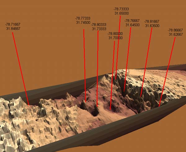
Three-dimensional image of part of the wreckfish grounds on the Charleston Bump. The image represents an area that is about 30 miles long and 10 miles wide. Depths drop from 1230 to 2300 ft at the scarp area. The red lines indicate dive site for the Islands in the Stream Expedition. This digital terrain model image of the Charleston Bump area was made using multi-beam data collected by the NOAA Ship WHITING. Our dive site was intended to be Note's Cliff's, though we ended up much closer to Alfonsin Abyss. Credit: Phil Weinbach of the SCDNR Marine Resources Division GIS lab. Image courtesy of Islands in the Stream 2001, NOAA/OER.
Related Links
Islands in the Stream: Islands