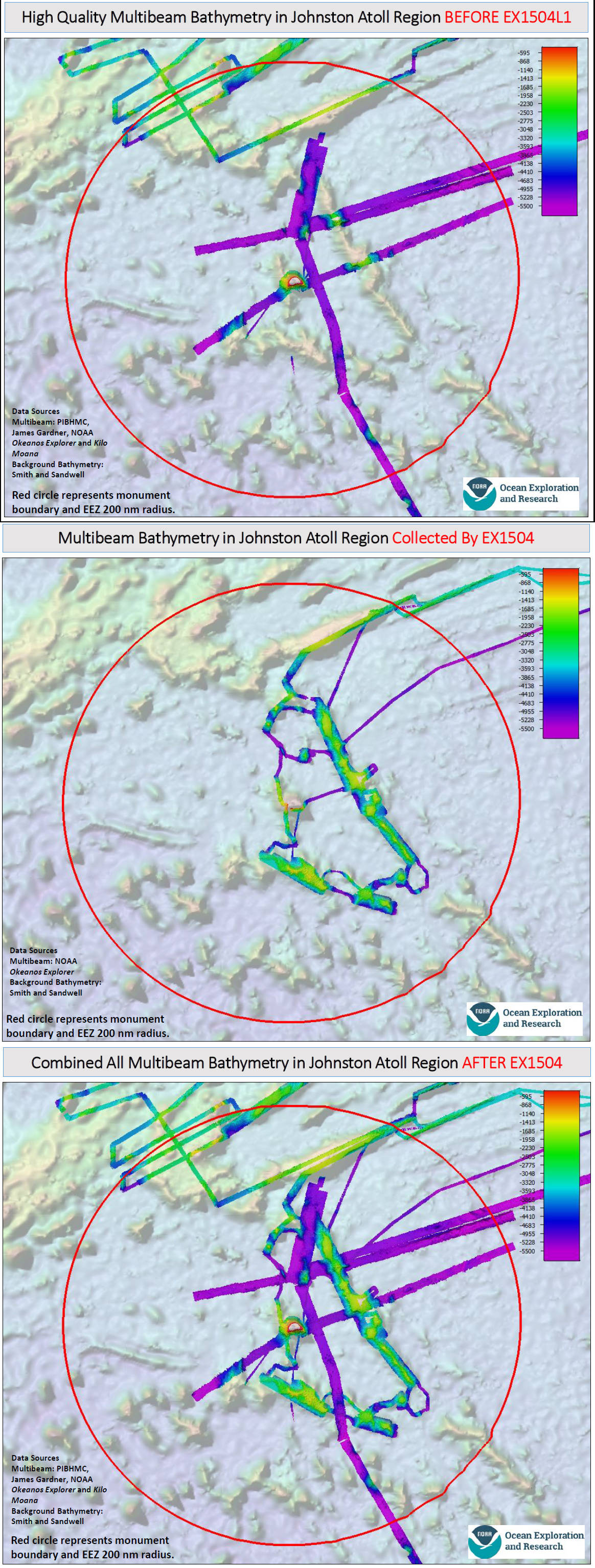
Maps showing the multibeam sonar mapping coverage in the Johnston Atoll Unit of the Pacific Remote Islands Marine National Monument before and after Legs 1 and 4 of the 2015 Hohonu Moana Expedition with NOAA Ship Okeanos Explorer.
