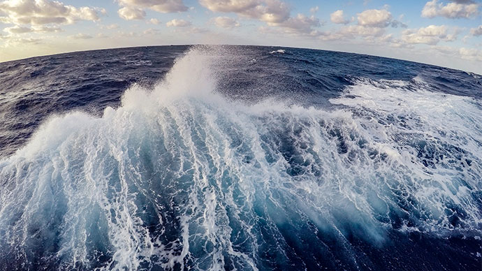
From February 25 to March 18 2016, NOAA Ship Okeanos Explorer will explore largely uncharted deep-sea ecosystems and seafloor in and around the Papahānaumokuākea Marine National Monument (PMNM). During the Hohonu Moana 2016: Exploring Deep Waters off Hawai’i expedition, our at-sea and shore-based science teams will work together to make some of the first deepwater scientific observations in this area. The expedition will commence in Pearl Harbor on the Hawaiian Island of Oʻahu and conclude at Kwajalein Atoll in the Marshall Islands.
On this page: Why? | Who? | Highlight Videos & Images | Press Releases | Background Info | Contact Info
The Papahānaumokuākea Marine National Monument is one of the largest fully protected conservation areas under the U.S. flag and one of the largest marine conservation areas in the world. The Monument encompasses 139,797 square miles of the Pacific Ocean (362,073 square kilometers) – an area larger than all the country's national parks combined.
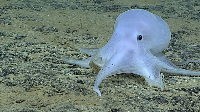
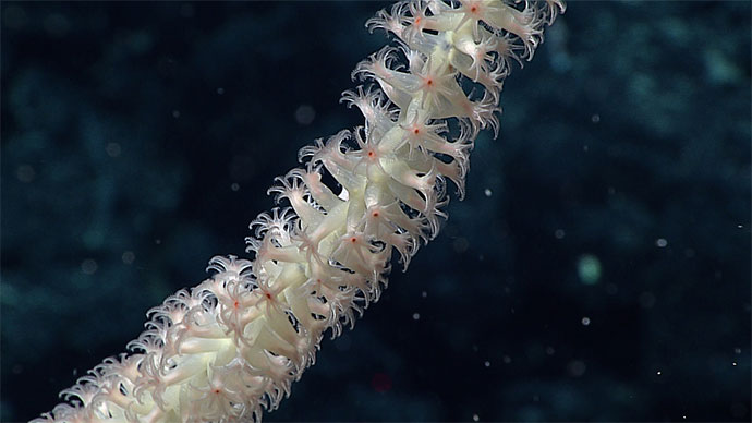
The Monument is home to more than 7,000 species, a myriad of geological features, significant cultural features, and a variety of post-Western-contact historic resources, including aircraft and vessels from World War II. More than 98 percent of the Monument’s seafloor lies below 100 meters and its deepwater resources are far less known than its shallow-water counterparts. These deep areas likely include many secrets yet to be discovered by scientists workign with the Okeanos Explorer.
The expedition will provide a foundation of publicly accessible baseline data and information to support science and management needs in and around the Papahānaumokuākea Marine National Monument. The effort also provides critical information about emerging regional issues like deep-sea mining and the potential U.S. Extended Continental Shelf.
Themes and objectives for this expedition include:
The expedition will include 24-hour operations consisting of remotely operated vehicle (ROV) dives and mapping operations.
The 2016 Hohonu Moana expedition marks the second year of a three-year NOAA campaign to explore and understand the central and western Pacific marine national monuments and sanctuaries. In 2017, field activities will shift back to the central Pacific and likely include areas extending from the vicinity of the Hawaiian Archipelago south to the equator. Priority areas include Kingman Reef and Palmyra Atoll, Jarvis Island, Howland and Baker Islands, and the Johnston Atoll portions of Pacific Remote Islands Marine National Monument, now known as Pacific Islands Heritage Marine National Monument; the National Marine Sanctuary of American Samoa; and Rose Atoll Marine National Monument. Additional work in the Phoenix Islands Protected Area and Musicians Seamounts is also under consideration.
The expedition involves a number of NOAA partners including National Marine Fisheries Service’s Pacific Islands Fisheries Science Center, Pacific Islands Regional Office, and Office of Habitat Conservation's Deep Sea Coral Research and Technology Program; National Ocean Service’s Office of National Marine Sanctuaries; Office of Marine and Aviation Operations; NESDIS National Centers for Environmental Information; and Office of Oceanic and Atmospheric Research’s Office of Ocean Exploration and Research.
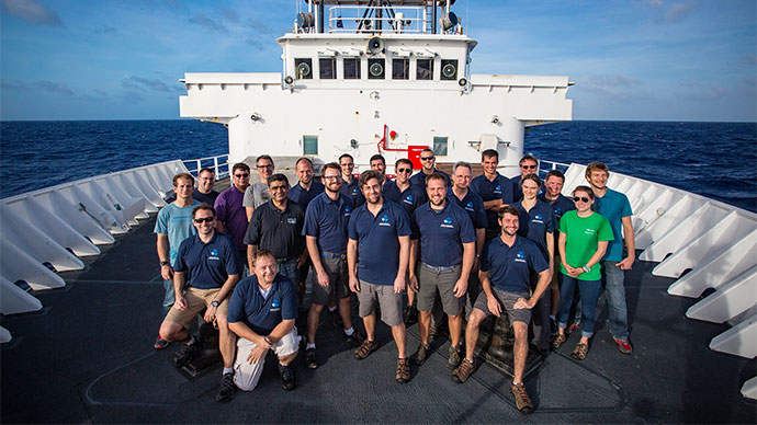
Activities during the expedition will be primarily led by the individuals listed below. They will coordinate input from multiple scientists participating from shore to plan dives, are the voices you hear on the live video feeds, and are primary participants in outreach events. For a full list of our on-ship team, please visit this page.
Dr. Daniel Wagner—Science Co-Lead
Research Specialist, NOAA Papahānaumokuākea Marine National Monument

Daniel Wagner received his Ph.D. in biological oceanography from the University of Hawaiʻi in 2011. Prior to that, Daniel received a B.S. in biology from Hawaiʻi Pacific University in 2005, and an M.S. in biological oceanography from the University of Hawaiʻi in 2008.
Daniel has conducted research on Hawaii’s deep-sea reefs for more than a decade and participated in over 20 research expeditions that have surveyed deepwater habitats using technical SCUBA diving, manned submersibles, and remotely operated vehicles. Daniel is interested in the taxonomy, life history, and ecology of deep-sea corals, particularly of black corals.
He is serving as a co-science lead during the first ROV expedition to the Northwestern Hawaiian Islands, and will help coordinate the science objectives during the expedition.
Jonathan Tree—Science Co-Lead
Graduate Student, University of Hawaiʽi at Mānoa

Jonathan Tree is a graduate student at the University of Hawaiʽi at Mānoa, finalizing his master’s degree in geology and geophysics. His research is focused on understanding the geologic history of the Hawaiian hotspot. To better understand the evolution of the hotspot, he uses multiple methods including the geochemistry and geophysical data of the Hawaiian volcanoes that are 5 to 45 million years old. Jonathan is originally from Colorado where he completed undergraduate degrees in geology, biology, and mathematics and developed his interest in the geology of volcanoes while conducting research on an extinct volcanic field in southwestern Colorado. Jonathan has been involved in multiple at-sea expeditions in the region of the Papahānaumokuākea Marine National Monument and is excited be heading back out to sea to further explore these seamounts.
Brian Kennedy—Expedition Coordinator
NOAA Office of Ocean Exploration and Research

In his role as expedition coordinator, Mr. Kennedy is responsible for overseeing all aspects of an expedition, including arranging logistics, planning science operations, and coordinating public outreach. He has participated in or led more than 25 expeditions of exploration that have taken him to two oceans (Atlantic and Pacific), three continents (North America, South America, and Asia), and through the waters of six countries (the U.S., Ecuador, Panama, Costa Rica, Honduras, and Indonesia). Originally from landlocked Athens, Ga., Mr. Kennedy grew up fascinated with marine mammals and the ocean. He holds a B.S. in marine biology with a minor in marine geology from the College of Charleston, in South Carolina, and is a former member of the NOAA Commissioned Corps.
Mashkoor Malik—Mapping Lead
NOAA Office of Ocean Exploration and Research

Mashkoor earned his master's in Ocean Mapping from the University of New Hampshire in 2005. He has been with NOAA since 2008 and served as the onboard mapping lead on the Okeanos Explorer from 2008-2013. From 2013-2015, he worked with the NOAA Office of Coast Survey. He rejoined OER in July 2015 as a Mapping Team Lead, where he is responsible for the ocean mapping systems onboard NOAA Ship Okeanos Explorer. On shore, Mashkoor works in Silver Spring, Maryland, where he contributes to expeditions through data processing and archiving, operational planning, and mapping product development.
Dive highlight videos, short video clips, and photos will be posted online as they are available.
Please see the Contact Us page for information regarding specific media, public, and government inquiries.
Access LIVE video feeds here
Expedition home page
Please see the Contact Us page for information regarding specific media, public, and government inquiries.