This media resources page provides members of the media with information; resources; and broadcast-, print-, and web-quality imagery developed during the 2017 American Samoa expedition.
Between February and April 2017, NOAA and partners will conduct two telepresence-enabled ocean exploration cruises on NOAA Ship Okeanos Explorer to collect critical baseline information of unknown and poorly known deepwater areas in American Samoa and Samoa, with an emphasis on the Rose Atoll Marine National Monument (RAMNM) and National Marine Sanctuary of American Samoa (NMSAS). During the cruises, our at-sea and shore-based science teams will work together to map the seafloor and make some of the first deepwater scientific observations in these areas.
On this page:
Why? | Who? | Highlight Videos & Images | Press Releases | Background Info | Contact Info
The expedition is part of the three-year Campaign to Address the Pacific monument Science, Technology, and Ocean NEeds (CAPSTONE), a foundational science initiative to collect deepwater baseline information to support science and management decisions in and around U.S. marine protected areas in the central and western Pacific. These areas contain some of the last relatively pristine marine ecosystems on the planet and harbor numerous protected species, undiscovered shipwrecks, and cultural landscapes. Their designation is unprecedented in terms of geographic scope, ecological value, and national symbolism for ocean conservation. However, their remoteness creates substantial challenges. Most deepwater areas remain poorly known and are of high interest to federal and state agencies with research and management responsibilities. To address this challenge, NOAA is conducting a series of expeditions aboard NOAA Ship Okeanos Explorer.
National Marine Sanctuary of American Samoa is located in the cradle of Polynesia’s oldest culture and thought to support the greatest diversity of marine life in the National Marine Sanctuary System. The sanctuary is comprised of six protected areas, covering 13,581 square miles of nearshore coral reef and offshore open ocean waters across the Samoan archipelago. The sanctuary protects extensive coral reefs, including some of the oldest and largest Porites coral heads in the world, deepwater reefs, hydrothermal vent communities, and rare marine archaeological resources. Additionally, the sanctuary encompasses important fishing grounds, the southernmost point in the United States, and waters surrounding one of the world’s smallest atolls. The sanctuary contains some of the most spectacular tropical reef ecosystems in the world and is the most remote location within the National Marine Sanctuary System. NOAA co-manages the sanctuary with the government of American Samoa and works closely with communities adjacent to the sanctuary, all within the context of Samoan cultural traditions.
Rose Atoll lies approximately 130 nautical miles east-southeast of American Samoa's Pago Pago Harbor and is the easternmost Samoan island and the southernmost point of the United States. This small atoll remains one of the most pristine atolls in the world, and the marine environment around Rose Atoll supports a dynamic reef ecosystem that is home to a diverse assemblage of marine species, many of which are threatened or endangered. The Rose Atoll Marine National Monument area consists of approximately 13,436 square miles and its outer boundary is approximately 50 nautical miles from the mean low water line of Rose Atoll. One of the most striking features of Rose Atoll is the pink hue of the fringing reef, which is caused by the dominance of coralline algae, the primary reef-building species in the area. Though there are roughly 100 species of stony corals, the shallow reefs are dominated by crustose coralline algae, making them distinctive and quite different from the reefs found at other Samoan islands. NOAA, the U.S. Fish and Wildlife Service, and the American Samoa Government cooperatively manage the Monument, which encompasses the Rose Atoll National Wildlife Refuge and was added to the National Marine Sanctuary of American Samoa in 2014.
Only recently have scientists visited the realm of these deep-ocean areas, where they observed previously unknown biological, chemical, and geological wonders of nature. These deep areas likely include many secrets yet to be discovered during this expedition.
The expedition will provide a foundation of publicly accessible baseline data and information to support science and management needs in and around American Samoa, Rose Atoll Marine National Monument, and the National Marine Sanctuary of American Samoa. The effort also provides critical information about emerging or future regional issues.
NOAA priorities for the expedition include a combination of science, education, outreach, and open data objectives that will support management decisions at multiple levels:
This expedition is part of the three-year Campaign to Address the Pacific monument Science, Technology, and Ocean NEeds (CAPSTONE), a foundational science initiative to collect deepwater baseline information to support science and management decisions in and around U.S. marine protected areas in the central and western Pacific. Other 2017 focus areas include the Musicians Seamounts and the Pacific Remote Islands Marine National monument, now known as Pacific Islands Heritage Marine National Monument, including the units of Howland, Baker, and Jarvis Islands; Palmyra Atoll and Kingman Reef; and Johnston Atoll. While the focus of 2017 operations remains within U.S. waters, NOAA is pleased to partner with several Pacific Island countries and will explore the deep waters of Samoa, the Republic of Kiribati's Phoenix Islands Protected Area, the Cook Islands, and New Zealand's Territory of Tokelau.
The expedition involves a number of NOAA partners including National Marine Fisheries Service's Pacific Islands Fisheries Science Center, Pacific Islands Regional Office, and Office of Habitat Conservation's Deep-sea Coral Research and Technology Program; Office of Marine and Aviation Operations; the National Ocean Service's Office of National Marine Sanctuaries, NESDIS National Centers for Environmental Information; and Office of Oceanic and Atmospheric Research's Office of Ocean Exploration and Research.
The individuals listed below will primarily lead activities during Part 1 of the expedition. They will coordinate input from multiple scientists and managers participating from shore to plan dives and are the voices you hear on the live video feeds and the primary participants in outreach events. For a full list of our on-ship team, please visit this page.

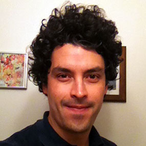
Co-science Lead - Lehigh University
Santiago's research focuses on the ecological and evolutionary processes that produce global biodiversity patterns in the ocean. He uses interdisciplinary approaches that combine molecular and environmental data with bioinformatic tools to study the past, present, and future of deep-sea and cold-water ecosystems, focusing on species of corals, anemones, fish, and crustaceans. He has participated in more than 16 oceanographic expeditions, including several via telepresence.
Santiago received bachelor's degrees in Biology and Microbiology, and a Master's degree in Biological Sciences from the Universidad de los Andes in Bogota, Colombia. During his Master's, he was a graduate fellow at the Smithsonian's National Museum of Natural History. He earned a Ph.D. in Biological Oceanography from the Massachusetts Institute of Technology - Woods Hole Oceanographic Institution (WHOI) joint program. Santiago was also a postdoctoral fellow funded by the Canadian Institutes of Health Research at the University of Toronto. He is currently a Visiting Assistant Professor at Lehigh University and a Guest Researcher at WHOI and Temple University. In addition to his research, he also teaches courses in biodiversity, epigenetics, and oceanography. You can learn more about Santiago’s research and interests at his website: http://santiagoherrera.github.io/ .

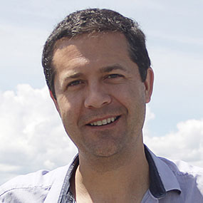
Co-science Lead, Associate Professor - University of California Santa Barbara
Dr. Matt Jackson's research interests focus on the long-term evolution and dynamics of the deep Earth. Volcanoes erupted at oceanic hotspots provide insights into the composition of the Earth's interior: deep-seated mantle plumes convey material from the deepest mantle to the shallow mantle, where they melt. The chemistry of these melts, which are erupted at the Earth's surface, gives clues to the composition of the Earth's interior. The lavas collected from the Samoan hotspot will shed light on evolution of Samoan hotspot volcanoes and, potentially, volcanoes from nearby hotspots that have contributed volcanism to the Samoan region.
Matt has spent several months at sea on prior oceanographic expeditions focusing on submarine volcanoes. All prior cruises focused on dredging to retrieve volcanic rocks, and the Okeanos Explorer cruise will be Matt's first ROV-based expedition.
Matt received his B.S. from Yale University and his PhD from the Massachusetts Institute of Technology - Woods Hole Oceanographic Institution Joint Program.

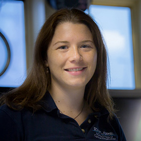
Expedition Manager, NOAA Office of Ocean Exploration and Research
Kelley Elliott is the Senior Expedition Manager for the NOAA Office of Ocean Exploration and Research’s telepresence-enabled exploration program. She holds a Master’s degree in Maritime Archaeology from the University of Southampton and a Bachelor’s degree in Environmental Conservation from New Century College, George Mason University. Kelley is responsible for planning, coordinating, and managing expeditions conducted by NOAA Ship Okeanos Explorer. She has coordinated 10 Okeanos’ cruises since joining the operation in 2009, including five telepresence-enabled remotely operated vehicle cruises and one telepresence-enabled autonomous underwater vehicle cruise. In this role, she acts as a liaison for science and operational partners onshore as well as coordinating the mission planning process between all personnel onboard the ship. Her background demonstrates the depth of knowledge and expertise the Ocean Exploration Program requires and embodies. In addition to geographic information system, video editing, and web publishing expertise, Kelley is an excellent writer and frequently develops and edits articles for publication on NOAA’s website.
Over the last decade, her combined professional and academic field experiences have taken her around the globe investigating a diversity of science topics from Arctic Ocean ecology, tropical ecosystems, and submerged cultural heritage to deep-sea ecosystems including hydrothermal vents, gas seeps, submarine canyons, and deep-sea coral habitats. An explorer at heart, Kelley spends most of her spare time exploring the great outdoors from the volcanos of Nicaragua to the trails surrounding her home.

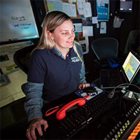
Mapping Lead - NOAA Office of Ocean Exploration and Research
Elizabeth (Meme) Lobecker is a physical scientist with NOAA’s Office of Ocean Exploration and Research. She has led or sailed on over 20 cruises on NOAA Ship Okeanos Explorer. When working on shore, she is located at the Integrated Ocean and Coastal Mapping center at the University of New Hampshire, where she plans Okeanos Explorer mapping operations and cruises, facilitates data archival procedures with the National Geophysical Data Center, and collaborates with other scientists on Okeanos Explorer missions.
Ms. Lobecker began her career in hydrography in 2002 at Science Applications International Corporation, Inc. (SAIC, now Leidos), where she spent five years mapping the U.S. East Coast, the Gulf of Mexico, and Alaska, primarily for NOAA and U.S. Geological Survey contracts. She was also an in-house software tester for SAIC’s multibeam acquisition and processing software suite. In 2007, Ms. Lobecker left SAIC to diversify her survey experience through fieldwork in Papua New Guinea, the North Sea, and the Mediterranean Sea for various research and commercial purposes.
She holds a master’s degree in marine affairs from the University of Rhode Island and a bachelor’s degree in environmental studies, with minors in geography and biology, from The George Washington University.
B-roll footage is available here.
Additional dive highlight videos, short video clips, and photos will be posted online as they are available.
Please contact Katie Wagner for high-res footage, B-roll, and other materials at (301) 734-1008 or Katie.Wagner@noaa.gov.
Access LIVE video feeds here
Expedition home page
NOAA ship journeys into remote, deep Pacific ocean
February 14 - NOAA News