by Adam Skarke, Mississippi State University

Figure 1: Diagram of continental drift over the past 225 million years. The red square indicates the position of the early Gulf of Mexico basin after Pangea broke apart into Laurasia and Gondwana. Download larger version (jpg, 325 KB).
Hundreds of millions of years ago, all land on Earth was part of single “supercontinent” known as Pangea, which was surrounded by a continuous global ocean. About 200 million years ago, a 6,000-kilometer-long fracture split Pangea into two separate and smaller supercontinents, Laurasia (which would later become North America, Europe, and Asia) and Gondwana (which would later become South America, Africa, Antarctica, and Australia).
As Pangea broke apart, a section of the fracture between the future North American and South American continental plates expanded and the resulting stretching as well as thinning of the Earth’s crust created a large depression that would become the Gulf of Mexico basin (Figure 1).
As spreading of new oceanic crust expanded and deepened the young Gulf of Mexico basin, between 160 and 140 million years ago, it was intermittently filled by seawater, first from the Pacific Ocean and later from the early Atlantic Ocean. Repeated cycles of seawater flooding and evaporation resulted in the formation of extensive salt deposits on the floor of the Gulf of Mexico that were up to four kilometers thick in some locations.
Later, large volumes of “terrigenous” sediment eroded from the North American content and transported to the northern Gulf of Mexico by rivers, such as the early Mississippi, created seafloor deposits overlying the salt. Between 120 and 100 million years ago, layered reef deposits on top of a crustal block in the in the eastern Gulf of Mexico began to build a large steep-sided platform of carbonate rock that would later become the Florida peninsula. Over the last 60 million years, the Gulf of Mexico basin has continued to subside or deepen, especially along the northern edges, under the immense load of accumulated terrigenous sediments that are more than 10,000 meters thick in some locations.
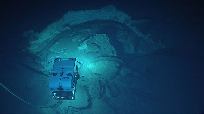
During the 2018 Gulf of Mexico expedition, remotely operated vehicle Deep Discoverer will dive at locations across the northern Gulf of Mexico that exhibit a wide range of seafloor materials, features, and processes that reflect this complex geologic history.

Figure 2: Bathymetric map of the northern Gulf of Mexico with the location of the Sigsbee Escarpment, West Florida Escarpment, Mississippi Canyon, and salt domes indicated. Image courtesy of Adam Skarke. Download larger version (jpg, 778 KB).
The most notable geologic feature in the northwestern Gulf of Mexico is the uniquely rough seafloor surface north of the Sigsbee Escarpment, which is conspicuous in bathymetric maps of the basin (Figure 2). This widespread deformation is a result of the upward migration and then dissolution of the deep salt deposits noted above. Under very high pressures created by thick layers of overlying terrigenous sediment, salt deforms plastically (like modeling clay) and moves laterally as well as upward toward the seafloor in ridges and pillars known as diapirs. At locations where these salt diapirs breach the seafloor and contact seawater, they gradually dissolve, producing the complex irregular collapse features seen in seafloor bathymetry as well as “pools” and “rivers” of highly concentrated saltwater brine.
Additionally, as salt diapirs cut upward through overlying terrigenous sediment, they create vertical pathways for the movement of hydrocarbons (oil and natural gas) along their edges. When these hydrocarbons emerge at the seafloor, they create “cold seep” environments including asphalt seeps, mud volcanoes, and gas seeps, which often harbor unique chemosynthetic ecosystems.
The Sigsbee Escarpment along the southern edge of this salt complex is cut by a number of undersea canyons, including Perdido, Alaminos, Keathley, Bryant, Cortés, Farnella, and Green Canyons, which serve as pathways for downslope movement of sediment into the deeper central Gulf of Mexico. The steep walls of these canyons often have outcrops of exposed rock, free of sediment cover, which provide necessary hard substrate habitat for sessile organisms including many species of deep-sea coral and sponge.

Figure 3: Oblique projection of northern Gulf of Mexico bathymetry including salt domes and Mississippi Canyon. Image courtesy of the NOAA Office of Ocean Exploration and Research. Download larger version (jpg, 818 KB).
Notable geologic features in the central portion of the northern Gulf of Mexico include a series of salt domes and the incised Mississippi Canyon (Figure 3). Salt domes are created by migration of salt diapirs, which uplift sediment into hills and mounds as they slowly approach the seafloor from below. Many of these domes are rimmed by cold seeps, as a result of vertical gas migration along the edges of their salt core as well as warming of gas hydrates in surrounding sediments by the more thermally conductive salt. The upper portion of the Mississippi Canyon was formed by incision of the Mississippi River during periods of lower sea level, and the lower portion was carved by sediment laden turbidity currents, which are currents with elevated density that flow rapidly downslope due to the weight of the suspended particles they carry.

Figure 4: Oblique projection of the West Florida Escarpment. Image courtesy of the NOAA Office of Ocean Exploration and Research. Download larger version (jpg, 425 KB).
The Mississippi Canyon formed approximately 30,000 years ago and continues to serve as an transport pathway, funneling terrigenous sediment from the Mississippi River and continental shelf to a vast offshore fan that covers thousands of square kilometers and is over 3,000 meters thick.
The most notable geologic feature in the northeastern Gulf of Mexico is the West Florida Escarpment, a steep limestone cliff that is the western edge of the carbonate rock platform that forms the Florida peninsula (Figure 4). The escarpment extends from De Soto Canyon to the Florida Keys and has a vertical relief of over 2,500 meters for much of its length. The face of the erosional escarpment is “stepped” with a series of sediment covered terraces separated by steeper sections of exposed rock that approach vertical in many locations. Much of the exposed rock is covered in a thin layer of iron and manganese oxide crust. In the same manner as exposed canyon walls, the rocky outcrops of the escarpment serve as a hard substrate habitat for sessile organisms including many species of deep sea coral and sponge.
Dive sites for the 2018 Gulf of Mexico expedition will extend across the northern Gulf of Mexico and encompass a wide range of geological environments and features, which may include brine pools, cold seeps, mud volcanoes, canyons, domes, ridges, and escarpment walls.