Summary Map
Map created by the NOAA Office of Ocean Exploration and Research. Service layer credits: Esri, DigitalGlobe, GeoEye, Earthstar Geographics, CNES/Airbus DS, USGS, AEX, Getmapping, Aerogrid, IGN, IGP, swisstopo, and the GIS User Community. Download larger version (jpg, 448 KB).
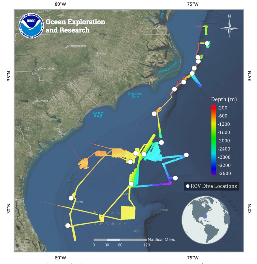
Overview map showing seafloor bathymetry mapping coverage and ROV dives (white circles) completed during both parts of the Windows to the Deep 2018 expedition.
 completed during both parts of the Windows to the Deep 2018 expedition. Map created by the NOAA Office of Ocean Exploration and Research. Service layer credits: Esri, DigitalGlobe, GeoEye, Earthstar Geographics, CNES/Airbus DS, USGS, AEX, Getmapping, Aerogrid, IGN, IGP, swisstopo, and the GIS User Community.")