NOAA Ship Okeanos Explorer
October 30 - November 20, 2018
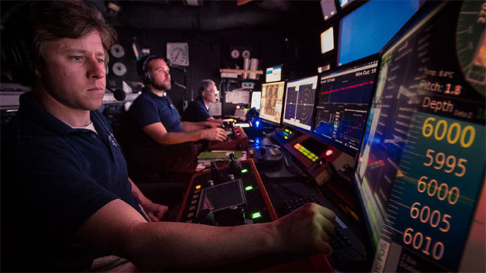
Océano Profundo 2018: Exploring Deep-Sea Habitats off Puerto Rico and the U.S. Virgin Islands was a 22-day telepresence-enabled expedition on NOAA Ship Okeanos Explorer to collect data on priority exploration areas identified by the ocean management and scientific communities. During the expedition, scientists explored a diversity of features with mapping and remotely operated vehicle (ROV) operations, including deep-sea fish habitats, deep-sea coral and sponge communities, midwater habitats, submarine canyons, submarine landslides, and other unique geological features.

Overview map showing the locations of ROV and mapping operations completed during the Océano Profundo 2018 expedition. Map created by the NOAA Office of Ocean Exploration and Research. Download larger version (jpg, 2.6 MB).
Major accomplishments of this expedition are summarized below. For more information, download the summary fact sheet (pdf, 3.4 MB).

This infographic provides a snapshot of the expedition by the numbers. Infographic created by the NOAA Office of Ocean Exploration and Research. Download larger version (pdf, 1.1 MB).
Baseline characterization of deep-sea biological diversity and monitoring of potential geo-hazards in the U.S. Caribbean is important for management and protection to sustain or restore ecosystems and balance that with the local fishing industry. Through our expedition and live streaming, we build awareness in the local community, taking the first step to effective management. Video courtesy of the NOAA Office of Ocean Exploration and Research, Océano Profundo 2015: Exploring Puerto Rico’s Seamounts, Trenches, and Troughs. Download larger version (mp4, 311.4 MB).
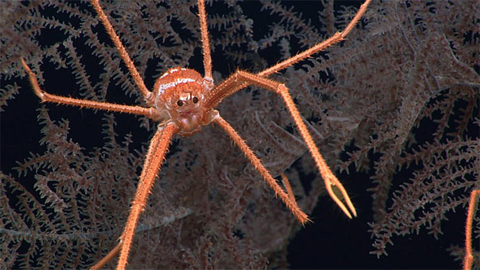
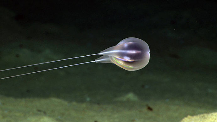
Throughout the expedition, scientists encountered coral and sponge communities during every dive in newly mapped areas and in previously unexplored areas with many dives having high to medium density or abundance. A rare sighting of a coral community at a depth of over 2,000 meters (6,500 feet) is currently among the deepest high-density communities known from the U.S. Caribbean Region.
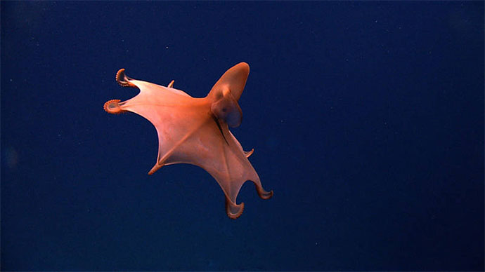
The expedition also included exploration of the water column, the largest and least explored biome on the planet by volume. Scientists conducted midwater explorations at depths ranging from 300 to 900 meters (984 to 2953 feet) during two dives to investigate the diversity and abundance of the largely unknown pelagic fauna of the region.
Not only do these discoveries change our expectations in terms of what lies in the deep sea, since we can’t manage and protect what we don’t know, all of these observations can help to inform management of these sensitive habitats and potential resources within the U.S. Exclusive Economic Zone.
This embryonic catshark and egg case was found attached to an octocoral colony on one of the shallower dives of the expedition. We've seen these cases before but they have all been empty, leaving us wondering what laid them. The fact that we saw this one, alive, and directly linked to a coral colony, tells us a lot about how important deep-sea corals are as nursery habitats for fishes and other organisms. Video courtesy of the NOAA Office of Ocean Exploration and Research, Océano Profundo 2015: Exploring Puerto Rico’s Seamounts, Trenches, and Troughs. Download larger version (mp4, 80.9 MB).
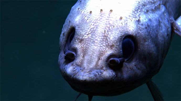
During ROV dives, the team collected both biological and geological samples, adhering to the Okeanos Explorer sampling objective of collecting a limited number of samples in order to characterize a dive site. The team documented rare species including five species of sea stars, some of which might be new to science; rare behaviors; and animals at deeper depths than expected, including the commercially important queen snapper seen at a record depth of 539 meters (1,768 feet). Other commercially important fish species seen included the silk snapper and misty grouper. The team also had a very rare observation of a catshark embryo swimming in a translucent egg case.
When combined with other deep-sea and water column discoveries, these data will be important for increasing our ability to manage marine resources, as well as increasing our understanding of deep-sea ecosystem connectivity across the Atlantic basin.
, distinct sand waves, and the head of a gently sloping canyon system with steep walls on the north side of the feature.")
During the expedition, the team collected multibeam bathymetry of Engaño Canyon and Engaño Bank; this area within the Dominican Republic had never been previously mapped with multibeam surveys. The data reveals a plateau area with depths as shallow as 80 meters (262 feet), distinct sand waves, and the head of a gently sloping canyon system with steep walls on the north side of the feature. Image courtesy of the NOAA Office of Ocean Exploration and Research. Download larger version (jpg, 135 KB).
During the Océano Profundo 2018 expedition, the Okeanos Explorer team mapped over 14,959 square kilometers; several of theses areas had never been mapped before, including deep-sea areas around Mona Island, Saba Valley, Engaño Canyon, and Engaño Bank. During ROV dives, geological samples were collected that will help increase understanding of the geologic history of the region and to characterize habitat substrate.
Data collected during this expedition are intended to inform initial characterization of the areas visited and include multibeam, single beam, subbottom, ADCP, XBT, CTD, and dissolved oxygen profiles; surface oceanographic and meteorological observations; video and imagery; and physical specimens. All data from this expedition will be publicly available through national archives and a direct link to expedition data will be posted on this website once available.
This expedition had multiple objectives in terms of surveying and characterizing deep-sea habitats in the waters around Puerto Rico. Meeting these objectives was made possible by collaborations between a number of entities, including scientists from all over the world, local Puerto Rican fishermen, NOAA, and representatives of the Caribbean Fisheries Management Council. Information collected during the expedition will help in the management and use of these deep habitats, particularly with respect to the commercial fisheries of Puerto Rico and the greater Caribbean. Video courtesy of the NOAA Office of Ocean Exploration and Research, Océano Profundo 2015: Exploring Puerto Rico’s Seamounts, Trenches, and Troughs. Download larger version (mp4, 304.8 MB).
63 scientists, resource managers, and students from 15 U.S. states and seven international countries participated regularly in the expedition—mostly from shore. Additionally, ship tours, ship-to-shore interactions, and live online streaming of ROV dives to the general public opened a window of understanding into the deep sea for audiences around the world.
Océano Profundo 2018: Exploring Deep-Sea Habitats off Puerto Rico and the U.S. Virgin Islands was one of several expeditions being conducted from NOAA Ship Okeanos Explorer as part of the Atlantic Seafloor Partnership for Integrated Research and Exploration (ASPIRE) campaign, a major multi-year, multi-national collaborative field program focused on raising collective knowledge and understanding of the North Atlantic Ocean. Major expedition accomplishments are linked to ASPIRE goals in the summary fact sheet (pdf, 3.4 MB).