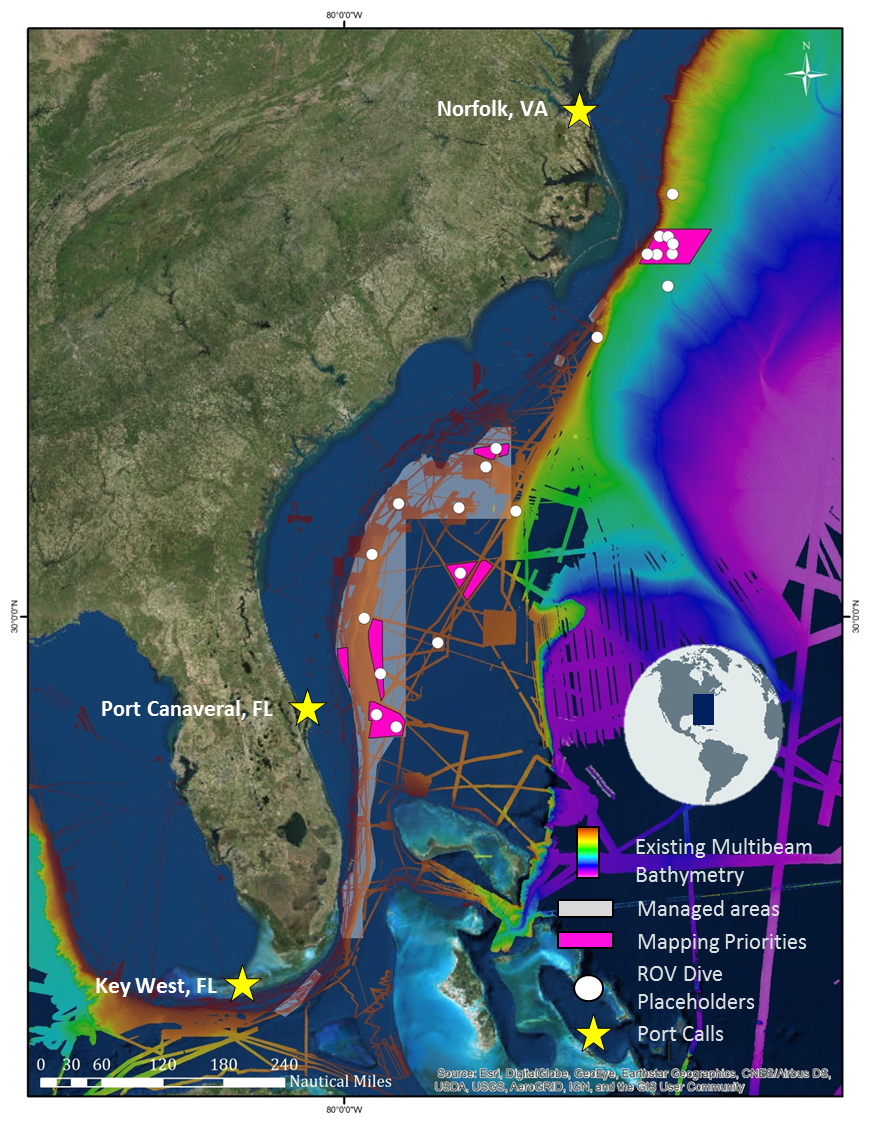
Leg 2 Map
Tentative plans for Leg 2 of the Windows to the Deep 2019 expedition, starting in Port Canaveral, Florida, and wrapping up in Norfolk, Virginia. Over the past decade, NOAA Ship Okeanos Explorer and the U.S. Extended Continental Shelf Project have mapped much of the deepwater habitats offshore the U.S. east coast (assembled bathymetry shown on this map), but much of the Blake Plateau remains unmapped and poorly explored. This expedition will contribute much-needed ROV survey and bathymetry data to build upon the existing foundation.
, but much of the Blake Plateau remains unmapped and poorly explored. This expedition will contribute much-needed ROV survey and bathymetry data to build upon the existing foundation.")