by Kasey Cantwell, NOAA Office of Ocean Exploration and Research
June 20, 2019

Chris Ritter, Global Foundation for Ocean Exploration Operations Manager for Leg 2 of the expedition, gives a tour of the remotely operated vehicles to Windows to the Deep 2019 Science Leads Amy Wagner and Alexis Weinnig. Image courtesy of the NOAA Office of Ocean Exploration and Research, Windows to the Deep 2019. Download image (jpg, 3.9 MB).
Today marks the first day of the Windows to the Deep 2019 expedition and NOAA Ship Okeanos Explorer’s 100th ocean exploration mission! Over the years, there have been many highlights that millions of people around the world have joined us for, but few know how we determine where we go and what we do when we get there. Planning for a mission of this nature starts months in advance, with much of the initial framework developed years prior.
The first step of planning a NOAA Office of Ocean Exploration and Research (OER) expedition begins with assessing available seafloor mapping data, made available through the NOAA National Centers for Environmental Information (NCEI), and by analyzing United States Bathymetry Gap Analysis completed by the NOAA Office of Coast Survey, the University of New Hampshire Center for Coastal and Ocean Mapping/Joint Hydrographic Center, and NCEI. From here, we begin assessing the highest-priority areas in need of exploration.
The next step in expedition planning is to solicit input from the resource management and science communities. OER uses a variety of methods to gather this input and then uses it to define expedition-specific objectives and priorities. Information about the specific cruise planning process, and interactive maps that provide additional detail, can be found on this story map .

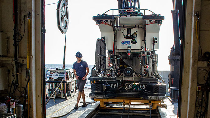
Lars Murphy reviews one of the new tools added to the remotely operated vehicle Deep Discoverer over the winter with Science Leads Alexis Weinnig and Amy Wagner as they discuss how to approach sampling operations during this expedition. Image courtesy of the NOAA Office of Ocean Exploration and Research, Windows to the Deep 2019. Download image (jpg, 3.9 MB).
In 2018, OER solicited input from the science and resource management communities to identify areas that need mapping and remotely operated vehicle (ROV) investigation. In the deepwater areas offshore the southeastern United States, over 175,000 square kilometers of seafloor mapping were requested by the community. Of the 121 ROV dive targets submitted, over 50 percent recommended exploring deep-sea coral and sponge habitats. The rest of the proposals recommended exploring methane seeps and their chemosynthetic communities, underwater cultural heritage sites, and geological features like submarine canyons, large bedforms, past landslides, and other potential geohazards. So much input was received as part of the planning for Windows to the Deep 2018 that OER was able to use this same information to inform planning for the 2019 expedition.
Another key source of input in planning this expedition was input from OER's 2018 Atlantic Seafloor Partnership for Integrated Research and Exploration (ASPIRE) Science Planning Workshop. On November 15-16, 2018, over 50 experts in deep-sea exploration convened in Silver Spring, Maryland, to discuss North Atlantic Ocean exploration interests and priorities as part of ASPIRE, a major multi-year, multi-national collaborative field program focused on raising collective knowledge and understanding of the North Atlantic. This campaign provides timely, actionable information to support decision-making based on reliable and authoritative science. It also serves as an opportunity for the nation to highlight the uniqueness and importance of these deepwater environments. ASPIRE builds on the momentum of past U.S. campaigns and international initiatives to support ecosystem-based management of marine resources. The objectives of the workshop were to determine Atlantic Ocean-based mapping and characterization needs from a variety of deep-sea exploration interests. Workshop outputs will not only guide planning for this expedition, but also be used to refine operating areas through 2021.
OER also works extensively with partners to assess what questions were left unanswered from previous expeditions, and where information gaps remain. This expedition builds on the Windows to the Deep 2003 expedition, the Windows to the Deep 2018 expedition, and the DEEP SEARCH expeditions, which built the groundwork for what we now know about environments along the edge of the southeastern U.S. continental margin. Every dive builds upon on our collective knowledge of this area, and each mile of mapping data collected reveals something new about the seafloor. With the upcoming ROV dives and mapping, we hope to continue to enhance our understanding of this fascinating region.

Multibeam bathymetry collected during Leg 1 of this expedition offshore the southeastern United States revealed several interesting features that will be investigated via remotely operated vehicle exploration during Leg 2. Image courtesy of the NOAA Office of Ocean Exploration and Research, Windows to the Deep 2019. Download image (jpg, 2.7 MB).
Shown above are new mapping data from Leg 1 of the Windows to the Deep 2019 expedition, which took place from May 30-June 14, 2019. The area shown is approximately 100 miles off the coast of Florida, within the Stetson-Miami Terrace Deep Water Coral Habitat Area of Particular Concern. Data collected in this region will support the South Atlantic Fishery Management Council, the Southeast Deep Sea Coral Initiative, and Seabed 2030 initiative to help us better understand, manage, and appreciate our marine environment for the benefit of the nation. These data have already been used to plan operations during Leg 2 of the Window to the Deep 2019 expedition, including two ROV dives in the area and plans to collect additional multibeam bathymetry, and will be publicly available in approximately 90 days through the NOAA archives. This second leg, an ROV and mapping cruise in the same region, will take place from June 20-July 12, 2019.
The last three days have been a whirlwind of preparations, training new personnel, reviewing planned operations, meeting with our remote science team to finalize dive plans, and checking and double-checking that everything is prepared for the upcoming cruise. We’re excited to see what the next 22 days hold and what we uncover!

Members of the video and data team learn how to use a new system on board NOAA Ship Okeanos Explorer. Image courtesy of the NOAA Office of Ocean Exploration and Research, Windows to the Deep 2019. Download image (jpg, 3.6 MB).