Date: November 2, 2019
Location: Lat: 29.5857°, Long: -79.1229°
Dive Depth Range: 748 - 825 meters (2,454 - 2,707 feet)
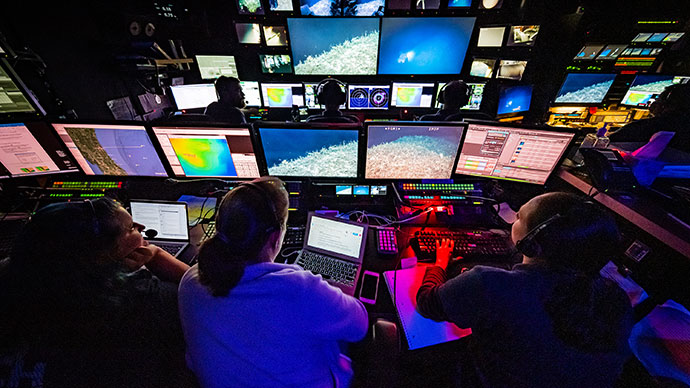
Access Dive Summary and ROV Data
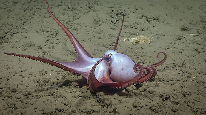
The “grumpy goosefish” (Lophiodes beroe), not an official common name, is an angler fish that prefers to live among Lophelia coral rubble, at very dimly lit depths. With its disruptive camouflage of spots, blotches, and leafy fringes around the belly, the goosefish hides motionless on the seafloor. Mostly head and belly, this fish is a sit-and-wait stealth predator. It rarely swims or chases prey. Instead, it uses a fishing lure to attract fishes and shrimps. Two very long dorsal fin rays sprout from between its eyes. When it’s hungry, it dangles one or both of these fishing poles in front of its enormous jaws, which are equipped with hundreds of long sharp teeth. This deep-sea angler has one of the fastest strike motions of any fish. Small fish that get too close do so at their own peril.
Text contributed by Ken Sulak, Ph.D., U.S. Geological Survey (retired)
Video courtesy of the NOAA Office of Ocean Exploration and Research, 2019 Southeastern U.S. Deep-sea Exploration. Download larger version (mp4, 80.4 MB).
Today’s dive was on a ridge topped with a series of mounds that may mark the eastern extent of the Million Mounds area on the edge of the Stetson Miami Terrace Deep Water Coral Habitat Area of Particular Concern (HAPC). The site was selected to help characterize mapping data collected during the first part of the 2019 Southeastern U.S. Deep-sea Exploration. Given its location in the HAPC, the site is a priority for regional managers.

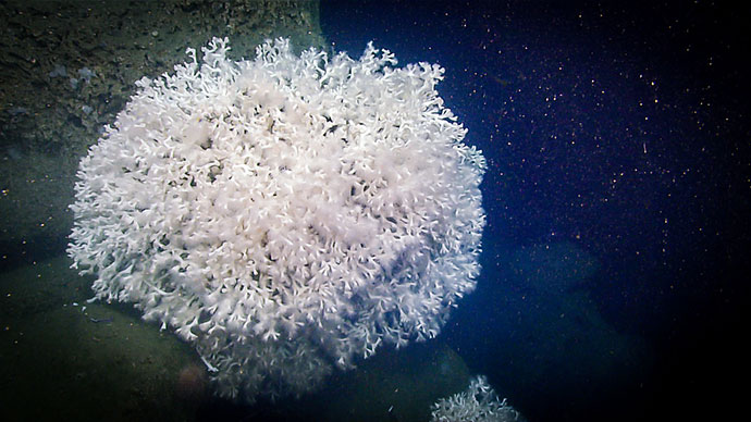
We visited this beautiful coral garden on the top of the ridge during Dive 02 of the 2019 Southeastern U.S. Deep-sea Exploration expedition. Image courtesy of the NOAA Office of Ocean Exploration and Research, 2019 Southeastern U.S. Deep-sea Exploration. Download larger version (jpg, 1.9 MB).
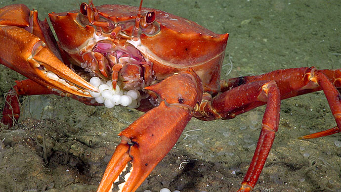
When we first arrived on the seafloor, it was covered in coral rubble, much like what was seen during Dive 01. As we traveled up the slope, we began to see limestone features eroded by dissolution and carbonate slabs covered in a ferromanganese crust as well as more live (and larger) corals and associated invertebrates.

This flytrap anemone was caught hanging out on a black coral branch during Dive 02 of the 2019 Southeastern U.S. Deep-sea Exploration expedition. Image courtesy of the NOAA Office of Ocean Exploration and Research, 2019 Southeastern U.S. Deep-sea Exploration. Download larger version (jpg, 1.4 MB).
During this high biodiversity dive, which we extended two hours to really get a sense of the area, we saw a number of bamboo corals, black corals, sharks, and sponges. Despite the large abundance of Lophelia pertusa coral rubble throughout the dive, large colonies of live Lophelia pertusa were rare.
We collected eight samples, including three which are target species for the Atlantic Seafloor Partnership for Integrated Research and Exploration (ASPIRE): two black corals (Leiopathes and Bathypathes alternata) and a glass sponge (Vazella pourtalesii).

Stalked crinoids, or sea lilies, like this one are abundant farther south, but until this individual was sampled on Dive 02 of the 2019 Southeastern U.S. Deep-sea Exploration expedition, no specimens had been collected for DNA. It may be an “undescribed species,” which means it does not have a formal species name and has not been compared in detail to closely related species. Informally, it is called Endoxocrinus “minimus.” Image courtesy of the NOAA Office of Ocean Exploration and Research, 2019 Southeastern U.S. Deep-sea Exploration. Download larger version (jpg, 1.9 MB).
As we neared the end of the dive, we saw a glass sponge never before seen by either our biology science lead or other scientists on the phone. It was determined that it may be a new species or a range expansion for a species that has only been found in the Antarctic region. The sponge was collected in its entirely. Our onboard science team will collect its DNA and then preserve it to share with the Smithsonian for further research by interested scientists.
 joubini), which has only been documented in the Antarctic region.")
On Dive 02 of the 2019 Southeastern U.S. Deep-sea Exploration expedition, we came across this unusual glass sponge with a fringe of large spicules at its base. It may be a new species or may expand the range of a known species (Anoxycalyx (Scolymastra) joubini), which has only been documented in the Antarctic region. Image courtesy of the NOAA Office of Ocean Exploration and Research, 2019 Southeastern U.S. Deep-sea Exploration. Download larger version (jpg, 1.7 MB).

Location of Dive 02 of the 2019 Southeastern U.S. Deep-sea Exploration expedition on November 2, 2019. Download larger version (jpg, 2.0 MB).

The remotely operated vehicle track for Dive 02 of the 2019 Southeastern U.S. Deep-sea Exploration expedition, shown as an orange line with a white curtain. This mapping data was collected during the first part of the expedition. Legend is water depth in meters. Download larger version (jpg, 4.6 MB).