The essays below will help you to understand the goals and objectives of the mission and provide additional context and information about the places being explored and the science, tools, and technologies being used.
Download the expedition factsheet (pdf, 2.2 MB).
By Mike White, Derek Sowers, Shannon Hoy, Stephanie Farrington, Kimberly Galvez, and Scott France

From October 31 through November 21, 2019, NOAA and partners will conduct the second part of a two-part telepresence-enabled ocean exploration expedition on NOAA Ship Okeanos Explorer to collect critical baseline information about unknown and poorly understood deepwater areas of the U.S. Southeast. As with previous Okeanos Explorer expeditions, NOAA will work closely with the science and resource management communities to explore priority deepwater areas.
Read moreBy Kimberly Galvez

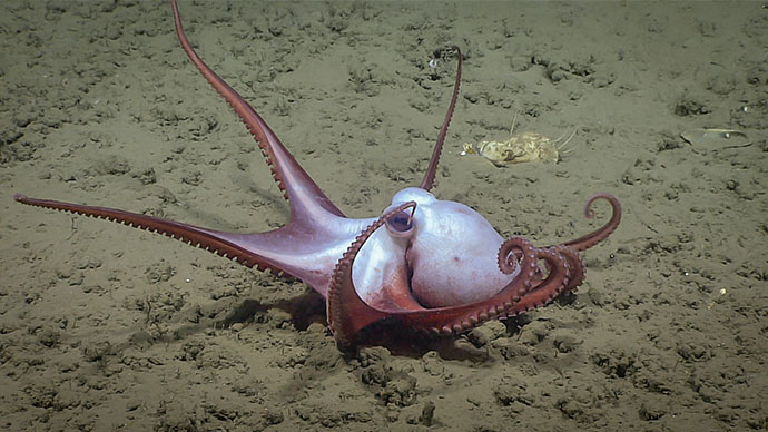
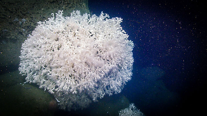
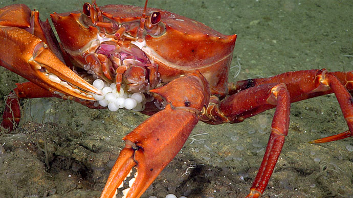
Deep-sea corals, or cold-water corals, have been around for millions of years. They are globally distributed, with more biological hotspots being discovered every year. Generally, in order to survive, these cold-water corals need the right temperatures, oxygen saturation levels, and a current flow that transports their food supply. When all these conditions are met, deep-sea corals flourish. As corals begin to grow, reefs form and begin to alter the morphology of the seafloor. This is where deep-sea biology meets geology. The scale of seafloor alteration depends heavily on the current systems and the sediments that drift along with the particulate organic matter that the corals feed on.
Read moreBy Daniel Wagner and Heather Coleman
 depth on Elvers Bank in the northwestern Gulf of Mexico.")
In 2016, NOAA launched a new four-year initiative to study deep-sea coral and sponge ecosystems across the Southeast United States, a region that includes the U.S. federal waters of the Gulf of Mexico, South Atlantic Bight, and Caribbean Sea. This multidisciplinary effort, known as the Southeast Deep Coral Initiative (SEDCI), is led by a NOAA team from multiple line offices that work in close collaboration with partners from federal and academic institutions. Funding for SEDCI activities is provided primarily by NOAA through the Deep Sea Coral Research and Technology Program.
Read moreBy Anna Lienesch
 and waypoints (red points) with superposed water column bubble plumes (multi-colored point clouds) imaged by NOAA Ship Okeanos Explorer during a previous mission. Methane bubble plumes at Norfolk Seeps have been imaged rising over 900 meters (2,950 feet) above the seafloor in previous surveys. Bathymetric data were collected with the Okeanos Explorer multibeam sonar and are contoured at 10-meter (about 3-feet) intervals. The locations of previously identified seeps are indicated with white points. All data shown at two times vertical exaggeration.")
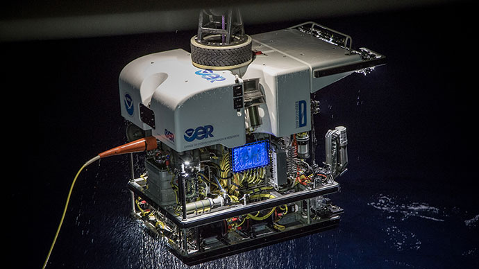
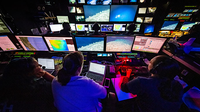
NOAA Ship Okeanos Explorer expeditions are most well-known for capturing never-before-seen footage of the deep sea and creating beautiful maps of the seafloor. But did you know that these videos and maps are only part of the data that is collected during Okeanos Explorer expeditions?
Read more