Date: November 8-11, 2019
With every expedition, we know that weather delays and cancelations are a real possibility, but we’re always disappointed when we can’t dive. Unfortunately, we had to cancel dives three days in a row because the winds, waves, and currents made it unsafe to deploy the remotely operated vehicles.
On November 8, we had planned to dive for the second day on a site of interest to our U.S. Geological Survey and Bureau of Ocean Energy Management partners. When we were forced to cancel the dive that day, we decided to try again on November 9. Sadly, it was just not meant to be. Similar weather and large waves hampered our plans yet again.
November 10 was a different story. It was a beautiful day. However, there were unfavorable surface currents at our original dive site. Nevertheless, we were confident that we would dive, and we headed to an alternate site. But that didn’t work out, nor did the next one, or the one after that, where this time the bottom currents became the problem. When afternoon came, and we still had not found a suitable site, we made the difficult decision to call it a day.
With the following day came new challenges. On November 11, due to unforeseen circumstances, we had to temporarily suspend operations and return to port in Charleston, South Carolina.

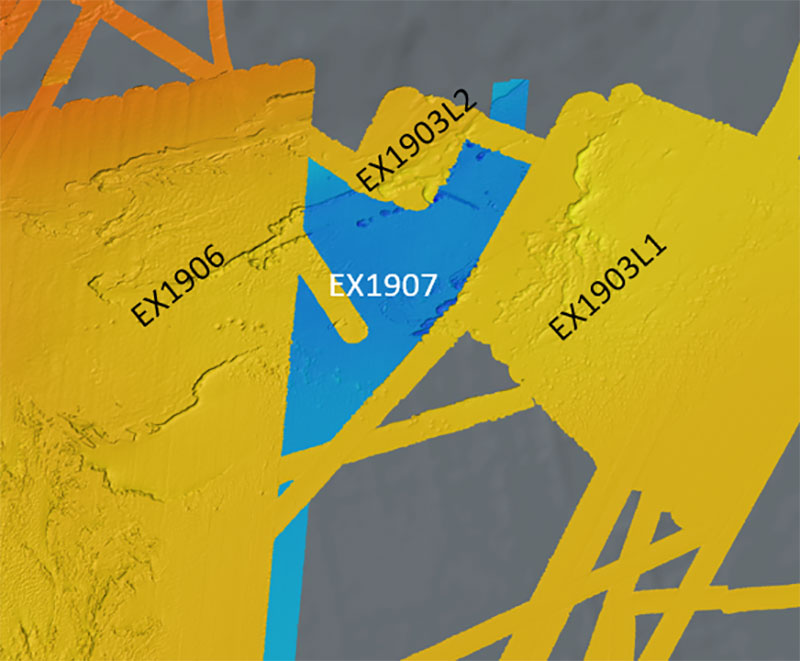
Taking advantage of weather days during the 2019 Southeastern U.S. Deep-sea Exploration (EX1907), the Mapping Team was able to fill in an unmapped area and merge it with mapping data from three previous NOAA Ship Okeanos Explorer missions in the region: Windows to the Deep 2019 legs one and two (EX1903L1 and EX1903L2) and the first part of the 2019 Southeastern U.S. Deep-sea Exploration (EX1906). Image courtesy of the NOAA Office of Ocean Exploration and Research. Download image (jpg, 82 KB).
A day without a dive doesn’t mean a day off for the hard-working folks on board NOAA Ship Okeanos Explorer. To make the most of our time at sea, our Mapping Team switched to 24-hour-a-day operations (on November 8 and 9), collecting data to continue our efforts to fill in some of the largest gaps in high-resolution ocean mapping data on the East Coast. This supports one of the NOAA Office of Ocean Exploration and Research’s top priorities: to map and characterize the U.S. Exclusive Economic Zone deeper than 200 meters (656 feet) by 2030. During these weather days, the Mapping Team was able to fill in an unmapped area and merge it with mapping data from three previous missions in the region: Windows to the Deep 2019 legs one and two and the first part of the 2019 Southeastern U.S. Deep-sea Exploration (see map above).
The Mapping Team members weren’t the only ones keeping busy. Among the other activities, the Science Team caught up on dive summaries and planned midwater transects, the Engineering Team conducted training and performed vehicle maintenance, the Telelpresence Team trouble-shooted and resolved some communications issues, and the Operations Team continued planning for winter repairs.