2022 Puerto Rico Mapping and Deep-Sea Camera Demonstration
April 4 - 28, 2022
Expedition Summary
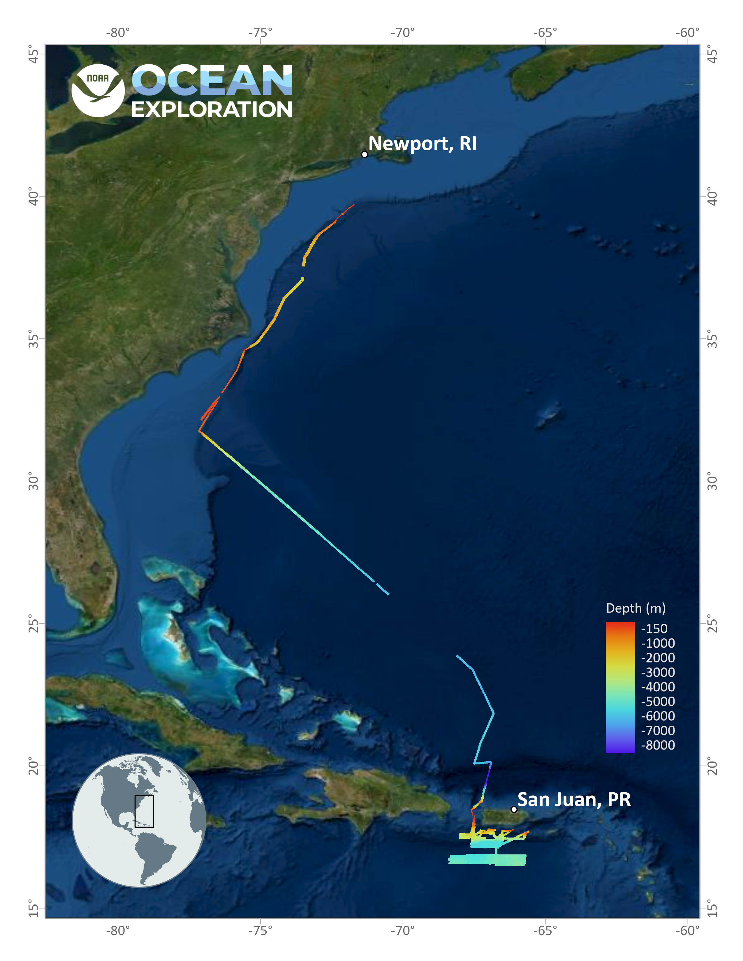
April 4-28, NOAA Ocean Exploration conducted an expedition on NOAA Ship Okeanos Explorer to fill deepwater mapping gaps in the Atlantic’s U.S. Exclusive Economic Zone (EEZ) and test deep-sea camera operations.
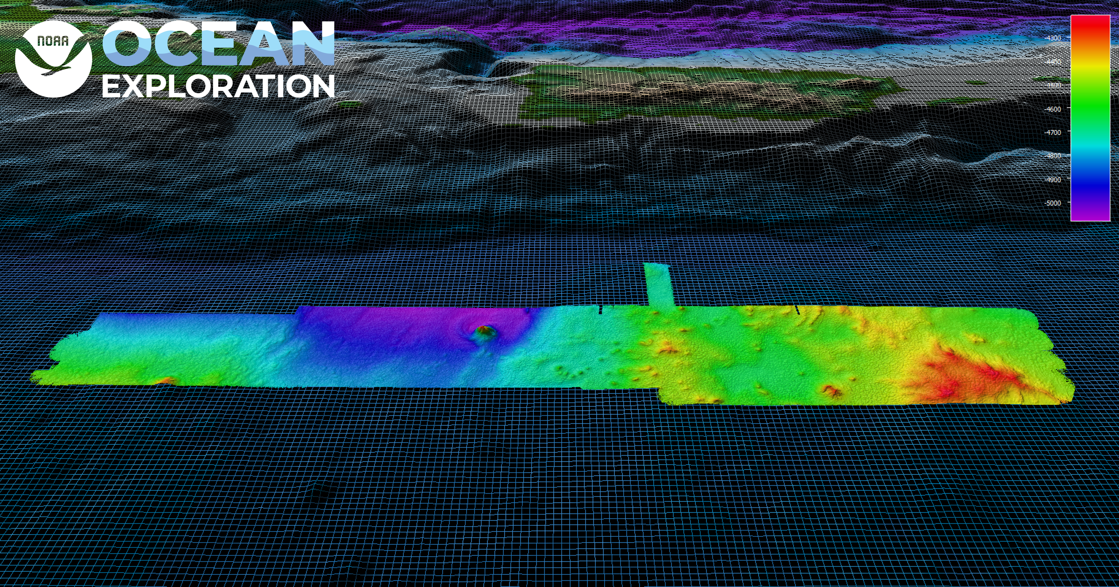
Some of the remaining mapping gaps in waters deeper than 200 meters (656 feet) are around Puerto Rico. During this expedition, we mapped 26,628 square kilometers (10,281 square miles) of seafloor in Puerto Rico waters alone, making great progress toward filling these gaps. In total, we mapped 3,838 linear kilometers (2,385 miles) and 44,159 square kilometers (17,050 square miles) of seafloor — an area almost five times the size of Puerto Rico — using the ship’s deepwater mapping systems. Discoveries of note included seamounts and other interesting geological features south of Puerto Rico that will be further analyzed by the scientific community. Also, during our transit across the Puerto Rico Trench, we tested the depth capabilities of our new EM 304 multibeam sonar system.
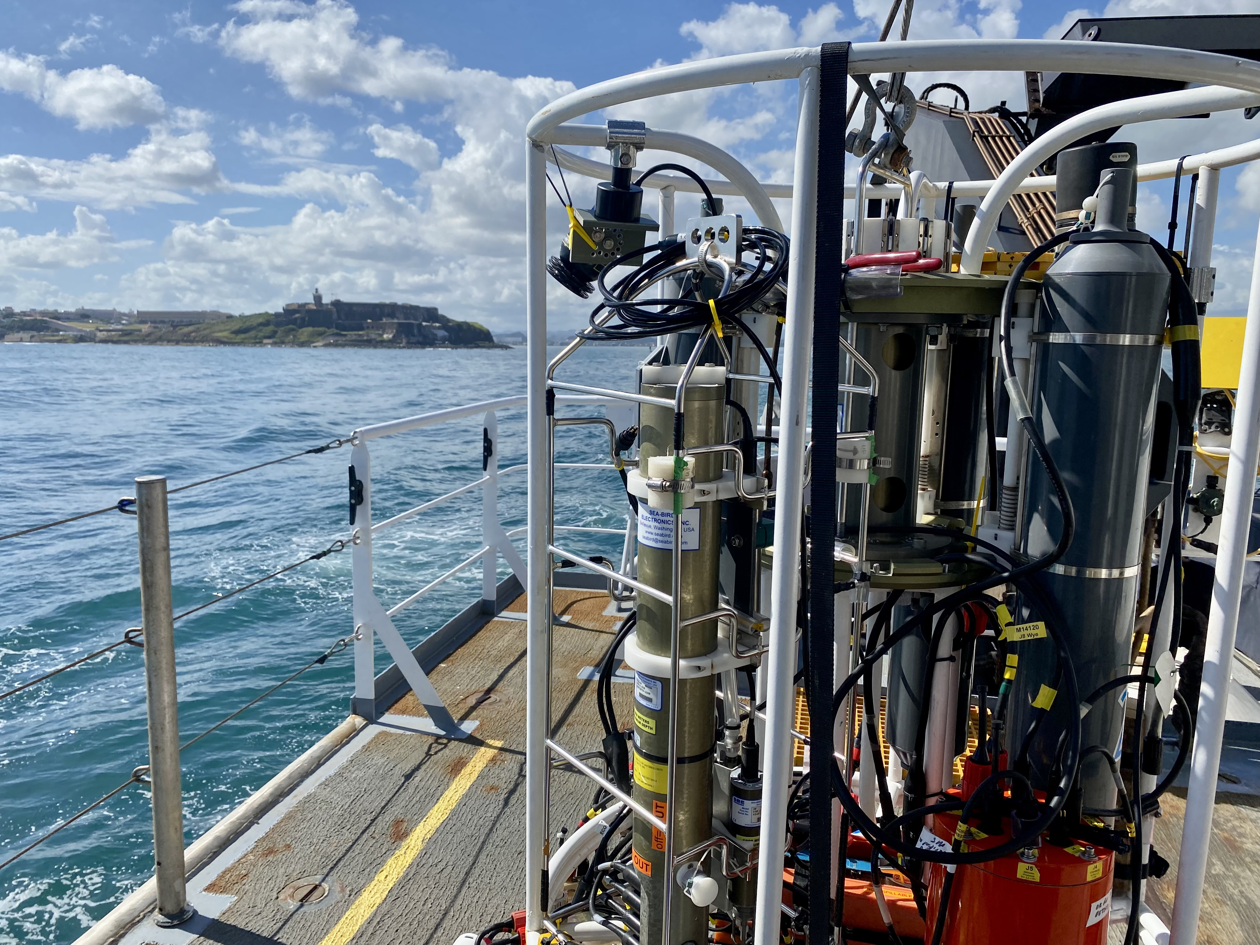
In addition to the standard mapping operations, we also collected and processed water samples for environmental DNA (eDNA) analysis and tested two deep-sea camera systems in partnership with the NOAA Ocean Exploration Cooperative Institute. Designed and provided by the Multidisciplinary Instrumentation in Support of Oceanography (MISO) facility at Woods Hole Oceanographic Institution, these cameras were deployed on a conductivity, temperature, and depth (CTD) rosette and reached depths approximating 1,500 meters (4,921 feet). During the tests, the cameras captured images within 4 meters (13 feet) of the seafloor while the ship was still as well as while it was traveling. Given these successes, NOAA Ocean Exploration will consider incorporating deep-sea cameras into standard operations on Okeanos Explorer.
As part of our effort to support future ocean explorers, during the 2022 Puerto Rico Mapping and Deep-Sea Camera Demonstration, we hosted two explorers-in-training and a Knauss fellow and participated in a live interaction with the College of Charleston BEnthic Acoustic Mapping (BEAMS) Program’s inaugural mini-conference.
View the initial Expedition Overview.
Operations
Education Themes

Related Links
NOAA Ship Okeanos Explorer

Media Contacts
NOAA Ocean Exploration
Emily Crum
Communication Specialist
emily.crum@noaa.gov
NOAA Office of Marine and Aviation Operations
David Hall
Public Affairs Officer
david.l.hall@noaa.gov
Woods Hole Oceanographic Institution
Suzanne Pelisson
Associate Director, Public Relations
media@whoi.edu
NOAA Ocean Exploration’s 2022 Puerto Rico Mapping and Deep-Sea Camera Demonstration expedition contributed to the National Strategy for Exploring, Mapping, and Characterizing the United States Exclusive Economic Zone (PDF, 1.9 MB) and Seabed 2030 and was part of NOAA’s Atlantic Seafloor Partnership for Integrated Research and Exploration (ASPIRE) campaign.
Data collected during the expedition will be available in NOAA’s public data archives within 60-90 days of its completion and will be accessible via the NOAA Ocean Exploration Data Atlas.