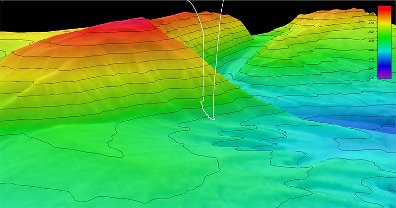
During the Seascape Alaska 3 expedition, the team mapped and thus discovered “Big Bend Canyon” and then explored part of the canyon during the second dive of the expedition. This image shows the dive track (white line) taken by remotely operated vehicles Deep Discoverer and Seirios during the dive overlain on collected multibeam bathymetry data with 100-meter (328-foot) contour intervals. Scale is water depth in meters.