Seascape Alaska 5: Gulf of Alaska Remotely Operated Vehicle Exploration and Mapping

(EX2306)

Expedition Summary

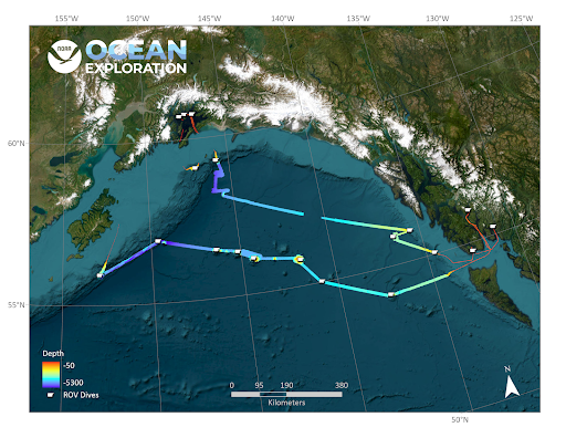
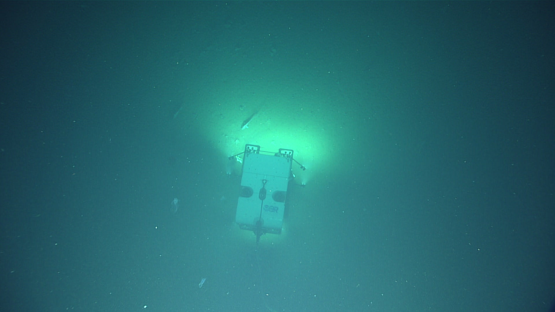
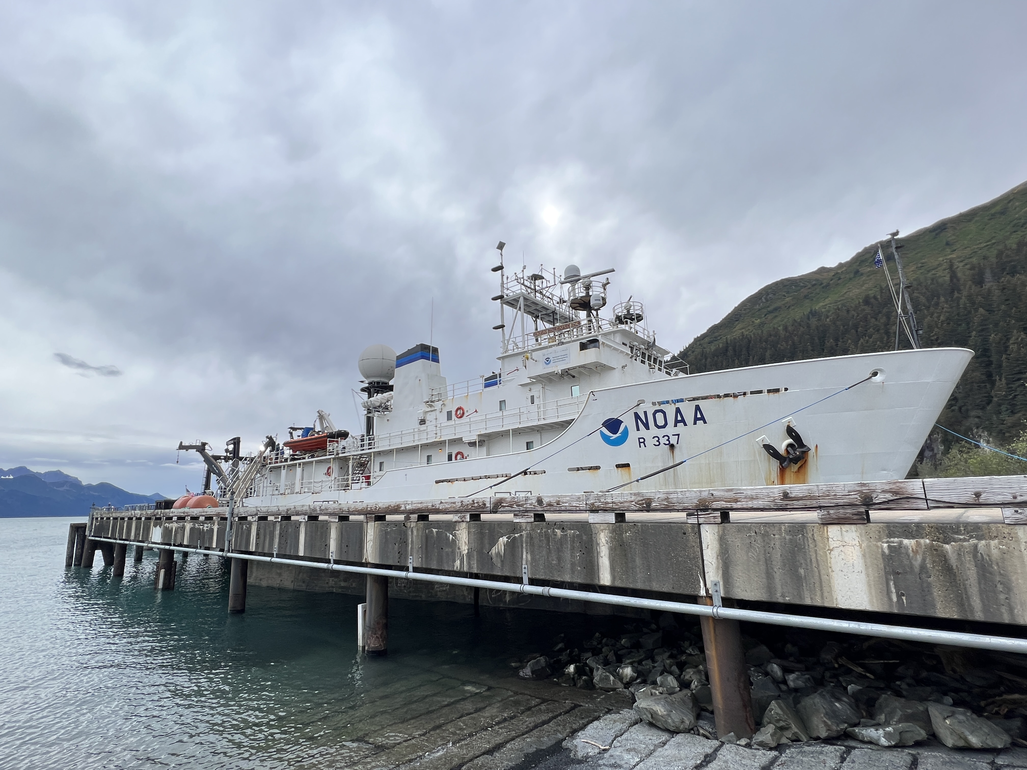
From August 23 - September 14, NOAA Ocean Exploration and partners conducted the fifth in a series of Seascape Alaska expeditions on NOAA Ship Okeanos Explorer. Operations during this 23-day expedition included 19 successful remotely operated vehicle (ROV) dives conducted in water depths ranging from 253 - 4,262 meters (830 - 13,983 feet), mapping of 28,287 square kilometers (10,922 square miles) of seafloor, and the collection of a wide variety of biological and geological samples. Altogether, data from the Seascape Alaska 5: Gulf of Alaska Remotely Operated Vehicle Exploration and Mapping expedition will contribute to our collective baseline understanding of the ocean, improving our ability to protect and manage marine ecosystems and furthering public awareness of the splendor, importance, and interconnectivity of the ocean to our everyday lives.

During the Seascape Alaska 5 expedition, the team navigated challenges ranging from rough weather to poor visibility, and completed 19 deepwater remotely operated vehicles (ROV) dives in the Gulf of Alaska and coastal fjords. Dives revealed brooding octopuses and landscapes covered in brittlestars, and provided a glimpse into the complex ecological and geological processes of the area. The data collected during mapping and ROV operations throughout the expedition will help to fill gaps in our understanding of the deep waters in the region. Video courtesy of NOAA Ocean Exploration, Seascape Alaska. Download largest version (mp4, 670 MB)

During the Seascape Alaska 5 expedition, the team navigated challenges ranging from rough weather to poor visibility, and completed 19 deepwater remotely operated vehicles (ROV) dives in the Gulf of Alaska and coastal fjords.

Operational Summary

  • Days at sea: 23
  • Full ROV dives: 19, ranging in depth from 253 - 4,262 meters (830 - 13,983 feet)
  • Biological samples collected: 72 primary samples, 197 associates
  • Geological samples collected: 32 primary samples, 13 associates
  • Water samples collected for eDNA analysis: 70
  • Seafloor area mapped: nearly 28,287 square kilometers (10,922 square miles)
  • Science party participants: >50
  • Live video views: Approximately 222,000
Map showing the location of the 19 dives successfully conducted during the Seascape Alaska 5 expedition, as well as preliminary bathymetry data collected during mapping operations.
Map showing the location of the 19 dives successfully conducted during the Seascape Alaska 5 expedition, as well as preliminary bathymetry data collected during mapping operations. Image courtesy of NOAA Ocean Exploration, Seascape Alaska. Download largest version (jpg, 302 KB).


Expedition Priorities

Priority exploration areas identified by the ocean management and scientific communities included a diversity of features across the Gulf of Alaska. These ranged from areas with the potential to host deep-sea coral and sponge communities, to maritime heritage sites, a landslide feature, and even water column sonar anomalies possibly indicating the presence of cold seeps. Overnight mapping data collected during this expedition filled major data gaps in the region and will contribute to Seabed 2030 goals for mapping unexplored regions of the global seafloor.


Mapping Highlights

During the Seascape Alaska 5 expedition, the team mapped approximately 28,278 square kilometers (8,245 square miles) of seafloor. Often referred to as the first step in ocean exploration, seafloor mapping lays the groundwork for future exploration both through remotely operated vehicle dives during the expedition and through continued exploration by others. Mapping efforts extended bathymetric mapping coverage in both the U.S. Exclusive Economic Zone and in international waters in support of Seabed 2030, and filled critical gaps in our understanding of deepwater areas in the Gulf of Alaska.


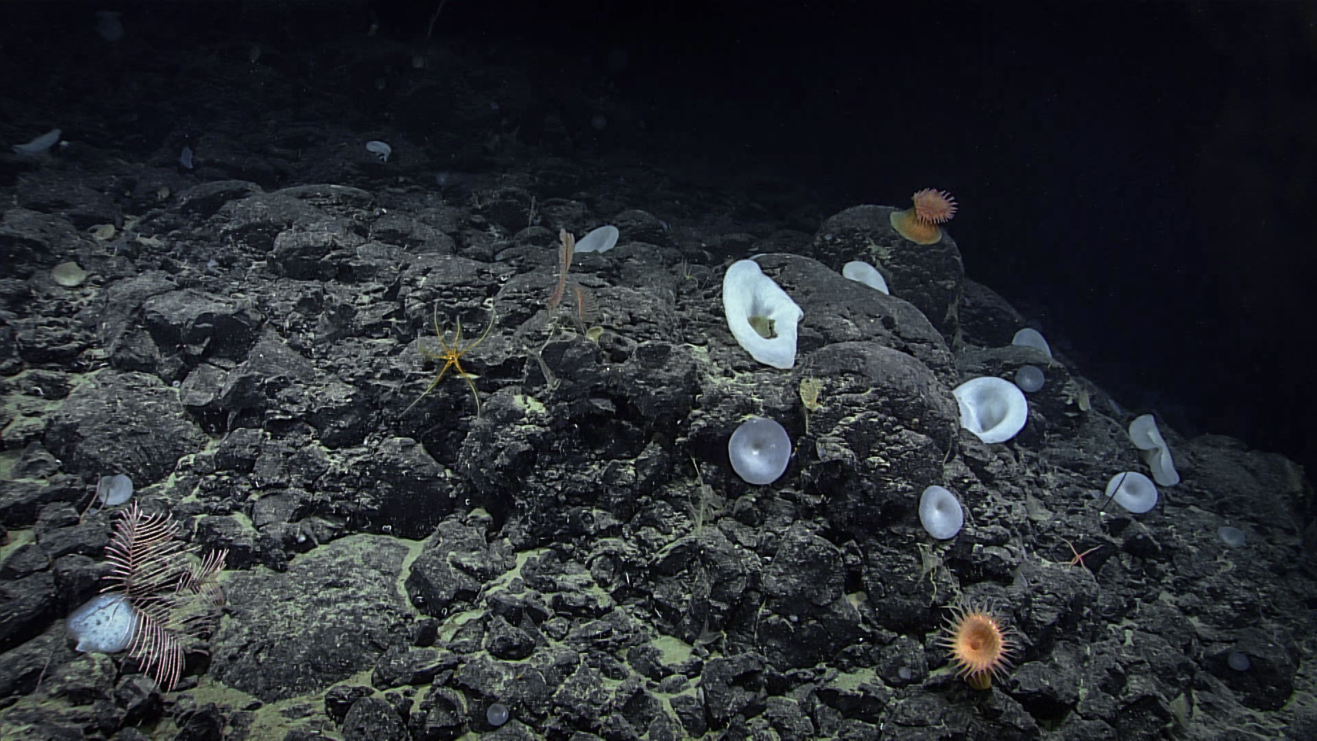
Biological Highlights

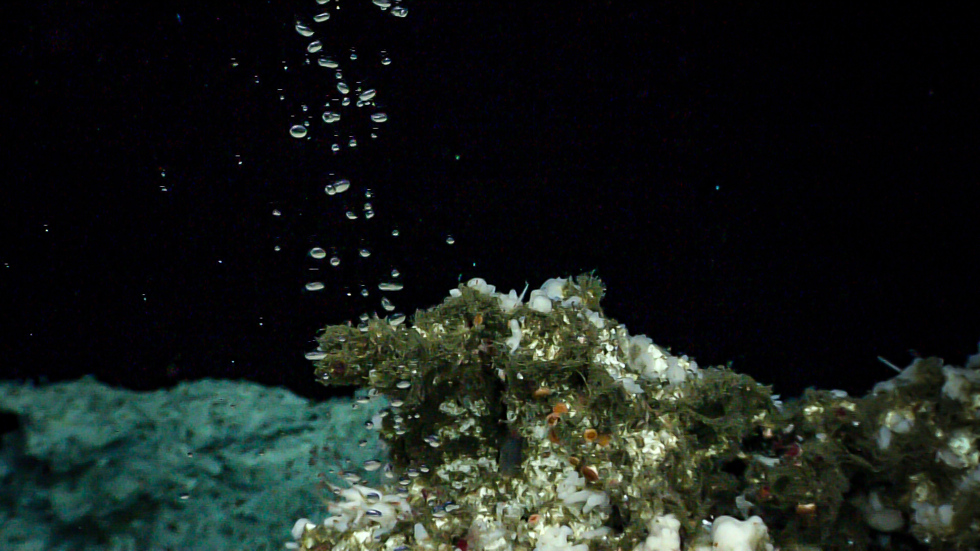
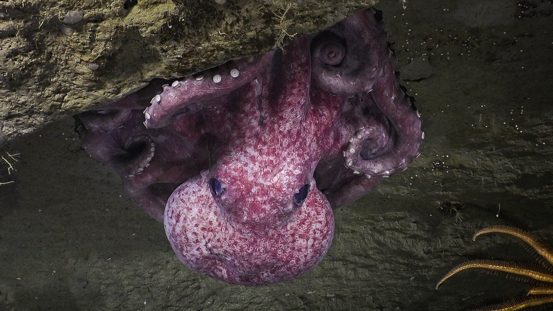
Biological specimens collected during the Seascape Alaska 5 expedition included representatives of new records and species that are likely new to science. The team also recorded significant depth and geographic range extensions for several fish and coral species, and documented the presence of commercially important species. Deep-sea corals and sponges were observed on every dive aside from one, which was conducted specifically in search of an underwater cultural heritage target. These areas of deep-sea coral and sponge habitat not only improve our understanding of this region, but have habitat modeling implications that may apply to many other places in the world.

Bubble plumes: Overnight mapping revealed two bubble plumes in the water column, leading the team to dive offshore of Chatham Strait. Dive 14 at Chatham seep revealed a massive and remarkable cold seep community, with giant carbonate rocks providing substrate for a large diversity of fauna. The areas around the bubble sources supported vibrant and likely endemic chemosynthetic organisms including snails, clams, worms, and sponges. Image courtesy of NOAA Ocean Exploration, Seascape Alaska. Download largest version (mp4, 229 MB)
Bubble plumes revealed during overnight mapping paved the way for a remotely operated vehicle dive offshore Chatham Strait.
Bubble plumes revealed during overnight mapping paved the way for a remotely operated vehicle dive offshore Chatham Strait. Catham Seep was first identified in 2016, but Seascape Alaska 5 marked the first time it was visually surveyed. Image courtesy of NOAA Ocean Exploration, Seascape Alaska. Download largest version (jpg, 1.27 MB).
Apparent octopus nurseries were observed at two dive sites, Noyes Canyon and Gumby Ridge, during Seascape Alaska 5.
Octopus nurseries: Apparent octopus nurseries were observed at two dive sites, Noyes Canyon and Gumby Ridge, during Seascape Alaska 5. At both locations, octopuses were observed brooding over their eggs with juveniles in the vicinity. This image was taken during Dive 18 at Gumby Ridge. Image courtesy of NOAA Ocean Exploration, Seascape Alaska. Download largest version (jpg, 1.64 MB).
Golden Mystery: This unidentified specimen, which was sent to the Smithsonian’s National Museum of Natural History for genetic analysis shortly after the expedition, captured public imagination. Video courtesy of NOAA Ocean Exploration, Seascape Alaska. Download largest version (mp4, 95.9 MB)


Geological Highlights

The exploration of submarine geology was another priority for this expedition. Geological samples collected will be used to better understand the geologic history of this region, as well as to characterize habitat substrate, while mapping and remotely operated vehicle imagery data support enhanced predictive capabilities for vulnerable marine habitats and submarine geohazards. During the expedition, the team identified new methane seeps and fully mapped a number of previously unmapped or poorly mapped seamounts in the Kodiak-Bowie and Patton Seamount Chains. The exploration of four seamounts in the Kodiak-Bowie seamount chain, along with numerous geological samples collected there for chemical and chronologic studies, will help scientists understand the origin of these hot spot volcanoes.
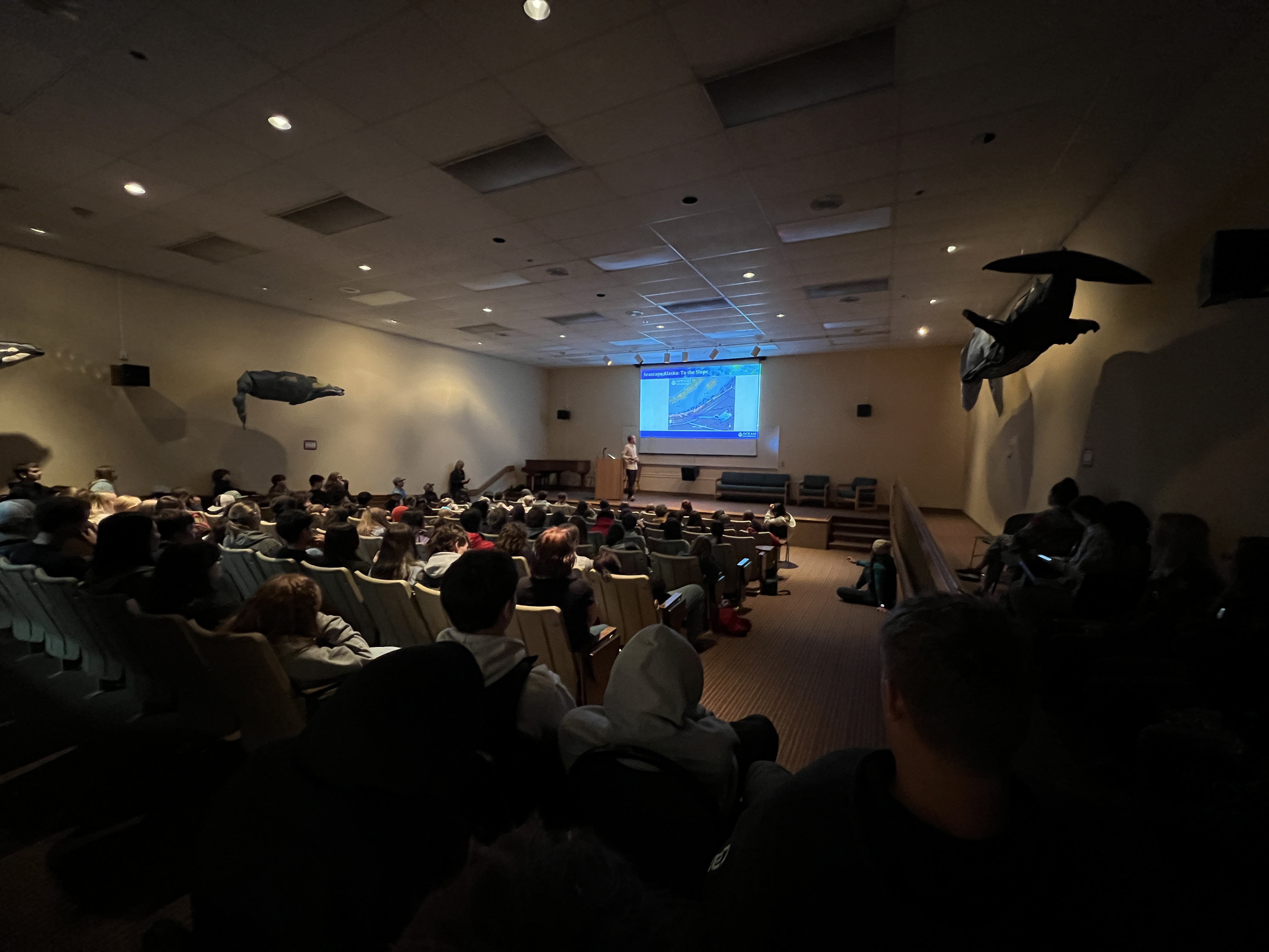
During the expedition, the team observed evidence of submarine landslides at a number of different scales and locations via remotely operated vehicle Deep Discoverer.
During the expedition, the team observed evidence of submarine landslides at a number of different scales and locations via remotely operated vehicle Deep Discoverer. Some top geology highlights included the first look at a likely recent event, possibly related to the deadly 1946 tsunamigenic earthquake, and landslide headwalls and extensive areas of mass-wasting on the walls of Noyes Canyon, less than 10 miles from the Queen Charlotte fault and the epicenter of the 2013 earthquake, which had a magnitude of 7.5. This photo was taken during Dive 12 at Noyes Canyon. Image courtesy of NOAA Ocean Exploration, Seascape Alaska. Download largest version (jpg, 538 KB).
In this photo from the dive, a rocky substrate supporting sponges and anemones is seen.
Unexplored seamounts: During Dive 07 of Seascape Alaska 5, the team conducted the first-ever exploration of one many small seamounts of unknown age and origin which form small chains apparently unrelated to the larger seamount chains of the North Pacific. This is where the "golden orb" was discovered. In this photo from the dive, a rocky substrate supporting sponges and anemones is seen. Image courtesy of NOAA Ocean Exploration, Seascape Alaska. Download largest version (jpg, 1.36 MB).


Public Engagement

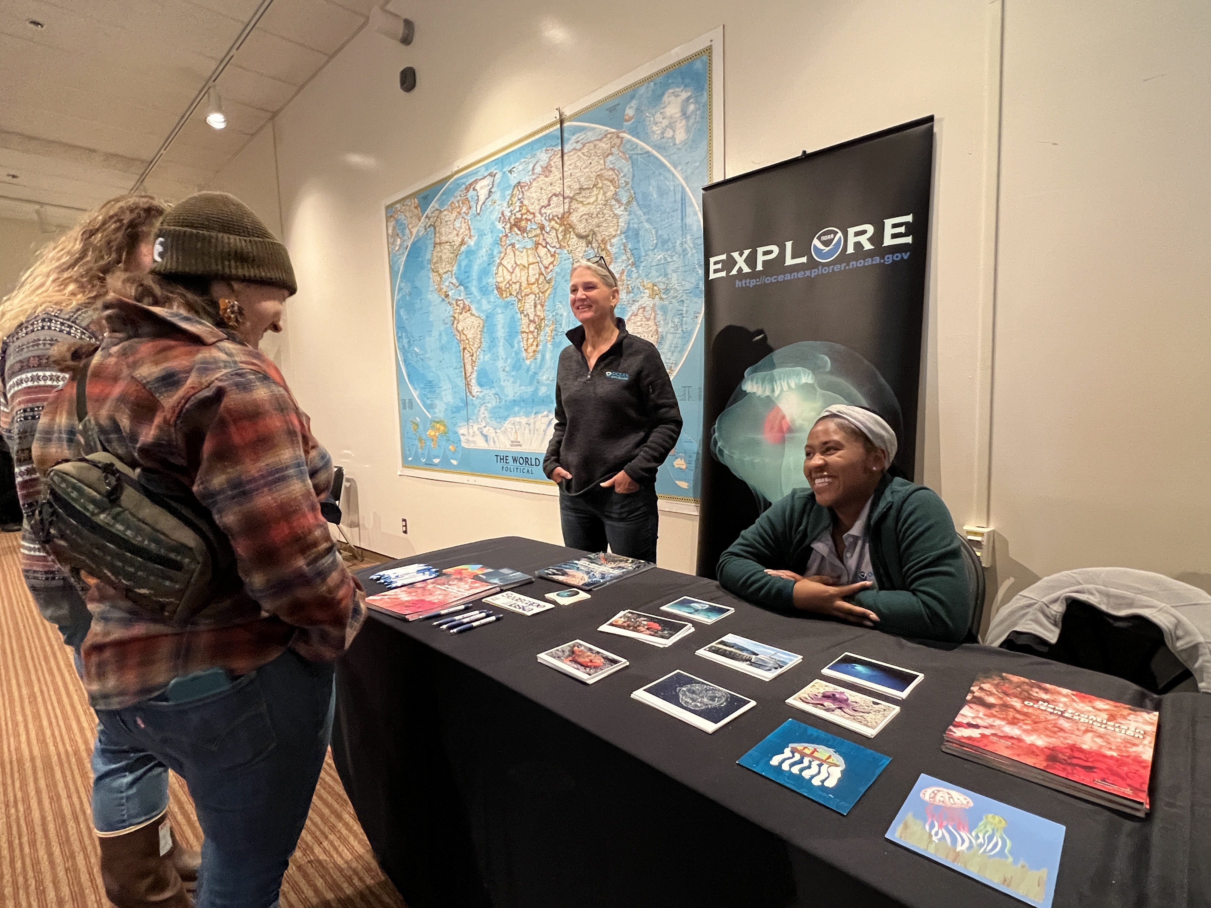
During the expedition, the team engaged with audiences around the world, opening a window of understanding into the deep sea with over 222,000 livestream views, expedition web content that was viewed over 250,000 times, and media coverage that reached thousands. Community members visiting the Alaska Sea Life Center and students at the College of Charleston had the opportunity to engage with the expedition while the ship was at sea through live telepresence connections.

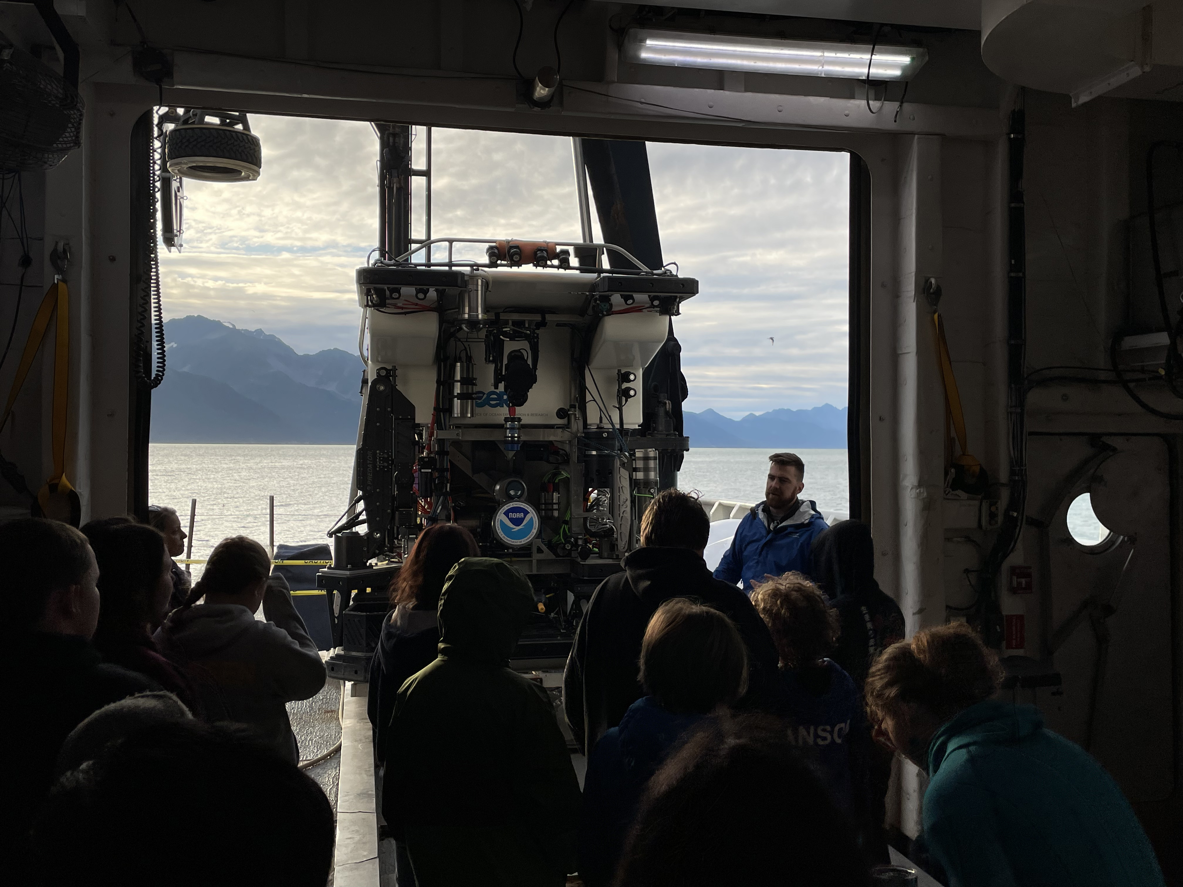
Once in port, the expedition team, partners, and other NOAA Ocean Exploration staff supported the first annual Seward Marine Science Symposium in Seward, Alaska. Ship tours were conducted for several local organizations and groups including middle and high school students and their teachers, homeschoolers, staff from Kenai Fjords National Park, members of the Qutekcak Native Tribe of Seward, leadership and staff from the Alaska Sea Life Center, the Alutiiq Pride Marine Institute, University of Alaska’s Seward Marine Center, local staff from the National Weather Service, local media, and more. These tours provided the opportunity for over 200 individuals to engage first hand with the exploration tools, samples, and expedition team, and to learn more about ocean exploration and its role in the greater ocean science field. Meanwhile, science talks from the expedition coordinator along with partners and other local scientists provided the opportunity for an exchange of ideas and new and continuing collaborations. A new public mural based on deep-sea imagery captured during the Seascape Alaska series of expeditions was also unveiled during the symposium, which brought in not only the expertise of local Seward-based artists, but of members of the local scientific community and the public at large.

NOAA Ship Okeanos Explorer as seen docked in Seward, Alaska, at the end of the Seascape Alaska 5 expedition.
NOAA Ship Okeanos Explorer as seen docked in Seward, Alaska, at the end of the Seascape Alaska 5 expedition. Image courtesy of NOAA Ocean Exploration, Seascape Alaska. Download largest version (jpg, 4.12 MB).
Lars Murphy, of the Global Foundation for Ocean Exploration, explains the intricacies of remotely operated vehicle Deep Discoverer to local students in Seward, Alaska.
Lars Murphy, of the Global Foundation for Ocean Exploration, explains the intricacies of remotely operated vehicle Deep Discoverer to local students in Seward, Alaska. Image courtesy of NOAA Ocean Exploration, Seascape Alaska. Download largest version (jpg, 4.17 MB).
NOAA Ocean Exploration staff members Susan Haynes and Shellby Rodney-Johnson table at the first annual Seward Marine Science Symposium in Seward, Alaska, after the completion of the Seascape Alaska 5 expedition.
NOAA Ocean Exploration staff members Susan Haynes and Shellby Rodney-Johnson table at the first annual Seward Marine Science Symposium in Seward, Alaska, after the completion of the Seascape Alaska 5 expedition. Image courtesy of NOAA Ocean Exploration, Seascape Alaska. Download largest version (jpg, 4.74 MB).
Expedition Coordinator Sam Candio presents to students during the first annual Seward Marine Science Symposium in Seward, Alaska, after the completion of the Seascape Alaska 5 expedition.
Expedition Coordinator Sam Candio presents to students during the first annual Seward Marine Science Symposium in Seward, Alaska, after the completion of the Seascape Alaska 5 expedition. Image courtesy of NOAA Ocean Exploration, Seascape Alaska. Download largest version (jpg, 3.25 MB).
Seward-based artists Luzan Quintero (left) and Marissa Amor survey their work. The mural was designed by the artists based on imagery from the Seascape Alaska series of expeditions and painted by the artists and local community members.
Seward-based artists Luzan Quintero (left) and Marissa Amor survey their work. The mural was designed by the artists based on imagery from the Seascape Alaska series of expeditions and painted by the artists and local community members. Image courtesy of NOAA Ocean Exploration, Seascape Alaska. Download largest version (jpg, 4.23 MB).

Published January 22, 2024